·

Enable Location

We need your location to show you interesting places around you

Discover nearby places

Find interesting locations and hidden gems around you

Precise directions

Get accurate directions and distances to places

Your location is never shared with other users. It's only used when you tap the location button.

Wedge Plantation

Log in to your account

Start exploring — it's free

Trusted by 62,653 travelers worldwide

Continue with Google
Continue with Apple
or

We will send you a code to connect

By continuing, you accept our Terms and Conditions and our Privacy Policy

Check your inbox

We've sent a pincode in your inbox. Please enter the code below.

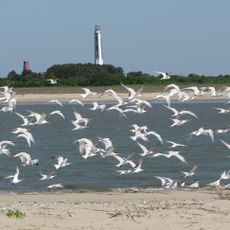
Wedge Plantation, human settlement in South Carolina, United States of America

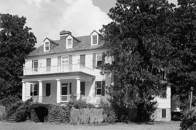
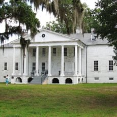
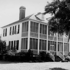
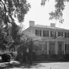
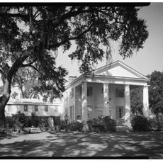
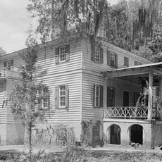
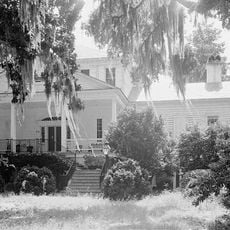
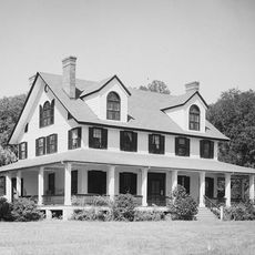
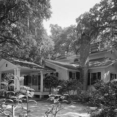
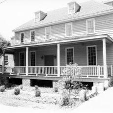
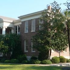
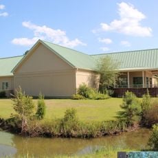
Wedge Plantation is a Federal-style house built around 1830 near McClellanville in South Carolina. The wood-frame structure has a rectangular form with a gable roof, five front openings with shutters, and four fluted Doric columns supporting the porch, along with a second-floor balcony and granite entrance steps.

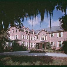
William Lucas, son of a rice-processing inventor, built the house and operated it as a rice plantation for over 80 years until around 1914. The property changed hands several times afterward and was listed on the National Register of Historic Places in 1980.

The house reflects how wealthy planters lived during the early 1800s, with its Federal style and classical details expressing the tastes and status of its owner at that time. The site represents a way of life centered on agricultural production that shaped the region's identity.

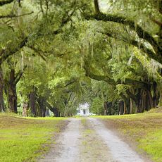
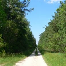
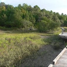
The house is located about five miles east of McClellanville and is privately owned, so visits are not always available. Check in advance if access is possible and respect the property owners' privacy when approaching the site.

Dr. Richard B. Dominick, an owner during the 1960s and 1970s, collected thousands of moths and butterflies on the grounds, a collection now housed at the University of South Carolina. His interest in insects turned the plantation into a research center for studying insect-borne diseases.

The community of curious travelers

AroundUs brings together thousands of curated places, local tips, and hidden gems, enriched daily by 60,000 contributors worldwide.

Start exploring
Location
GPS coordinates
33.17139,-79.39917
Latest update
February 7, 2026 11:40
Around this place
Hobcaw Barony
United States of America

Hobcaw Barony

23.8 km
Hampton Plantation
United States of America

Hampton Plantation

4.7 km
Mansfield Plantation
United States of America

Mansfield Plantation

32.1 km
Cape Romain National Wildlife Refuge
United States of America

Cape Romain National Wildlife Refuge

25.2 km
Hopsewee
United States of America

Hopsewee

4.6 km
Hell Hole Swamp
United States of America

Hell Hole Swamp

29 km
Arcadia Plantation
United States of America

Arcadia Plantation

28.7 km
Beneventum Plantation House
United States of America

Beneventum Plantation House

33.1 km
Annandale Plantation
United States of America

Annandale Plantation

10.3 km
Fairfield Plantation
United States of America

Fairfield Plantation

1.4 km
Harrietta Plantation
United States of America

Harrietta Plantation

561 m
Battery White
United States of America

Battery White

17.7 km
Georgetown Light
United States of America

Georgetown Light

20.8 km
Pee Dee River Rice Planters Historic District
United States of America

Pee Dee River Rice Planters Historic District

7.1 km
Temple Beth Elohim
United States of America

Temple Beth Elohim

24.5 km
Bethel African Methodist Episcopal Church
United States of America

Bethel African Methodist Episcopal Church

10.6 km
Wicklow Hall Plantation
United States of America

Wicklow Hall Plantation

9.1 km
Georgetown Historic District
United States of America

Georgetown Historic District

24.3 km
Joseph H. Rainey House
United States of America

Joseph H. Rainey House

24.4 km
Sewee Mound
United States of America

Sewee Mound

27.7 km
Winyah Indigo School
United States of America

Winyah Indigo School

24.8 km
Bull Island
United States of America

Bull Island

35.3 km
Cape Romain Lighthouse
United States of America

Cape Romain Lighthouse

17.1 km
Kaminski House Museum
United States of America

Kaminski House Museum

24.3 km
Old Cape Romain Lighthouse
United States of America

Old Cape Romain Lighthouse

17.2 km
St. Mary's Church
United States of America

St. Mary's Church

24.6 km
Sewee Visitor and Environmental Education Center
United States of America

Sewee Visitor and Environmental Education Center

33.3 km
Winyah Indigo Society Hall
United States of America

Winyah Indigo Society Hall

24.3 km
Show the full map
« Wedge Plantation - human settlement in South Carolina, United States of America » is provided by Around Us (aroundus.com). Images and texts are derived from Wikimedia project under a Creative Commons license. You are allowed to copy, distribute, and modify copies of this page, under the conditions set by the license, as long as this note is clearly visible.

Discover hidden gems everywhere you go!

From secret cafés to breathtaking viewpoints, skip the crowded tourist spots and find places that match your style. Our app makes it easy with voice search, smart filtering, route optimization, and insider tips from travelers worldwide. Download now for the complete mobile experience.

Around Us App Screenshot

A unique approach to discovering new places

Le Figaro

All the places worth exploring

France Info

A tailor-made excursion in just a few clicks

20 Minutes

Around Us
Travel Guide & Maps
Download

Send to your phone

QR Code
1

Open the camera app on your mobile.

2

Point at the QR code with your camera. A notification will appear.

3

Tap the notification to open the link.