Enable Location

We need your location to show you interesting places around you

Discover nearby places

Find interesting locations and hidden gems around you

Precise directions

Get accurate directions and distances to places

Your location is never shared with other users. It's only used when you tap the location button.

Sewee Mound

Log in to your account

Start exploring — it's free

Trusted by 61,808 travelers worldwide

Continue with Google
Continue with Apple
or

We will send you a code to connect

By continuing, you accept our Terms and Conditions and our Privacy Policy

Check your inbox

We've sent a pincode in your inbox. Please enter the code below.

Sewee Mound, Archaeological site in Charleston County, United States

Description

Sewee Mound is a prehistoric circular shell ring structure within Francis Marion National Forest measuring roughly 150 feet (45 m) across and rising about 10 feet (3 m) high. The formation consists primarily of accumulated oyster shells left behind by ancient inhabitants of the region.

History

The shell structure dates back to the Late Archaic through Early Woodland periods, roughly 2200 to 1000 years ago. It represents one of the earliest established settlements known along the South Carolina coast.

Culture

The mound reveals oyster shells and artifacts showing how Native American communities lived and what they ate in this coastal area. These remains tell the story of their daily routines and how they adapted to life by the water.

Practical

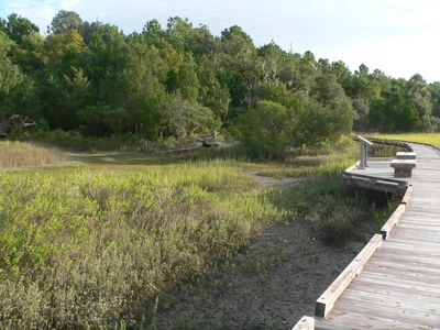
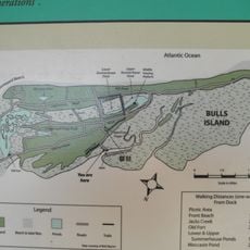
The site sits in Awendaw off Salt Pond Road within a national forest that offers walking trails through the woodland. Visitors should stay on marked paths to protect the archaeological remains and respect the preserved landscape.

Did you know?

This shell ring belongs to a group of about twenty similar structures scattered along a specific stretch of coast between central South Carolina and Georgia. The concentration of these ancient rings in this narrow band makes it a key location for understanding how early coastal peoples organized their settlements.

GPS coordinates
32.99670,-79.61030
Latest update
December 14, 2025 18:16

AroundUs brings together thousands of curated places, local tips, and hidden gems, enriched daily by 60,000 contributors worldwide. Discover all places nearby (Charleston County).

Around this place
Blackbaud Stadium
United States of America

Blackbaud Stadium

32.1 km
Hampton Plantation
United States of America

Hampton Plantation

27.6 km
Cape Romain National Wildlife Refuge
United States of America

Cape Romain National Wildlife Refuge

4.4 km
Ben Sawyer Bridge
United States of America

Ben Sawyer Bridge

33 km
Boone Hall Plantation
United States of America

Boone Hall Plantation

25.2 km
Medway
United States of America

Medway

33.8 km
Hopsewee
United States of America

Hopsewee

31.8 km
James B. Edwards Bridge
United States of America

James B. Edwards Bridge

30.8 km
Hell Hole Swamp
United States of America

Hell Hole Swamp

27.1 km
Oakland Plantation House
United States of America

Oakland Plantation House

21.9 km
Cypress Gardens
United States of America

Cypress Gardens

32.7 km
Mount Pleasant Historic District
United States of America

Mount Pleasant Historic District

34.1 km
Bethel African Methodist Episcopal Church
United States of America

Bethel African Methodist Episcopal Church

17.6 km
Christ Church
United States of America

Christ Church

25.5 km
Battery Thomson
United States of America

Battery Thomson

34.1 km
Battery Gadsden
United States of America

Battery Gadsden

34 km
Old Berkeley County Courthouse
United States of America

Old Berkeley County Courthouse

33.4 km
Dr. John B. Patrick House
United States of America

Dr. John B. Patrick House

34.2 km
White Church
United States of America

White Church

23.5 km
Taveau Church
United States of America

Taveau Church

33.1 km
Bull Island
United States of America

Bull Island

9.9 km
Snee Farm House
United States of America

Snee Farm House

26.1 km
Cape Romain Lighthouse
United States of America

Cape Romain Lighthouse

22.2 km
Old Cape Romain Lighthouse
United States of America

Old Cape Romain Lighthouse

22.2 km
Smokehouse
United States of America

Smokehouse

25.3 km
Sewee Visitor and Environmental Education Center
United States of America

Sewee Visitor and Environmental Education Center

6 km
Snee Farm Servant's House
United States of America

Snee Farm Servant's House

26.1 km
Dock House
United States of America

Dock House

25.4 km
Show the full map
« Sewee Mound - Archaeological site in Charleston County, United States » is provided by Around Us (aroundus.com). Images and texts are derived from Wikimedia project under a Creative Commons license. You are allowed to copy, distribute, and modify copies of this page, under the conditions set by the license, as long as this note is clearly visible.

Discover hidden gems everywhere you go!

From secret cafés to breathtaking viewpoints, skip the crowded tourist spots and find places that match your style. Our app makes it easy with voice search, smart filtering, route optimization, and insider tips from travelers worldwide. Download now for the complete mobile experience.

Around Us App Screenshot

A unique approach to discovering new places

Le Figaro

All the places worth exploring

France Info

A tailor-made excursion in just a few clicks

20 Minutes

Around Us
Travel Guide & Maps
Download

Send to your phone

QR Code
1

Open the camera app on your mobile.

2

Point at the QR code with your camera. A notification will appear.

3

Tap the notification to open the link.