Enable Location

We need your location to show you interesting places around you

Discover nearby places

Find interesting locations and hidden gems around you

Precise directions

Get accurate directions and distances to places

Your location is never shared with other users. It's only used when you tap the location button.

Cape Romain National Wildlife Refuge

Log in to your account

Start exploring — it's free

Trusted by 61,808 travelers worldwide

Continue with Google
Continue with Apple
or

We will send you a code to connect

By continuing, you accept our Terms and Conditions and our Privacy Policy

Check your inbox

We've sent a pincode in your inbox. Please enter the code below.

Cape Romain National Wildlife Refuge

Cape Romain National Wildlife Refuge, National wildlife refuge in eastern South Carolina, United States.

Description

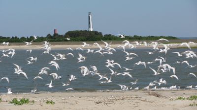
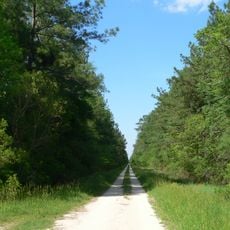
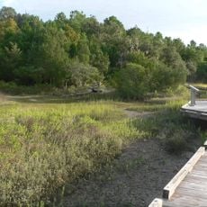
Cape Romain National Wildlife Refuge is a large protected coastal area in South Carolina that contains barrier islands, salt marshes, maritime forests, and extensive waterways. These different habitats work together to support a wide range of wildlife and plants.

History

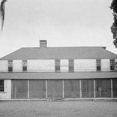
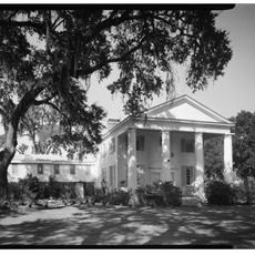
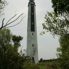
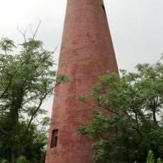
This area received federal protection in 1932 to preserve habitats for migrating waterfowl. Two lighthouses built in the 1800s still stand on Lighthouse Island as reminders of the region's maritime past.

Culture

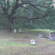
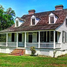
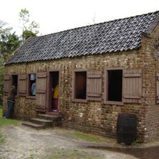
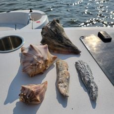
Shell mounds scattered across the refuge show that people have lived along this coast for centuries. Today you can explore these remains and see how early settlers shaped their lives between the land and sea.

Practical

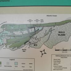
Reach the refuge by boat from Garris Landing or join guided tours to Bulls Island through local outfitters. Plan your visit around tides since water levels and how easily you can access different areas change throughout the day.

Did you know?

The refuge protects a significant portion of the northern loggerhead sea turtle population because three barrier islands serve as primary nesting areas. These sea turtles return each year to lay eggs in the sand, making this location crucial for their survival.

Location
Inception
1932
GPS coordinates
32.99250,-79.56389
Latest update
December 9, 2025 18:41

AroundUs brings together thousands of curated places, local tips, and hidden gems, enriched daily by 60,000 contributors worldwide. Discover all places nearby (South Carolina).

Around this place
Boone Hall
United States of America

Boone Hall

28.7 km
Hampton Plantation
United States of America

Hampton Plantation

25.8 km
Boone Hall Plantation
United States of America

Boone Hall Plantation

28.5 km
Hopsewee
United States of America

Hopsewee

29.5 km
Middleburg Plantation
United States of America

Middleburg Plantation

27.9 km
Wedge Plantation
United States of America

Wedge Plantation

25.2 km
James B. Edwards Bridge
United States of America

James B. Edwards Bridge

34.4 km
Hell Hole Swamp
United States of America

Hell Hole Swamp

29.2 km
Annandale Plantation
United States of America

Annandale Plantation

34.9 km
Fairfield Plantation
United States of America

Fairfield Plantation

25.9 km
Harrietta Plantation
United States of America

Harrietta Plantation

25.3 km
Oakland Plantation House
United States of America

Oakland Plantation House

25 km
Pee Dee River Rice Planters Historic District
United States of America

Pee Dee River Rice Planters Historic District

31.8 km
Bethel African Methodist Episcopal Church
United States of America

Bethel African Methodist Episcopal Church

14.7 km
Christ Church
United States of America

Christ Church

28.6 km
Wicklow Hall Plantation
United States of America

Wicklow Hall Plantation

33.8 km
Sewee Mound
United States of America

Sewee Mound

4.4 km
Charleston Fun Park
United States of America

Charleston Fun Park

24.4 km
White Church
United States of America

White Church

27.7 km
Bull Island
United States of America

Bull Island

10.3 km
Snee Farm House
United States of America

Snee Farm House

29.3 km
Cape Romain Lighthouse
United States of America

Cape Romain Lighthouse

18 km
Splash Island Water Park
United States of America

Splash Island Water Park

29 km
Old Cape Romain Lighthouse
United States of America

Old Cape Romain Lighthouse

17.9 km
Smokehouse
United States of America

Smokehouse

28.6 km
Sewee Visitor and Environmental Education Center
United States of America

Sewee Visitor and Environmental Education Center

10 km
Sandy Point Beach
United States of America

Sandy Point Beach

10.2 km
Snee Farm Servant's House
United States of America

Snee Farm Servant's House

29.3 km
Show the full map
« Cape Romain National Wildlife Refuge - National wildlife refuge in eastern South Carolina, United States » is provided by Around Us (aroundus.com). Images and texts are derived from Wikimedia project under a Creative Commons license. You are allowed to copy, distribute, and modify copies of this page, under the conditions set by the license, as long as this note is clearly visible.

Discover hidden gems everywhere you go!

From secret cafés to breathtaking viewpoints, skip the crowded tourist spots and find places that match your style. Our app makes it easy with voice search, smart filtering, route optimization, and insider tips from travelers worldwide. Download now for the complete mobile experience.

Around Us App Screenshot

A unique approach to discovering new places

Le Figaro

All the places worth exploring

France Info

A tailor-made excursion in just a few clicks

20 Minutes

Around Us
Travel Guide & Maps
Download

Send to your phone

QR Code
1

Open the camera app on your mobile.

2

Point at the QR code with your camera. A notification will appear.

3

Tap the notification to open the link.