Francis Beidler Forest
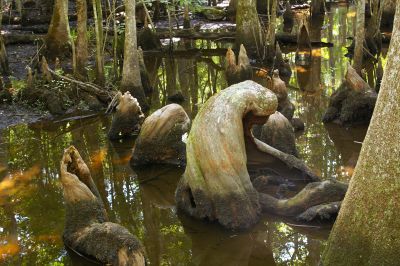
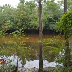
Francis Beidler Forest, Protected swamp forest in Four Holes Swamp, South Carolina.
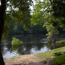
Francis Beidler Forest is a swamp forest located within Four Holes Swamp and protects an extensive area of wetlands dominated by cypress and hardwood trees. The forest contains multiple ecological zones that support diverse plant and animal species adapted to wet conditions.
The area was acquired by Francis Beidler in the 1890s and subsequently protected through conservation efforts by his family. After his death in 1924, the family continued stewardship until the National Audubon Society assumed management of the land.
The Four Holes Swamp area gained recognition in 2020 as part of the National Park Service's Underground Railroad Network to Freedom program.
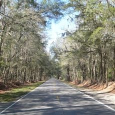
A wooden boardwalk allows visitors to explore the swamp landscape on foot while observing wildlife from a safe vantage point. During warmer months, guided canoe trips and evening walks offer additional ways to experience the area.
This location contains one of North America's oldest tree populations, with cypress trees exceeding 1,000 years in age and soaring more than 100 feet high. These ancient trees have survived hundreds of years of environmental changes and natural disturbances, making them scientifically valuable today.
Location: South Carolina
Website: https://sc.audubon.org/visit/beidler
GPS coordinates: 33.23390,-80.36110
Latest update: December 8, 2025 19:48
Lake Marion
27.4 km
Middleton Place
42.4 km
Mepkin Abbey
40.5 km
Lewisfield Plantation
35.2 km
Medway
42.8 km
Colonial Dorchester State Historic Site
36.2 km
Givhans Ferry State Park
22.5 km
Santee National Wildlife Refuge
31.7 km
Cypress Gardens
42.9 km
Ashley River Historic District
42.1 km
Biggin Church
36.8 km
Indian Fields Methodist Campground
17.3 km
Colleton State Park
30.5 km
Old White Meeting House Ruins and Cemetery
33.7 km
Santee Indian Mound and Fort Watson
34.7 km
Providence Methodist Church
24.4 km
Gippy Plantation
33.8 km
Lawson's Pond Plantation
19.9 km
Cypress Methodist Camp Ground
22.6 km
Numertia Plantation
18.4 km
Pineville Historic District
30.4 km
Appleby's Methodist Church
29.1 km
Walterboro Historic District
45.5 km
William Robertson House
30.2 km
Taveau Church
41.8 km
Hickory Valley Historic District
45.9 km
Walterboro Library Society Building
45.7 km
St. Paul's Church
29.4 kmVisited this place? Tap the stars to rate it and share your experience / photos with the community! Try now! You can cancel it anytime.
Discover hidden gems everywhere you go!
From secret cafés to breathtaking viewpoints, skip the crowded tourist spots and find places that match your style. Our app makes it easy with voice search, smart filtering, route optimization, and insider tips from travelers worldwide. Download now for the complete mobile experience.
A unique approach to discovering new places❞
— Le Figaro
All the places worth exploring❞
— France Info
A tailor-made excursion in just a few clicks❞
— 20 Minutes