Cherokee Path, Historic Native American trade route in South Carolina, United States.
The Cherokee Path is a historic trade route in South Carolina that once connected the colonial settlements along the coast to the Cherokee lands in the interior. It crosses hills, rivers, and valleys as it moves through the heart of the state.
The route was used by Cherokee peoples long before European settlers arrived, serving as a path between communities across the region. In 1730, George Hunter, Surveyor-General of the Province of South Carolina, mapped it officially, giving the trail a documented role in colonial trade.
The path was a meeting place where different groups encountered each other and exchanged goods and knowledge. This contact shaped colonial society and reshaped how people moved through the region.
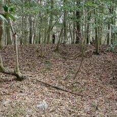
Modern Highway 3 follows parts of the original route, and historical markers along the way help travelers trace the path on the ground. Sections near St. Matthews are accessible and give a clearer sense of what the trail once looked like.
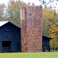
Some sections of the path near St. Matthews are listed on the National Register of Historic Places, making them among the few tangible remains of one of the oldest trade routes in North America. At these spots, the ground still follows much the same line it did before modern development reshaped most of the rest of the route.
The community of curious travelers
AroundUs brings together thousands of curated places, local tips, and hidden gems, enriched daily by 60,000 contributors worldwide.