Congaree National Park

Log in to your account

AroundUs is a community-driven map of interesting places, built by curious explorers like you. It grows with every review, story, and photo you share.
Connect to save your favorite spots, contribute locations, and create personalized routes.
Continue with Google
Continue with Apple
Continue with X
Continue with Facebook
Continue with email
By continuing, you accept our Terms and Conditions and our Privacy Policy
Create an account
Add to collection
Map
Suggest a change
Share

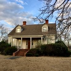
Congaree National Park, National Park in Richland County, South Carolina

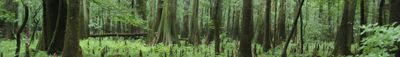
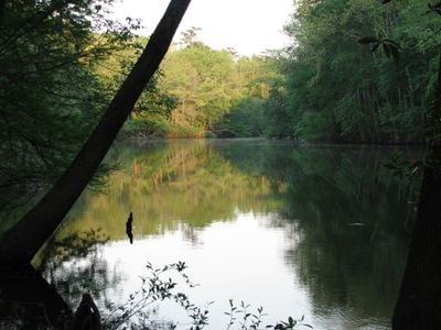
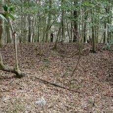
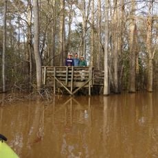
Congaree National Park protects over 26,000 acres of bottomland forest in central South Carolina, where the Congaree River floods regularly and enriches the soil with nutrients. The terrain stays flat and crossed by creeks, while hardwoods and swamps form a dense, humid ecosystem.

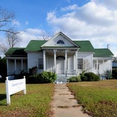
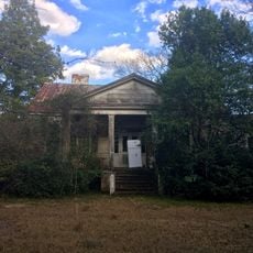
Logging companies arrived in the late 1800s, but difficult swamp conditions slowed cutting and saved large sections of the forest. Environmental advocates pushed for protection in the 1960s, leading to designation as a National Monument in 1976 and later elevation to National Park status in 2003.

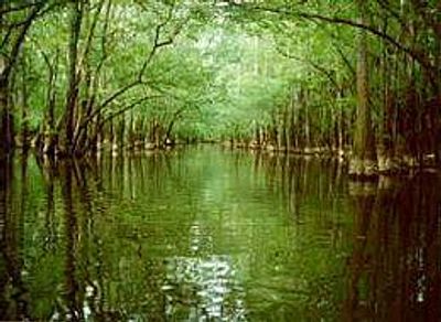
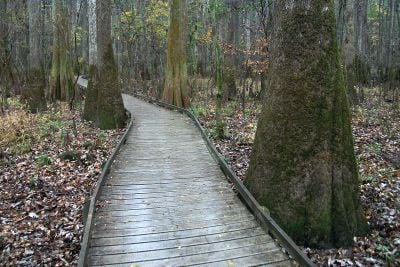
The name comes from the Congaree people who lived in this region before European settlement. Visitors walk today beneath dense canopies where light filters softly through the leaves, and boardwalks cross swampy sections that prevented logging for centuries.

More than 25 miles (40 km) of trails cross the protected area, including a boardwalk that remains accessible during floods. Those planning to paddle on Cedar Creek or camp in simple sites should book ahead during busier months.

Several of the tallest hardwoods on the East Coast grow here, including baldcypress and oaks older than 500 years. At night in late spring, synchronous fireflies flash together in a rare natural display seen in only a few places across North America.

Location: Richland County

Inception: November 10, 2003

Operator: National Park Service

Website: https://nps.gov/cong

GPS coordinates: 33.78333,-80.78333

Latest update: December 13, 2025 17:46

Photos
Around this place
United States of America

Fort Motte

9.7 km
Kensington Plantation House
United States of America

Kensington Plantation House

15.5 km
Midway Plantation
United States of America

Midway Plantation

14.6 km
Calhoun County Courthouse
United States of America

Calhoun County Courthouse

13.4 km
Oakland Plantation
United States of America

Oakland Plantation

15.2 km
Col. Olin M. Dantzler House
United States of America

Col. Olin M. Dantzler House

13.6 km
David Houser House
United States of America

David Houser House

12.8 km
Puritan Farm
United States of America

Puritan Farm

13.7 km
Col. J.A. Banks House
United States of America

Col. J.A. Banks House

13.5 km
United States of America

Oakwood

10.5 km
United States of America

Grovewood

13.8 km
United States of America

Farmers and Merchants Bank Building

13.3 km
United States of America

Magnolia

14.3 km
Calhoun County Library
United States of America

Calhoun County Library

13 km
Claudius Scott Cottage
United States of America

Claudius Scott Cottage

16.7 km
Richland Presbyterian Church
United States of America

Richland Presbyterian Church

10.2 km
United States of America

Brady's Cattle Mound

3.9 km
Cooner's Cattle Mound
United States of America

Cooner's Cattle Mound

1.7 km
United States of America

Saint Thomas' Protestant Episcopal Church

16.6 km
United States of America

St. Phillip School

14.2 km
John J. Kaminer House
United States of America

John J. Kaminer House

7.2 km
United States of America

Big Lake Cattle Mound

194 m
United States of America

Dead River Cattle Mound

1.7 km
Harry Hampton Visitor Center
United States of America

Harry Hampton Visitor Center

6.3 km
United States of America

Millwood Pond

12.7 km
Weston Lake Overlook
United States of America

Weston Lake Overlook

5.3 km
United States of America

Longleaf Campground

7.1 km
United States of America

Weston Lake Overlook

5.3 km
Show the full map
Reviews

Visited this place? Tap the stars to rate it and share your experience / photos with the community! Try now! You can cancel it anytime.

« Congaree National Park - National Park in Richland County, South Carolina » is provided by Around Us (aroundus.com). Images and texts are derived from Wikimedia project under a Creative Commons license. You are allowed to copy, distribute, and modify copies of this page, under the conditions set by the license, as long as this note is clearly visible.

Discover hidden gems everywhere you go!

From secret cafés to breathtaking viewpoints, skip the crowded tourist spots and find places that match your style. Our app makes it easy with voice search, smart filtering, route optimization, and insider tips from travelers worldwide. Download now for the complete mobile experience.

Around Us App Screenshot

A unique approach to discovering new places

Le Figaro

All the places worth exploring

France Info

A tailor-made excursion in just a few clicks

20 Minutes