Chest opened
+${chestReward.xp} XP
Explorer
NOUVEAU ×${chestReward.collectible.quantity}
tapez pour fermer

See the monuments around you in AR Open chests in the app

Around Us is built for your phone — point your camera at the streets and discover the monuments and places around you in augmented reality. Around Us is built for your phone — chests unlock when you walk, explore and capture nearby places.

Enable Location

We need your location to show you interesting places around you

Discover nearby places

Find interesting locations and hidden gems around you

Precise directions

Get accurate directions and distances to places

Your location is never shared with other users. It's only used when you tap the location button.

Log in to your account

Start exploring — it's free

Trusted by 85,347 travelers worldwide

Continue with Google
Continue with Apple
or

We will send you a code to connect

By continuing, you accept our Terms and Conditions and our Privacy Policy

Check your inbox

We've sent a pincode in your inbox. Please enter the code below.

Discussion Reviews Photo
4.6k Popularity

Fort Motte, Revolutionary War military site in South Carolina, United States

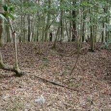
Fort Motte is an archaeological site along the Congaree River with remains of 18th-century fortifications and earthworks. The ruins show the layout of a military installation that protected supply lines between Charleston and Camden.

The British converted Mount Joseph Plantation into a military fortification in 1780 and used it as a strategic outpost during their occupation of South Carolina. The installation was abandoned in 1781 during a siege.

The site shows how warfare changed private architecture in the 1700s when military forces adapted buildings for defense. Visitors can still see the marks of how a plantation became a military stronghold.

The site is straightforward to explore, with remains clearly marked and most areas easy to walk through. A visit works best with a guided tour to understand the layout and learn details that are otherwise easy to miss.

The plantation owner provided the arrows that were used to set fire to her own mansion during the 1781 siege. This act of self-sabotage led to the British withdrawal.

The community of curious travelers

AroundUs brings together thousands of curated places, local tips, and hidden gems, enriched daily by 60,000 contributors worldwide.
Start exploring
Location
GPS coordinates
33.73920,-80.69250
Latest update
August 30, 2026 13:01
Around this place
Congaree National Park
United States of America

Congaree National Park

4.5 mi
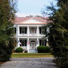
Millford Plantation
United States of America

Millford Plantation

8.9 mi
Borough House Plantation
United States of America

Borough House Plantation

17.3 mi
Poinsett State Park
United States of America

Poinsett State Park

10 mi
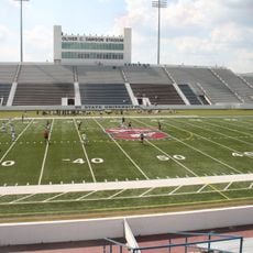
Oliver C. Dawson Stadium
United States of America

Oliver C. Dawson Stadium

18.8 mi
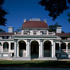
Kensington Plantation House
United States of America

Kensington Plantation House

9.3 mi
Midway Plantation
United States of America

Midway Plantation

4.4 mi
Stateburg Historic District
United States of America

Stateburg Historic District

19 mi
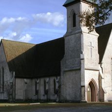
Good Hope Baptist Church
United States of America

Good Hope Baptist Church

13.9 mi
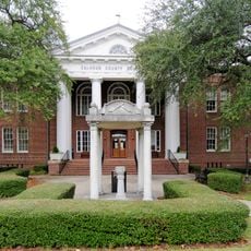
Calhoun County Courthouse
United States of America

Calhoun County Courthouse

7.3 mi
Ulmer-Summers House
United States of America

Ulmer-Summers House

12.3 mi
Oakland Plantation
United States of America

Oakland Plantation

3.9 mi
Col. Olin M. Dantzler House
United States of America

Col. Olin M. Dantzler House

7.1 mi
Haigler House
United States of America

Haigler House

12.2 mi
Hodge Hall
United States of America

Hodge Hall

19 mi
David Houser House
United States of America

David Houser House

9.3 mi
Puritan Farm
United States of America

Puritan Farm

8.8 mi
Col. J.A. Banks House
United States of America

Col. J.A. Banks House

7.2 mi
William P. Stroman House
United States of America

William P. Stroman House

18.9 mi
Calhoun County Library
United States of America

Calhoun County Library

6.9 mi
William Baker House
United States of America

William Baker House

18.6 mi
Claudius Scott Cottage
United States of America

Claudius Scott Cottage

12.3 mi
Richland Presbyterian Church
United States of America

Richland Presbyterian Church

7.3 mi
Cooner's Cattle Mound
United States of America

Cooner's Cattle Mound

6.7 mi
Maj. John Hammond Fordham House
United States of America

Maj. John Hammond Fordham House

19.1 mi
John J. Kaminer House
United States of America

John J. Kaminer House

8.3 mi
Harry Hampton Visitor Center
United States of America

Harry Hampton Visitor Center

9.8 mi
Weston Lake Overlook
United States of America

Weston Lake Overlook

9.2 mi
Show the full map
Reviews
Share your experience

No review yet

Discussions
Start a discussion...

No discussion yet

« Fort Motte - Revolutionary War military site in South Carolina, United States » is provided by Around Us (aroundus.com). Images and texts are derived from Wikimedia project under a Creative Commons license. You are allowed to copy, distribute, and modify copies of this page, under the conditions set by the license, as long as this note is clearly visible.

Discover hidden gems everywhere you go!

From secret cafés to breathtaking viewpoints, skip the crowded tourist spots and find places that match your style. Our app makes it easy with voice search, smart filtering, route optimization, and insider tips from travelers worldwide. Download now for the complete mobile experience.
Around Us App Screenshot

A unique approach to discovering new places

Le Figaro

All the places worth exploring

France Info

A tailor-made excursion in just a few clicks

20 Minutes

Around Us
Travel Guide & Maps
Download

Send to your phone

QR Code
1

Open the camera app on your mobile.

2

Point at the QR code with your camera. A notification will appear.

3

Tap the notification to open the link.