Enable Location

We need your location to show you interesting places around you

Discover nearby places

Find interesting locations and hidden gems around you

Precise directions

Get accurate directions and distances to places

Your location is never shared with other users. It's only used when you tap the location button.

Watsonville

Log in to your account

Start exploring — it's free

Trusted by 61,365 travelers worldwide

Continue with Google
Continue with Apple
or

We will send you a code to connect

By continuing, you accept our Terms and Conditions and our Privacy Policy

Check your inbox

We've sent a pincode in your inbox. Please enter the code below.

Watsonville, Charter city in Santa Cruz County, California, United States

Description

Watsonville is a city in Santa Cruz County along California's central coast, surrounded by agricultural fields in the Monterey Bay area. The town spreads across flat land between the coast and hills, with residential neighborhoods and commercial streets set among the farmland.

History

The settlement began in 1852 when Watson and Gregory laid out the town, which gained official status in 1868. A narrow-gauge railway connected the town to a coastal port during the early 1900s, carrying passengers and produce until operations ended.

Culture

Strawberry stands and farm markets dot the edges of town during harvest months, when fields turn into workplaces for picking crews. Spanish remains common in shops and streets, reflecting generations of families who arrived to work the land and stayed.

Practical

The town sits near the coast and can be reached by main highways that cut through farm country. Libraries and public services are located downtown, while neighborhoods fan out in all directions.

Did you know?

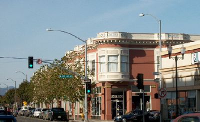
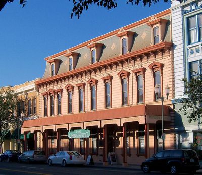
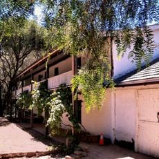
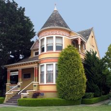
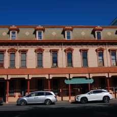
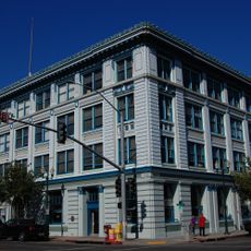
An old train depot still stands at the edge of town, a remnant of the brief railway era to the port. Some older buildings downtown still carry marks from the 1989 earthquake that damaged parts of the center.

Inception
1868
GPS coordinates
36.92000,-121.76361
Latest update
December 13, 2025 18:11

AroundUs brings together thousands of curated places, local tips, and hidden gems, enriched daily by 60,000 contributors worldwide. Discover all places nearby (Santa Cruz County).

Around this place
Show the full map
« Watsonville - Charter city in Santa Cruz County, California, United States » is provided by Around Us (aroundus.com). Images and texts are derived from Wikimedia project under a Creative Commons license. You are allowed to copy, distribute, and modify copies of this page, under the conditions set by the license, as long as this note is clearly visible.

Discover hidden gems everywhere you go!

From secret cafés to breathtaking viewpoints, skip the crowded tourist spots and find places that match your style. Our app makes it easy with voice search, smart filtering, route optimization, and insider tips from travelers worldwide. Download now for the complete mobile experience.

Around Us App Screenshot

A unique approach to discovering new places

Le Figaro

All the places worth exploring

France Info

A tailor-made excursion in just a few clicks

20 Minutes

Around Us
Travel Guide & Maps
Download

Send to your phone

QR Code
1

Open the camera app on your mobile.

2

Point at the QR code with your camera. A notification will appear.

3

Tap the notification to open the link.