Nisqually Entrance Historic District

Log in to your account

AroundUs is a community-driven map of interesting places, built by curious explorers like you. It grows with every review, story, and photo you share.
Connect to save your favorite spots, contribute locations, and create personalized routes.
Continue with Google
Continue with Apple
Continue with X
Continue with Facebook
Continue with email
By continuing, you accept our Terms and Conditions and our Privacy Policy
Create an account
Add to collection
Map
Suggest a change
Share

Nisqually Entrance Historic District, Historic entrance district at Mount Rainier National Park, United States.

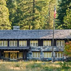
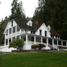
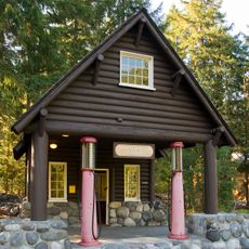
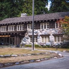
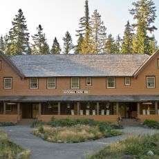
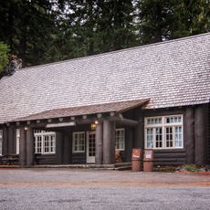
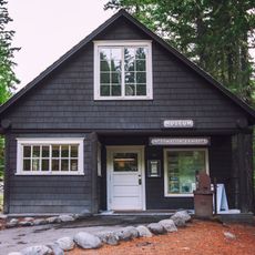
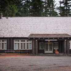
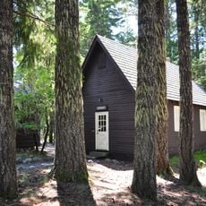
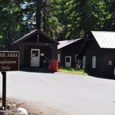
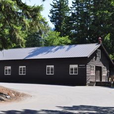
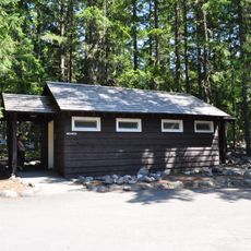
The Nisqually Entrance Historic District is the main entry point to Mount Rainier National Park, with a collection of buildings representing different construction periods. The site includes a log entrance arch, ranger station, checking station, and service structures arranged to manage visitor flow and provide essential services.

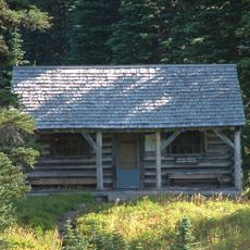
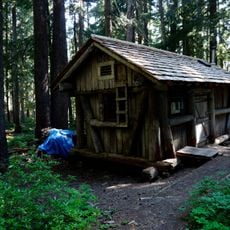
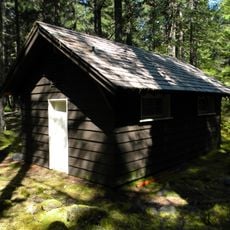
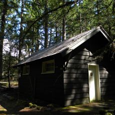
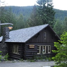
The site began with the Oscar Brown Cabin from 1908, the oldest surviving structure in the entire national park. Most of the visible buildings were constructed during the 1920s when the National Park Service developed an organized entrance system and built visitor facilities.

The buildings reflect the National Park Service Rustic architectural style, using local wood and stone to blend with the surrounding forest. This approach to design shows how structures can be built to feel part of the natural landscape rather than stand apart from it.

The entrance is easy to locate and provides parking and restroom facilities right at the arrival point. Visitors should expect this area to be busy during peak seasons, especially on weekends and holidays.

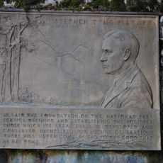
This entrance gained recognition as the first location within the National Park Service system to allow visitor vehicles and collect entry fees, beginning in 1907. This practice then became the standard approach for managing access across all other national parks.

Location: Pierce County

Architectural style: rustic architecture

GPS coordinates: 46.74141,-121.91836

Latest update: December 14, 2025 18:05

Photos
Around this place
Glacier View Wilderness
United States of America

Glacier View Wilderness

6 km
Mount Wow
United States of America

Mount Wow

4.3 km
Kautz Creek
United States of America

Kautz Creek

8.6 km
Gobbler's Knob Fire Lookout
United States of America

Gobbler's Knob Fire Lookout

5.9 km
Longmire Buildings
United States of America

Longmire Buildings

8.2 km
Indian Henry's Patrol Cabin
United States of America

Indian Henry's Patrol Cabin

8.4 km
Lake George Patrol Cabin
United States of America

Lake George Patrol Cabin

5.9 km
Ashford Mansion
United States of America

Ashford Mansion

8.5 km
South Puyallup River Bridge
United States of America

South Puyallup River Bridge

7.7 km
United States of America

Iron Mountain

9 km
Copper Mountain
United States of America

Copper Mountain

9.3 km
Longmire Service Station
United States of America

Longmire Service Station

8.1 km
Longmire Administration Building
United States of America

Longmire Administration Building

8.2 km
National Park Inn
United States of America

National Park Inn

8.1 km
Longmire Suspension Bridge
United States of America

Longmire Suspension Bridge

8.5 km
Longmire Campground Comfort Station No. L-302
United States of America

Longmire Campground Comfort Station No. L-302

8.2 km
Longmire Campground Comfort Station No. L-303
United States of America

Longmire Campground Comfort Station No. L-303

8.2 km
Longmire Historic District
United States of America

Longmire Historic District

8.1 km
Longmire Museum
United States of America

Longmire Museum

8.1 km
Longmire Community Building
United States of America

Longmire Community Building

8.2 km
Longmire General Store
United States of America

Longmire General Store

8 km
Longmire Library
United States of America

Longmire Library

8.2 km
Rampart Ridge Trail
United States of America

Rampart Ridge Trail

7.9 km
Longmire Oil House
United States of America

Longmire Oil House

8.2 km
Mount Rainier National Park Valor Memorial
United States of America

Mount Rainier National Park Valor Memorial

8.2 km
Longmire Warehouse Building‎
United States of America

Longmire Warehouse Building‎

8.2 km
Mather Plaque in Longmire
United States of America

Mather Plaque in Longmire

8.2 km
Longmire Comfort Station
United States of America

Longmire Comfort Station

8.1 km
Show the full map
Reviews

Visited this place? Tap the stars to rate it and share your experience / photos with the community! Try now! You can cancel it anytime.

« Nisqually Entrance Historic District - Historic entrance district at Mount Rainier National Park, United States » is provided by Around Us (aroundus.com). Images and texts are derived from Wikimedia project under a Creative Commons license. You are allowed to copy, distribute, and modify copies of this page, under the conditions set by the license, as long as this note is clearly visible.

Discover hidden gems everywhere you go!

From secret cafés to breathtaking viewpoints, skip the crowded tourist spots and find places that match your style. Our app makes it easy with voice search, smart filtering, route optimization, and insider tips from travelers worldwide. Download now for the complete mobile experience.

Around Us App Screenshot

A unique approach to discovering new places

Le Figaro

All the places worth exploring

France Info

A tailor-made excursion in just a few clicks

20 Minutes