Seattle Municipal Light and Power Plant, public hydroelectric plant near North Bend, Washington operated by Seattle City Light
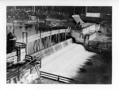
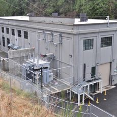
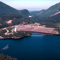
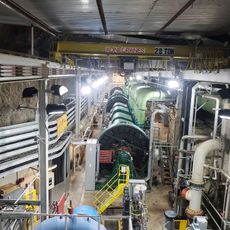
The Seattle Municipal Light and Power Plant is a hydroelectric station in King County built in the early 1900s that generates electricity using water from the Cedar River. The facility features masonry dams, power chambers, and industrial-style machinery buildings from the early 20th century, all still visible and operational.
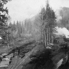
The plant began operation in 1904 and was one of the first publicly owned hydroelectric facilities in an American city of its size. The massive stone dam built in 1914 and expansions during the 1920s and 1930s allowed the city to provide reliable and affordable power to its growing population.
The site reflects Seattle's approach to public power generation, which served both residents and businesses starting in the early 1900s. The buildings and surrounding area show how the city harnessed water flow to transform urban life and bring modern conveniences to homes and streets.
The site in a protected watershed area offers walking paths and open spaces for exploration where visitors can observe the massive structures and water channels. Informational signs and occasional guided tours explain how the plant operates, with the best views of the dam structure and surrounding landscape available from designated vantage points.
The original power distribution station from 1910 on Yesler Way was illuminated at night with hundreds of incandescent bulbs and served as a visible symbol of the city's electricity. This glowing display was more than practical - it was a statement about Seattle's progress and the availability of modern technology to everyone in the city.
The community of curious travelers
AroundUs brings together thousands of curated places, local tips, and hidden gems, enriched daily by 60,000 contributors worldwide.