Sechelt, District municipality on the Sunshine Coast, Canada
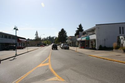
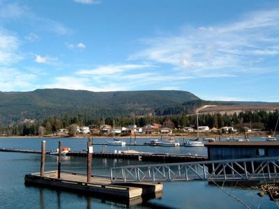
Sechelt is a district municipality on the Sunshine Coast positioned across the isthmus of a peninsula between Sechelt Inlet and the Strait of Georgia. The area spans roughly 35 kilometers of Pacific Ocean shoreline, creating a unique geography where two bodies of water are connected by land.
The settlement began in 1862 when European settlers arrived in the territory of the shíshálh Nation and established a Roman Catholic church. This arrival of pioneers marked a major turning point in how the region developed from that time forward.
The tems swiya Museum displays traditions of the shíshálh Nation through exhibits and objects passed down across generations. The collection tells the story of how the local indigenous people lived and worked in this coastal region.
Visitors reach Sechelt by taking a roughly 40-minute ferry from Horseshoe Bay to Langdale, then driving about 25 minutes along Highway 101. The route is straightforward and ferries run regularly, so it's worth checking schedules before departing to plan your arrival.
The area protects Hidden Groves, a forest section with ancient trees and walking trails accessed through community-built wooden boardwalks. These paths let visitors explore the woods without damaging the delicate forest environment.
Location: Sunshine Coast Regional District
Inception: 1862
Elevation above the sea: 8 m
Website: https://sechelt.ca
GPS coordinates: 49.47420,-123.75400
Latest update: December 6, 2025 22:05
Porteau Cove Provincial Park
38.6 km
Lighthouse Park
38.8 km
Whytecliff Park
35.5 km
Smuggler Cove Marine Provincial Park
15.4 km
Saysutshun (Newcastle Island Marine) Provincial Park
34.2 km
Jedediah Island Marine Provincial Park
32.7 km
Bastion
36.6 km
Point Atkinson Lighthouse
38.9 km
Petroglyph Provincial Park
39.1 km
Skookumchuck Narrows Provincial Park
31.5 km
Mount Elphinstone Provincial Park
11.2 km
Tetrahedron Provincial Park
18.7 km
Lighthouse Pub
821 m
Porpoise Bay Provincial Park
3.7 km
Cowichan
8.9 km
Plumper Cove Marine Provincial Park
22.3 km
Cable Bay Trail
39.1 km
Ballenas Island Light
32.5 km
Apodaca Provincial Park
32.8 km
Francis Point Provincial Park
26.6 km
Wakes Cove Provincial Park
39.2 km
South Texada Island Provincial Park
30.5 km
Arbutus Grove Provincial Park
38 km
Gabriola Sands Provincial Park
32.1 km
Drumbeg Provincial Park
38.1 km
Christian Science Society
36.5 km
Entrance Island Lighthouse
29.8 km
Reid House
36.7 kmVisited this place? Tap the stars to rate it and share your experience / photos with the community! Try now! You can cancel it anytime.
Discover hidden gems everywhere you go!
From secret cafés to breathtaking viewpoints, skip the crowded tourist spots and find places that match your style. Our app makes it easy with voice search, smart filtering, route optimization, and insider tips from travelers worldwide. Download now for the complete mobile experience.
A unique approach to discovering new places❞
— Le Figaro
All the places worth exploring❞
— France Info
A tailor-made excursion in just a few clicks❞
— 20 Minutes