Enable Location

We need your location to show you interesting places around you

Discover nearby places

Find interesting locations and hidden gems around you

Precise directions

Get accurate directions and distances to places

Your location is never shared with other users. It's only used when you tap the location button.

Chloride

Log in to your account

Start exploring — it's free

Trusted by travelers worldwide

Continue with Google
Continue with Apple
or

We will send you a code to connect

By continuing, you accept our Terms and Conditions and our Privacy Policy

Check your inbox

We've sent a pincode in your inbox. Please enter the code below.

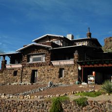
Chloride, Mining settlement in Mohave County, United States

Description

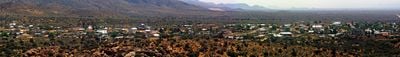
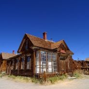
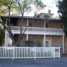
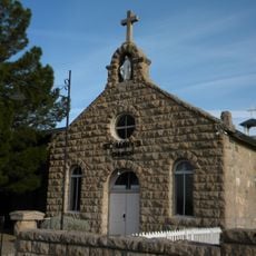
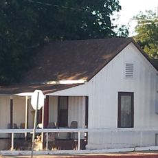
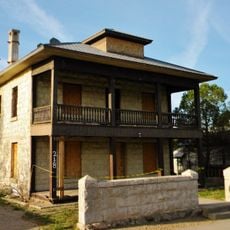
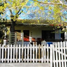
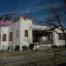
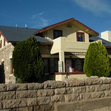
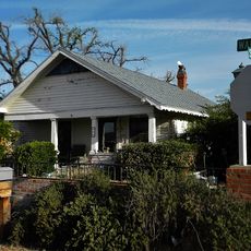
Chloride is a mining settlement in Mohave County in northwestern Arizona, spread across the landscape at about 4,000 feet (1,226 meters) elevation in a desert and mountain setting. The abandoned buildings and equipment remain scattered throughout the area, showing traces of 19th-century silver mining operations.

History

The settlement began in 1863 when prospectors discovered silver deposits in the surrounding mountains, sparking a mining boom in this remote region. Mining remained the lifeblood of the community for many decades, shaping its growth and structure.

Culture

The settlement preserves buildings and equipment from its mining past, allowing visitors to understand how miners worked and lived in this remote place. Through these remains, you can sense the daily life and hardships of those who made their home here.

Practical

Visitors can reach the settlement by paved roads connecting to major highways, and the preserved buildings are accessible for self-exploration. Spring and fall offer the most comfortable visiting conditions, as summer heat in this desert location becomes quite intense.

Did you know?

The place contains numerous original mining shafts and tunnels that run deep into the mountains, revealing the extent of extraction that once took place here. These underground passages stand as reminders of the enormous effort miners invested in this location.

Location
Inception
1863
Elevation above the sea
1,226 m
GPS coordinates
35.41444,-114.19944
Latest update
December 18, 2025 15:31

AroundUs brings together thousands of curated places, local tips, and hidden gems, enriched daily by 60,000 contributors worldwide. Discover all places nearby (Mohave County).

The 100 notable ghost towns in the United States

The United States have hundreds of abandoned towns. This selection includes 100 of these places where time seems to stand still. Most grew rich in the 19th century through gold or silver finds. They attracted miners, traders, and whole families. When the veins were empty, people left. They left...

Around this place
Atchison, Topeka and Santa Fe Railway 3759
United States of America

Atchison, Topeka and Santa Fe Railway 3759

28.1 km
AT&T Building
United States of America

AT&T Building

28 km
United States of America

Mount Tipton

13.9 km
Bonelli House
United States of America

Bonelli House

28.3 km
Saint John's Methodist Episcopal Church
United States of America

Saint John's Methodist Episcopal Church

28.3 km
Mohave County Courthouse and Jail
United States of America

Mohave County Courthouse and Jail

28.2 km
United States of America

Mount Tipton Wilderness

13.8 km
Desert Power & Water Co.
United States of America

Desert Power & Water Co.

28.2 km
Mohave Museum of History and Arts
United States of America

Mohave Museum of History and Arts

28 km
Saint Mary's Catholic Church
United States of America

Saint Mary's Catholic Church

28.1 km
Tyrell House
United States of America

Tyrell House

27.6 km
G. H. Sullivan Lodging House
United States of America

G. H. Sullivan Lodging House

28.2 km
Mohave County Hospital
United States of America

Mohave County Hospital

28 km
Dr. Toler R. White House
United States of America

Dr. Toler R. White House

28.3 km
House at 105 Spring St.
United States of America

House at 105 Spring St.

27.9 km
House at 527 Pine
United States of America

House at 527 Pine

28.3 km
United States of America

Building at 218 Spring

28.1 km
Kingman Grammar School
United States of America

Kingman Grammar School

28.2 km
United States of America

Arthur F. Black House

27.6 km
William G. Blakeley House
United States of America

William G. Blakeley House

28.3 km
Ross E. Householder House
United States of America

Ross E. Householder House

28.3 km
House at 809 Grand View
United States of America

House at 809 Grand View

27.4 km
J. B. Wright House
United States of America

J. B. Wright House

28.2 km
W. P. Mahoney House
United States of America

W. P. Mahoney House

27.8 km
United States of America

Cerbat Cliffs Golf Course (Kingman Municipal)

26.8 km
United States of America

Kingman Route 66 Arch

28.2 km
United States of America

Bonelli House

28.2 km
United States of America

Chloride Murals, by artist Roy Purcell

2.6 km
Show the full map
« Chloride - Mining settlement in Mohave County, United States » is provided by Around Us (aroundus.com). Images and texts are derived from Wikimedia project under a Creative Commons license. You are allowed to copy, distribute, and modify copies of this page, under the conditions set by the license, as long as this note is clearly visible.

Discover hidden gems everywhere you go!

From secret cafés to breathtaking viewpoints, skip the crowded tourist spots and find places that match your style. Our app makes it easy with voice search, smart filtering, route optimization, and insider tips from travelers worldwide. Download now for the complete mobile experience.

Around Us App Screenshot

A unique approach to discovering new places

Le Figaro

All the places worth exploring

France Info

A tailor-made excursion in just a few clicks

20 Minutes

Around Us
Travel Guide & Maps
Download

Send to your phone

QR Code
1

Open the camera app on your mobile.

2

Point at the QR code with your camera. A notification will appear.

3

Tap the notification to open the link.