Chest opened
+${chestReward.xp} XP
Explorer
NOUVEAU ×${chestReward.collectible.quantity}
tapez pour fermer
Chest locked

Open chests in the app

Around Us is built for your phone — chests unlock when you walk, explore and capture nearby places.

Enable Location

We need your location to show you interesting places around you

Discover nearby places

Find interesting locations and hidden gems around you

Precise directions

Get accurate directions and distances to places

Your location is never shared with other users. It's only used when you tap the location button.

Dolan Springs

Log in to your account

Start exploring — it's free

Trusted by 72,890 travelers worldwide

Continue with Google
Continue with Apple
or

We will send you a code to connect

By continuing, you accept our Terms and Conditions and our Privacy Policy

Check your inbox

We've sent a pincode in your inbox. Please enter the code below.

Discussion Reviews 1 Photos
15.2k Popularity

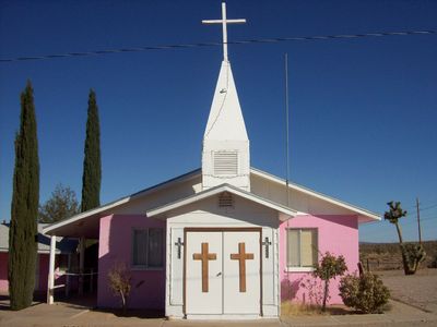
Dolan Springs, Census-designated place in Mohave County, Arizona

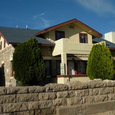
Dolan Springs is a small settlement in north-central Mohave County situated in Detrital Valley between the Cerbat Mountains and Table Mountain Plateau at roughly 1,000 meters elevation. The community spreads across an open landscape framed by mountains on either side.

The settlement developed in the early 20th century as a ranching community in this remote valley. Over the decades, population remained relatively stable, with modest fluctuations between 2,000 and 2,100 residents.

The population displays a varied composition with 76.7 percent White residents, 20.1 percent Hispanic or Latino, and additional ethnic groups contributing to local diversity.

The nearest larger medical facilities are about 50 miles (80 km) away, so plan travel time carefully for medical needs. Keep in mind this area has basic services but depends on nearby larger towns for most conveniences.

US Route 93 runs directly through the area, connecting Las Vegas and Phoenix, making this a natural waypoint between the two major cities. This highway location has shaped the community's development and character over time.

The community of curious travelers

AroundUs brings together thousands of curated places, local tips, and hidden gems, enriched daily by 60,000 contributors worldwide.

Start exploring
Location
Elevation above the sea
1,036 m
GPS coordinates
35.61583,-114.26083
Latest update
December 7, 2025 19:31
Around this place
Black Canyon of the Colorado
United States of America

Black Canyon of the Colorado

45.9 km
El Dorado Canyon
United States of America

El Dorado Canyon

41.7 km
Atchison, Topeka and Santa Fe Railway 3759
United States of America

Atchison, Topeka and Santa Fe Railway 3759

50.9 km
AT&T Building
United States of America

AT&T Building

50.7 km
Bonelli House
United States of America

Bonelli House

51 km
Saint John's Methodist Episcopal Church
United States of America

Saint John's Methodist Episcopal Church

51 km
Mohave County Courthouse and Jail
United States of America

Mohave County Courthouse and Jail

50.9 km
Mohave Museum of History and Arts
United States of America

Mohave Museum of History and Arts

50.7 km
Ross H. Blakely House
United States of America

Ross H. Blakely House

51 km
Saint Mary's Catholic Church
United States of America

Saint Mary's Catholic Church

50.8 km
Max J. Anderson House
United States of America

Max J. Anderson House

51 km
S. T. Elliott House
United States of America

S. T. Elliott House

51 km
Kingman Commercial Historic District
United States of America

Kingman Commercial Historic District

51.2 km
G. H. Sullivan Lodging House
United States of America

G. H. Sullivan Lodging House

50.9 km
Tyrell House
United States of America

Tyrell House

50.4 km
Masonic Temple
United States of America

Masonic Temple

51.1 km
Mohave County Hospital
United States of America

Mohave County Hospital

50.8 km
Dr. Toler R. White House
United States of America

Dr. Toler R. White House

51 km
House at 105 Spring St.
United States of America

House at 105 Spring St.

50.7 km
House at 527 Pine
United States of America

House at 527 Pine

51 km
Van Marter Building
United States of America

Van Marter Building

51.1 km
Duff T. Brown House
United States of America

Duff T. Brown House

51.1 km
Kingman Grammar School
United States of America

Kingman Grammar School

50.8 km
Little Red School
United States of America

Little Red School

51 km
William G. Blakeley House
United States of America

William G. Blakeley House

50.9 km
Ross E. Householder House
United States of America

Ross E. Householder House

50.9 km
House at 809 Grand View
United States of America

House at 809 Grand View

50.1 km
J. B. Wright House
United States of America

J. B. Wright House

50.9 km
Show the full map
Reviews
Share your experience

No review yet

Discussions
Start a discussion...

No discussion yet

« Dolan Springs - Census-designated place in Mohave County, Arizona » is provided by Around Us (aroundus.com). Images and texts are derived from Wikimedia project under a Creative Commons license. You are allowed to copy, distribute, and modify copies of this page, under the conditions set by the license, as long as this note is clearly visible.

Discover hidden gems everywhere you go!

From secret cafés to breathtaking viewpoints, skip the crowded tourist spots and find places that match your style. Our app makes it easy with voice search, smart filtering, route optimization, and insider tips from travelers worldwide. Download now for the complete mobile experience.

Around Us App Screenshot

A unique approach to discovering new places

Le Figaro

All the places worth exploring

France Info

A tailor-made excursion in just a few clicks

20 Minutes

Around Us
Travel Guide & Maps
Download

Send to your phone

QR Code
1

Open the camera app on your mobile.

2

Point at the QR code with your camera. A notification will appear.

3

Tap the notification to open the link.