Enable Location

We need your location to show you interesting places around you

Discover nearby places

Find interesting locations and hidden gems around you

Precise directions

Get accurate directions and distances to places

Your location is never shared with other users. It's only used when you tap the location button.

Floor of the Valley Road

Log in to your account

Start exploring — it's free

Trusted by 62,835 travelers worldwide

Continue with Google
Continue with Apple
or

We will send you a code to connect

By continuing, you accept our Terms and Conditions and our Privacy Policy

Check your inbox

We've sent a pincode in your inbox. Please enter the code below.

Floor of the Valley Road, scenic drive in Zion Canyon in Zion National Park in Washington County, Utah, United States

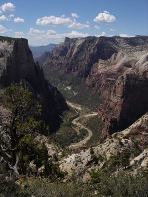
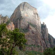
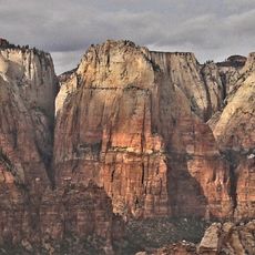
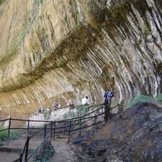
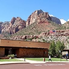
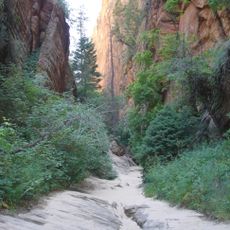
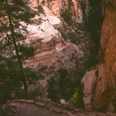
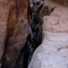
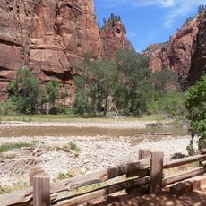
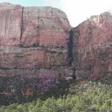
Floor of the Valley Road is a scenic route that runs through Zion Canyon in Zion National Park in Utah and follows the North Fork of the Virgin River. The nine-mile drive begins at the park's south boundary and ends near Temple of Sinawava, featuring towering canyon walls and colorful cliff formations along the way.

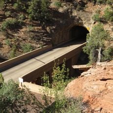
A simple dirt road was first built in 1916, then replaced by a gravel surface in the mid-1920s. The current route was constructed in the early 1930s by the Civilian Conservation Corps as a public works project during the Great Depression.

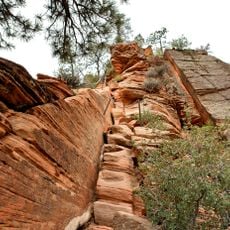
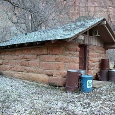
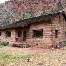
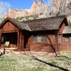
The road's name refers to the flat valley floor of Zion Canyon where it runs and where visitors experience the landscape. The rustic details like timber posts and railings reflect traditional building styles and create harmony between human structures and the natural surroundings.

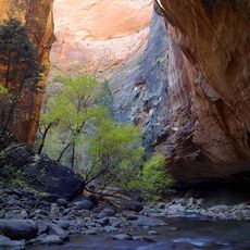
The road follows the river through the narrow canyon with several pullouts where you can stop and walk to nearby trails. During peak season from April to October, private cars are not permitted; visitors use propane-powered shuttle buses to avoid congestion.

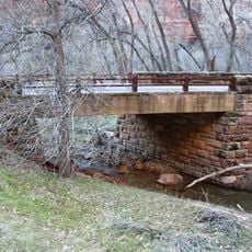
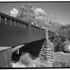
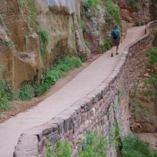
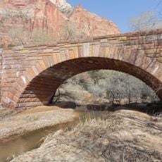
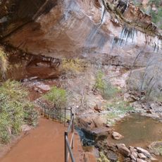
The Cable Creek Bridge was built in 1931 using local materials and showcases engineering from that era with a red chip seal surface and concrete beams. Beneath it runs an old stone path that once served for transporting goods across the creek and is rarely noticed by visitors today.

The community of curious travelers

AroundUs brings together thousands of curated places, local tips, and hidden gems, enriched daily by 60,000 contributors worldwide.

Start exploring
Architects
William G. Carnes
GPS coordinates
37.25556,-112.95472
Latest update
February 9, 2026 08:22
Around this place
The Narrows
United States of America

The Narrows

5.7 km
The Great White Throne
United States of America

The Great White Throne

1.4 km
Court of the Patriarchs
United States of America

Court of the Patriarchs

2.2 km
Weeping Rock
United States of America

Weeping Rock

2.5 km
Zion Lodge–Birch Creek Historic District
United States of America

Zion Lodge–Birch Creek Historic District

718 m
Angels Landing Trail
United States of America

Angels Landing Trail

1.7 km
Cable Creek Bridge
United States of America

Cable Creek Bridge

2.1 km
Virgin River Bridge
United States of America

Virgin River Bridge

4.6 km
Canyon Overlook Trail
United States of America

Canyon Overlook Trail

4.5 km
West Rim Trail
United States of America

West Rim Trail

5.3 km
East Rim Trail
United States of America

East Rim Trail

3.2 km
Riverside Walk
United States of America

Riverside Walk

4.1 km
Pine Creek Bridge
United States of America

Pine Creek Bridge

4.5 km
Grotto Camping Ground North Comfort Station
United States of America

Grotto Camping Ground North Comfort Station

1.2 km
Cable Mountain Draw Works
United States of America

Cable Mountain Draw Works

2.4 km
Emerald Pools Trail
United States of America

Emerald Pools Trail

680 m
Hidden Canyon Trail
United States of America

Hidden Canyon Trail

1.8 km
Zion Human History Museum
United States of America

Zion Human History Museum

5.6 km
Grotto Camping Ground South Comfort Station
United States of America

Grotto Camping Ground South Comfort Station

1.3 km
Grotto Residence
United States of America

Grotto Residence

425 m
Pine Creek Residential Historic District
United States of America

Pine Creek Residential Historic District

4.9 km
Oak Creek Historic District
United States of America

Oak Creek Historic District

5.7 km
Hidden Canyon
United States of America

Hidden Canyon

2.1 km
Walter's Wiggles
United States of America

Walter's Wiggles

2.3 km
Echo Canyon
United States of America

Echo Canyon

2.1 km
Temple of Sinawava
United States of America

Temple of Sinawava

3.3 km
The Streaked Wall
United States of America

The Streaked Wall

4.5 km
Upper Pine Creek Bridge
United States of America

Upper Pine Creek Bridge

4.9 km
Show the full map
« Floor of the Valley Road - scenic drive in Zion Canyon in Zion National Park in Washington County, Utah, United States » is provided by Around Us (aroundus.com). Images and texts are derived from Wikimedia project under a Creative Commons license. You are allowed to copy, distribute, and modify copies of this page, under the conditions set by the license, as long as this note is clearly visible.

Discover hidden gems everywhere you go!

From secret cafés to breathtaking viewpoints, skip the crowded tourist spots and find places that match your style. Our app makes it easy with voice search, smart filtering, route optimization, and insider tips from travelers worldwide. Download now for the complete mobile experience.

Around Us App Screenshot

A unique approach to discovering new places

Le Figaro

All the places worth exploring

France Info

A tailor-made excursion in just a few clicks

20 Minutes

Around Us
Travel Guide & Maps
Download

Send to your phone

QR Code
1

Open the camera app on your mobile.

2

Point at the QR code with your camera. A notification will appear.

3

Tap the notification to open the link.