Enable Location

We need your location to show you interesting places around you

Discover nearby places

Find interesting locations and hidden gems around you

Precise directions

Get accurate directions and distances to places

Your location is never shared with other users. It's only used when you tap the location button.

Bannock County

Log in to your account

Start exploring — it's free

Trusted by 61,769 travelers worldwide

Continue with Google
Continue with Apple
or

We will send you a code to connect

By continuing, you accept our Terms and Conditions and our Privacy Policy

Check your inbox

We've sent a pincode in your inbox. Please enter the code below.

Bannock County, Administrative division in southeastern Idaho, United States

Description

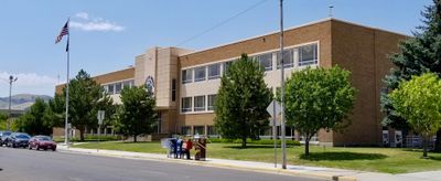
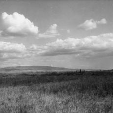
Bannock County is an administrative division in southeastern Idaho with mountains, valleys, and farmland as its main features. Pocatello serves as the economic and administrative center of the entire county.

History

The county was established in 1893 and named after the Bannock Native American people who lived in these southeastern Idaho lands long before. This connection to the region's early past remains a key part of its identity.

Culture

Idaho State University shapes the educational landscape in Pocatello, while the annual Idaho State Fair displays local farming traditions and craftsmanship. Visitors experience how farming and education matter deeply to daily life in the region.

Practical

The county includes multiple towns and offers both urban and rural areas to explore, with Pocatello as the central hub for services and facilities. The varied landscapes require a car to reach all areas comfortably.

Did you know?

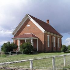
The county contains eight separate towns, with Pocatello being the largest while others like Lava Hot Springs are known for natural hot springs. This diverse collection of communities offers completely different experiences within a small area.

GPS coordinates
42.69362,-112.25060
Latest update
December 7, 2025 19:26

AroundUs brings together thousands of curated places, local tips, and hidden gems, enriched daily by 60,000 contributors worldwide. Discover all places nearby (Bannock County).

Around this place
Fort Hall
United States of America

Fort Hall

48 km
Holt Arena
United States of America

Holt Arena

24.4 km
American Falls Dam
United States of America

American Falls Dam

51.9 km
Chesterfield
United States of America

Chesterfield

34.1 km
Pocatello Idaho Temple
United States of America

Pocatello Idaho Temple

27.8 km
Lava Hot Springs
United States of America

Lava Hot Springs

21 km
Idaho Museum of Natural History
United States of America

Idaho Museum of Natural History

24.4 km
Malad Second Ward Tabernacle
United States of America

Malad Second Ward Tabernacle

56.6 km
St. Joseph's Catholic Church
United States of America

St. Joseph's Catholic Church

25.2 km
Standrod House
United States of America

Standrod House

25.5 km
Idaho State Arboretum
United States of America

Idaho State Arboretum

23.9 km
Church of the Assumption
United States of America

Church of the Assumption

25.3 km
Oneida County Courthouse
United States of America

Oneida County Courthouse

56.4 km
United Presbyterian Church
United States of America

United Presbyterian Church

56.5 km
Idaho State University Administration Building
United States of America

Idaho State University Administration Building

23.9 km
Power County Courthouse
United States of America

Power County Courthouse

49.9 km
Grace Pegram Truss Railroad Bridge
United States of America

Grace Pegram Truss Railroad Bridge

43.9 km
A.F.R. Building
United States of America

A.F.R. Building

25.3 km
Co-op Block and J. N. Ireland Bank
United States of America

Co-op Block and J. N. Ireland Bank

56.5 km
Walter Sparks House
United States of America

Walter Sparks House

49.9 km
Jedd Jones House
United States of America

Jedd Jones House

56 km
Pocatello Carnegie Library
United States of America

Pocatello Carnegie Library

24.8 km
Sullivan-Kinney House
United States of America

Sullivan-Kinney House

24.4 km
John Hood House
United States of America

John Hood House

24.6 km
United States of America

Oneida Milling and Elevator Company Grain Elevator

51.5 km
D.L. Evans Sr. Bungalow
United States of America

D.L. Evans Sr. Bungalow

56.1 km
Idaho Museum of Natural History
United States of America

Idaho Museum of Natural History

23.8 km
McCammon Overhead and River Crossing Bridge
United States of America

McCammon Overhead and River Crossing Bridge

5.9 km
Show the full map
« Bannock County - Administrative division in southeastern Idaho, United States » is provided by Around Us (aroundus.com). Images and texts are derived from Wikimedia project under a Creative Commons license. You are allowed to copy, distribute, and modify copies of this page, under the conditions set by the license, as long as this note is clearly visible.

Discover hidden gems everywhere you go!

From secret cafés to breathtaking viewpoints, skip the crowded tourist spots and find places that match your style. Our app makes it easy with voice search, smart filtering, route optimization, and insider tips from travelers worldwide. Download now for the complete mobile experience.

Around Us App Screenshot

A unique approach to discovering new places

Le Figaro

All the places worth exploring

France Info

A tailor-made excursion in just a few clicks

20 Minutes

Around Us
Travel Guide & Maps
Download

Send to your phone

QR Code
1

Open the camera app on your mobile.

2

Point at the QR code with your camera. A notification will appear.

3

Tap the notification to open the link.