Enable Location

We need your location to show you interesting places around you

Discover nearby places

Find interesting locations and hidden gems around you

Precise directions

Get accurate directions and distances to places

Your location is never shared with other users. It's only used when you tap the location button.

American Falls Dam

Log in to your account

Start exploring — it's free

Trusted by 62,360 travelers worldwide

Continue with Google
Continue with Apple
or

We will send you a code to connect

By continuing, you accept our Terms and Conditions and our Privacy Policy

Check your inbox

We've sent a pincode in your inbox. Please enter the code below.

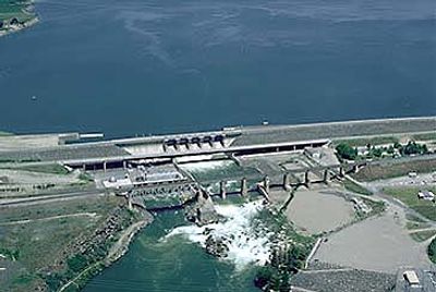
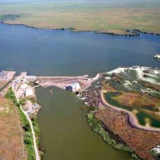
American Falls Dam, Hydroelectric power station and gravity dam in Power County, Idaho.

The dam spans 1,608 meters across the Snake River and holds back water to supply the surrounding region. The structure uses the river's flow to generate electricity while also serving as a major water storage facility for irrigation.

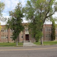
The dam was built in the 1920s and required relocating a large portion of the town of American Falls. This project was part of broader efforts to develop the Snake River for hydropower and irrigation.

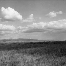
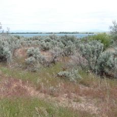
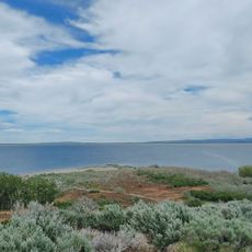
The reservoir transformed agricultural practices in the region by storing water for irrigation across dry farmland. Today, local farmers depend on this supply to maintain their crops throughout the growing season.

Several boat ramps provide water access on the southwest side and north of the dam, making it easy to reach the reservoir. The area around the water is suitable for fishing and swimming during warmer months.

The reservoir hosts trout populations that grow remarkably large in this part of Idaho. Anglers visit the area specifically because of these fish stocks.

The community of curious travelers

AroundUs brings together thousands of curated places, local tips, and hidden gems, enriched daily by 60,000 contributors worldwide.

Start exploring
Location
Length
1,608 m
GPS coordinates
42.77940,-112.87430
Latest update
December 8, 2025 19:53
Around this place
Fort Hall
United States of America

Fort Hall

33.2 km
Massacre Rocks State Park
United States of America

Massacre Rocks State Park

7.6 km
Holt Arena
United States of America

Holt Arena

37.8 km
Pocatello Idaho Temple
United States of America

Pocatello Idaho Temple

41 km
Register Rock
United States of America

Register Rock

18.2 km
Lake Walcott State Park
United States of America

Lake Walcott State Park

50.6 km
Lake Walcott
United States of America

Lake Walcott

41.4 km
Idaho Museum of Natural History
United States of America

Idaho Museum of Natural History

37.3 km
Minidoka National Wildlife Refuge
United States of America

Minidoka National Wildlife Refuge

43.8 km
Blackfoot LDS Tabernacle
United States of America

Blackfoot LDS Tabernacle

62.7 km
Zoo Idaho
United States of America

Zoo Idaho

37.6 km
St. Joseph's Catholic Church
United States of America

St. Joseph's Catholic Church

35.4 km
Standrod House
United States of America

Standrod House

35.3 km
Idaho State Arboretum
United States of America

Idaho State Arboretum

37.1 km
Church of the Assumption
United States of America

Church of the Assumption

36.4 km
Idaho State University Administration Building
United States of America

Idaho State University Administration Building

37.2 km
Power County Courthouse
United States of America

Power County Courthouse

2.1 km
A.F.R. Building
United States of America

A.F.R. Building

35.7 km
Walter Sparks House
United States of America

Walter Sparks House

2.1 km
Pocatello Carnegie Library
United States of America

Pocatello Carnegie Library

35.6 km
Sullivan-Kinney House
United States of America

Sullivan-Kinney House

35.8 km
John Hood House
United States of America

John Hood House

36.9 km
Ross Park Aquatic Complex
United States of America

Ross Park Aquatic Complex

37.5 km
United States of America

Oneida Milling and Elevator Company Grain Elevator

797 m
Shilling Avenue Historic District
United States of America

Shilling Avenue Historic District

62.7 km
Idaho Museum of Natural History
United States of America

Idaho Museum of Natural History

37.1 km
Wapi Lava Field
United States of America

Wapi Lava Field

30.4 km
Rainbow Beach
United States of America

Rainbow Beach

17.2 km
Show the full map
« American Falls Dam - Hydroelectric power station and gravity dam in Power County, Idaho » is provided by Around Us (aroundus.com). Images and texts are derived from Wikimedia project under a Creative Commons license. You are allowed to copy, distribute, and modify copies of this page, under the conditions set by the license, as long as this note is clearly visible.

Discover hidden gems everywhere you go!

From secret cafés to breathtaking viewpoints, skip the crowded tourist spots and find places that match your style. Our app makes it easy with voice search, smart filtering, route optimization, and insider tips from travelers worldwide. Download now for the complete mobile experience.

Around Us App Screenshot

A unique approach to discovering new places

Le Figaro

All the places worth exploring

France Info

A tailor-made excursion in just a few clicks

20 Minutes

Around Us
Travel Guide & Maps
Download

Send to your phone

QR Code
1

Open the camera app on your mobile.

2

Point at the QR code with your camera. A notification will appear.

3

Tap the notification to open the link.