Enable Location

We need your location to show you interesting places around you

Discover nearby places

Find interesting locations and hidden gems around you

Precise directions

Get accurate directions and distances to places

Your location is never shared with other users. It's only used when you tap the location button.

Lake Walcott

Log in to your account

Start exploring — it's free

Trusted by 62,367 travelers worldwide

Continue with Google
Continue with Apple
or

We will send you a code to connect

By continuing, you accept our Terms and Conditions and our Privacy Policy

Check your inbox

We've sent a pincode in your inbox. Please enter the code below.

Lake Walcott

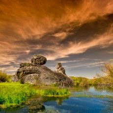
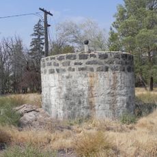
Lake Walcott, body of water

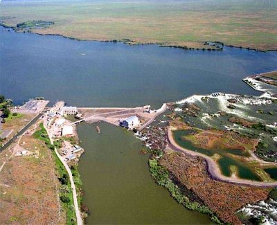
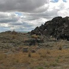
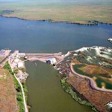
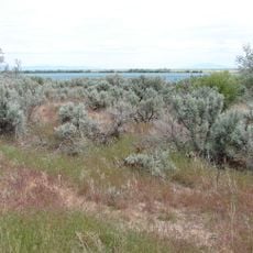
Lake Walcott is a large reservoir in Idaho that stretches for several miles along the Snake River. The lake has a long shoreline with flat fields and patches of trees nearby, plus several small islands including Bird Island, which serves as a resting place for birds.

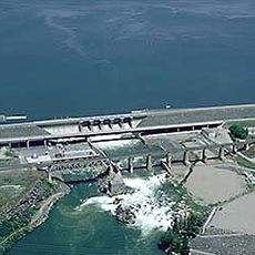
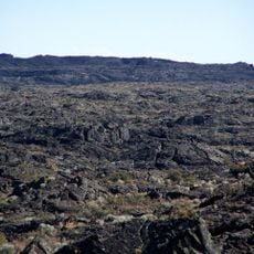
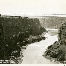
The lake was created in 1909 when the Minidoka Dam was built across the Snake River to control water and generate power. The project transformed dry desert landscape into farmland and enabled the development of farms and communities across the region.

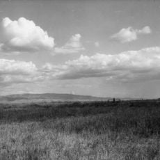
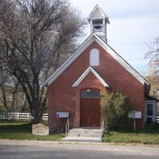
The lake and surrounding landscape play an important role in local life, especially for fishermen and bird watchers who visit regularly. The area reflects a history of settlement where farms and small communities developed in land that was once desert.

The lake is accessible for fishing, boating, and swimming, with picnic areas and camping available nearby. The best time to visit is in the summer months when boat rentals are available, or in early mornings and late evenings for bird watching.

The reservoir is home to over 235 bird species, making it a significant location for nature watchers. Bird Island, one of the lake's islands, serves as an important resting place for migratory birds and other species regularly spotted there.

The community of curious travelers

AroundUs brings together thousands of curated places, local tips, and hidden gems, enriched daily by 60,000 contributors worldwide.

Start exploring
Location
GPS coordinates
42.66970,-113.35838
Latest update
February 9, 2026 08:22
Around this place
Fort Hall
United States of America

Fort Hall

70.8 km
Massacre Rocks State Park
United States of America

Massacre Rocks State Park

35.4 km
City of Rocks National Reserve
United States of America

City of Rocks National Reserve

71.9 km
American Falls Dam
United States of America

American Falls Dam

41.4 km
Wilson Butte Cave
United States of America

Wilson Butte Cave

71.1 km
Register Rock
United States of America

Register Rock

28.1 km
Castle Rocks State Park
United States of America

Castle Rocks State Park

64.8 km
Lake Walcott State Park
United States of America

Lake Walcott State Park

9.7 km
Hansen Bridge
United States of America

Hansen Bridge

78 km
Minidoka National Wildlife Refuge
United States of America

Minidoka National Wildlife Refuge

2.5 km
St. Joseph's Catholic Church
United States of America

St. Joseph's Catholic Church

76.8 km
Standrod House
United States of America

Standrod House

76.8 km
Church of the Assumption
United States of America

Church of the Assumption

77.8 km
Empire School
United States of America

Empire School

26.6 km
Cassia County Courthouse
United States of America

Cassia County Courthouse

38.6 km
Albion Methodist Church
United States of America

Albion Methodist Church

33.7 km
Power County Courthouse
United States of America

Power County Courthouse

43.5 km
A.F.R. Building
United States of America

A.F.R. Building

77.1 km
Walter Sparks House
United States of America

Walter Sparks House

43.5 km
Rupert Town Square Historic District
United States of America

Rupert Town Square Historic District

26.3 km
Pocatello Carnegie Library
United States of America

Pocatello Carnegie Library

77 km
Denton J. Paul Water Tank
United States of America

Denton J. Paul Water Tank

76.9 km
Sullivan-Kinney House
United States of America

Sullivan-Kinney House

77.3 km
United States of America

Oneida Milling and Elevator Company Grain Elevator

42.1 km
James H. Laine Barn
United States of America

James H. Laine Barn

76.9 km
Wilson Theatre
United States of America

Wilson Theatre

26.6 km
Wapi Lava Field
United States of America

Wapi Lava Field

26 km
Hansen Bridge
United States of America

Hansen Bridge

78 km
Show the full map
« Lake Walcott - body of water » is provided by Around Us (aroundus.com). Images and texts are derived from Wikimedia project under a Creative Commons license. You are allowed to copy, distribute, and modify copies of this page, under the conditions set by the license, as long as this note is clearly visible.

Discover hidden gems everywhere you go!

From secret cafés to breathtaking viewpoints, skip the crowded tourist spots and find places that match your style. Our app makes it easy with voice search, smart filtering, route optimization, and insider tips from travelers worldwide. Download now for the complete mobile experience.

Around Us App Screenshot

A unique approach to discovering new places

Le Figaro

All the places worth exploring

France Info

A tailor-made excursion in just a few clicks

20 Minutes

Around Us
Travel Guide & Maps
Download

Send to your phone

QR Code
1

Open the camera app on your mobile.

2

Point at the QR code with your camera. A notification will appear.

3

Tap the notification to open the link.