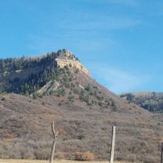
Dolores River Canyon, Natural canyon along Dolores River in Colorado, US.
Dolores River Canyon is a deep gorge cut by the Dolores River, featuring steep walls of layered rock in warm colors. The geological formations reveal multiple time periods stacked vertically against each other.
The ancestral Dolores River once flowed south toward the San Juan River near the Four Corners. About 70 million years ago, the uplift of Sleeping Ute Mountain diverted it north, and it carved the canyon on its way to the Colorado River. The canyon walls expose Pennsylvanian limestone around 300 million years old up to 140-million-year-old Entrada sandstone, capped by Cretaceous Dakota sandstone.
The river's name comes from the Spanish El Río de Nuestra Señora de Dolores, River of Our Lady of Sorrows, given during Juan Maria Antonio Rivera's 1765 expedition from Santa Fe. The canyon lies on Bureau of Land Management land and has been proposed for protection under the 1964 Wilderness Act.
The canyon lies west of Naturita and north of Dove Creek, entirely on Bureau of Land Management land. The river below McPhee Dam often drops to a small mandated flow, so boaters should check releases before planning a run. Whitewater appears mainly in years of heavy snowmelt.
The Hanging Flume, a wooden water channel, clings to the canyon wall near Uravan. Built in the late 1800s to carry water to gold mines, it is among the few surviving structures of its kind in the United States.
The community of curious travelers
AroundUs brings together thousands of curated places, local tips, and hidden gems, enriched daily by 93,225 contributors worldwide.