Maple Canyon, Natural canyon in Sanpete County, United States
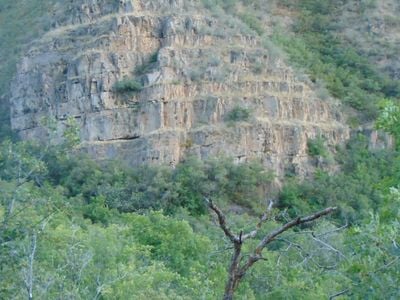
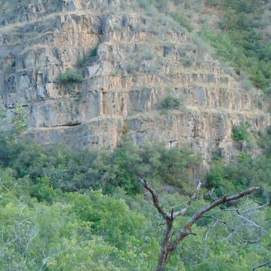
Maple Canyon is a canyon in the northeastern San Pitch Mountains of Sanpete County, Utah, with its mouth at 6,017 feet (1,834 m) in the northwestern Sanpete Valley. Its walls are conglomerate: stacked, rounded rock layers in tan, gray, and pale brown, broken by narrow ledges where sparse shrubs grow. The rough, eroded surface has vertical cracks and shallow recesses, and leafy green trees and bushes line the lower edge.
Millions of years ago, ancient rivers deposited cobblestones and sediments that gradually compressed into the rock formations visible today. This geological process created the layered structures that now define the canyon.
Climbers from around the world gather here to practice sport climbing on numerous rock faces, testing routes of varying difficulty levels.
The canyon mouth sits at 6,017 feet off Highway 132, south of Fountain Green and just northwest of Freedom; a signed side road leads in. Campgrounds such as Maple Canyon, Box Canyon and Left Fork have picnic tables, fire rings and vault toilets but no drinking water, so bring your own. Sites are first-come-first-served, so arrive early in the day.
The canyon's cobblestone walls are made of rounded river rocks cemented in a sandy matrix, giving climbers a surface unlike the sandstone found elsewhere in Utah. The mouth sits at 6,017 feet (1,834 m) just northwest of Freedom, and nearly the whole canyon lies within Uinta National Forest.
The community of curious travelers
AroundUs brings together thousands of curated places, local tips, and hidden gems, enriched daily by 93,857 contributors worldwide.