Enable Location

We need your location to show you interesting places around you

Discover nearby places

Find interesting locations and hidden gems around you

Precise directions

Get accurate directions and distances to places

Your location is never shared with other users. It's only used when you tap the location button.

Fort Bridger

Log in to your account

Start exploring — it's free

Trusted by 62,831 travelers worldwide

Continue with Google
Continue with Apple
or

We will send you a code to connect

By continuing, you accept our Terms and Conditions and our Privacy Policy

Check your inbox

We've sent a pincode in your inbox. Please enter the code below.

Fort Bridger, Military outpost in Uinta County, United States.

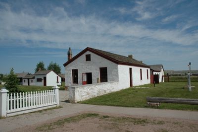
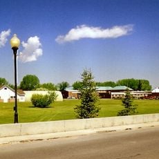
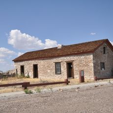
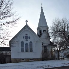
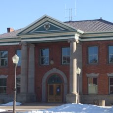
Fort Bridger is a historic military site and open-air museum in Uinta County, southern Wyoming. The grounds cover around 37 acres (15 hectares) along Groshon Creek and include more than two dozen preserved buildings from the military era as well as several reconstructed log structures.

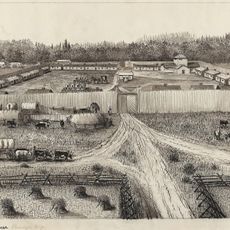
The post began in 1842 as a trading station with a stockade and four log cabins. Later, Mormons purchased the site before the US Army took control in 1858 and used it as a military garrison until 1890.

The name honors Jim Bridger, a trapper and trader who opened a station for travelers passing through the mountains. Today, visitors walk among log cabins and military buildings that recall the resupply role the post played for settlers and soldiers in the 1800s.

Access is via exit 34 off Interstate 80, about 3 miles (5 kilometers) south of the highway. The museum opens daily from May through September, with limited hours during the rest of the year.

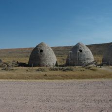
The grounds still hold the original Pony Express stable from the 1860s. Also visible are wall remnants from Mormon fortifications and structures from five different military building phases.

The community of curious travelers

AroundUs brings together thousands of curated places, local tips, and hidden gems, enriched daily by 60,000 contributors worldwide.

Start exploring
Location
Inception
June 27, 1928
Operator
Wyoming State Parks
GPS coordinates
41.31778,-110.39194
Latest update
December 20, 2025 00:11
Around this place
Wasatch-Cache National Forest
United States of America

Wasatch-Cache National Forest

42.4 km
Bear River State Park
United States of America

Bear River State Park

46 km
Fort Supply
United States of America

Fort Supply

17.2 km
Piedmont Charcoal Kilns
United States of America

Piedmont Charcoal Kilns

21.9 km
Wyoming State Insane Asylum
United States of America

Wyoming State Insane Asylum

47 km
United States of America

Elinore Pruitt Stewart Homestead

47.7 km
Union Pacific Railroad Complex
United States of America

Union Pacific Railroad Complex

48.6 km
Granger Stage Station State Historic Site
United States of America

Granger Stage Station State Historic Site

46.5 km
Medicine Butte
United States of America

Medicine Butte

43.3 km
United States of America

Mountain Skies Observatory

8.4 km
Evanston Main Post Office
United States of America

Evanston Main Post Office

48.3 km
A. V. Quinn House
United States of America

A. V. Quinn House

48.4 km
Downtown Evanston Historic District
United States of America

Downtown Evanston Historic District

48.2 km
St. Paul's Episcopal Church
United States of America

St. Paul's Episcopal Church

48.5 km
Uinta County Courthouse
United States of America

Uinta County Courthouse

48.2 km
ERT Bridge over Black's Fork
United States of America

ERT Bridge over Black's Fork

1.8 km
United States of America

Fish Lake

46.7 km
United States of America

Austin Reservoir

13.5 km
United States of America

Granger Stage Station Historical Marker

46.5 km
United States of America

Rocky Point

43.1 km
United States of America

Sulphur Creek Reservoir

40.7 km
United States of America

Hoop Lake

49.6 km
United States of America

Meeks Cabin Reservoir

37.5 km
United States of America

Crompton Reservoir

47.2 km
United States of America

Piedmont Reservoir

26.5 km
United States of America

Thirtythree Pond

33.8 km
United States of America

Crockers Point

39.4 km
United States of America

Skull Point

46 km
Show the full map
« Fort Bridger - Military outpost in Uinta County, United States » is provided by Around Us (aroundus.com). Images and texts are derived from Wikimedia project under a Creative Commons license. You are allowed to copy, distribute, and modify copies of this page, under the conditions set by the license, as long as this note is clearly visible.

Discover hidden gems everywhere you go!

From secret cafés to breathtaking viewpoints, skip the crowded tourist spots and find places that match your style. Our app makes it easy with voice search, smart filtering, route optimization, and insider tips from travelers worldwide. Download now for the complete mobile experience.

Around Us App Screenshot

A unique approach to discovering new places

Le Figaro

All the places worth exploring

France Info

A tailor-made excursion in just a few clicks

20 Minutes

Around Us
Travel Guide & Maps
Download

Send to your phone

QR Code
1

Open the camera app on your mobile.

2

Point at the QR code with your camera. A notification will appear.

3

Tap the notification to open the link.