Enable Location

We need your location to show you interesting places around you

Discover nearby places

Find interesting locations and hidden gems around you

Precise directions

Get accurate directions and distances to places

Your location is never shared with other users. It's only used when you tap the location button.

Fort Supply

Log in to your account

Join the adventure

Create your free account and start exploring (like 60k+ others)

We will send you a code to connect

or
Continue with Google
Continue with Apple
By continuing, you accept our Terms and Conditions and our Privacy Policy

Check your inbox

We've sent a pincode in your inbox. Please enter the code below.

Fort Supply

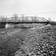
Fort Supply, Military outpost in Uinta County, Wyoming, US

Description

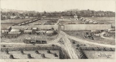
Fort Supply was a military outpost in Uinta County, Wyoming, consisting of a central blockhouse with four log wings surrounded by stockyards and fenced fields. The facility served as a waystation for travelers heading toward Salt Lake City.

History

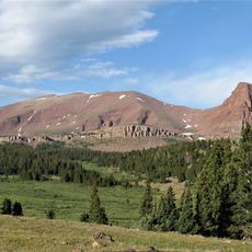
Mormon pioneers established the fort in November 1853 under Orson Hyde's direction to assist travelers heading toward Salt Lake City. The settlement played a key role in early occupation of Wyoming Territory by the religious community.

Culture

The settlers followed Brigham Young's guidance to share resources with Native Americans rather than engage in territorial conflicts. This shaped how the early Mormon community lived together and developed their settlement.

Practical

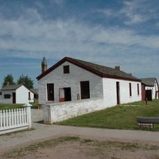
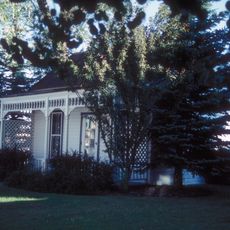
The site contains a commemorative monument erected in 1937 and operates as part of Fort Bridger State Historic Site. Visitors should focus on walking paths and viewing areas that illustrate the historical layout of the location.

Did you know?

Early settlers introduced irrigation methods that made the fort one of the first Anglo-American agricultural settlements in present-day Wyoming. These innovative techniques allowed the community to farm successfully in the dry region.

Location
Location
Inception
November 1853
GPS coordinates
41.16697,-110.43778
Latest update
December 13, 2025 17:00

AroundUs brings together thousands of curated places, local tips, and hidden gems, enriched daily by 60,000 contributors worldwide. Discover all places nearby (Wyoming).

Around this place
King's Peak
United States of America

King's Peak

43.8 km
Fort Bridger
United States of America

Fort Bridger

17.2 km
High Uintas Wilderness
United States of America

High Uintas Wilderness

48 km
Wasatch-Cache National Forest
United States of America

Wasatch-Cache National Forest

25.2 km
Lone Rock
United States of America

Lone Rock

70.5 km
J. C. Penney Historic District
United States of America

J. C. Penney Historic District

70.4 km
J.C. Penney House
United States of America

J.C. Penney House

70.4 km
Upper Stillwater Reservoir
United States of America

Upper Stillwater Reservoir

70.2 km
Bear River State Park
United States of America

Bear River State Park

43.2 km
Piedmont Charcoal Kilns
United States of America

Piedmont Charcoal Kilns

16.2 km
Wyoming State Insane Asylum
United States of America

Wyoming State Insane Asylum

44.2 km
Union Pacific Railroad Complex
United States of America

Union Pacific Railroad Complex

46 km
Granger Stage Station State Historic Site
United States of America

Granger Stage Station State Historic Site

61.3 km
Mount Agassiz
United States of America

Mount Agassiz

60.3 km
Medicine Butte
United States of America

Medicine Butte

44.4 km
Ute Mountain Fire Tower
United States of America

Ute Mountain Fire Tower

63.4 km
United States of America

South Kings Peak

44.9 km
A. V. Quinn House
United States of America

A. V. Quinn House

45.7 km
Mount Emmons
United States of America

Mount Emmons

51.9 km
Downtown Evanston Historic District
United States of America

Downtown Evanston Historic District

45.5 km
St. Paul's Episcopal Church
United States of America

St. Paul's Episcopal Church

45.7 km
Lincoln County Courthouse
United States of America

Lincoln County Courthouse

70.3 km
Uinta County Courthouse
United States of America

Uinta County Courthouse

45.4 km
ERT Bridge over Black's Fork
United States of America

ERT Bridge over Black's Fork

15.5 km
Mount Powell
United States of America

Mount Powell

41.1 km
Badlands Bowling Bar and Grill
United States of America

Badlands Bowling Bar and Grill

14.7 km
Kweeyahgut Peak
United States of America

Kweeyahgut Peak

54.7 km
Howe Flume
United States of America

Howe Flume

50 km
Show the full map
« Fort Supply - Military outpost in Uinta County, Wyoming, US » is provided by Around Us (aroundus.com). Images and texts are derived from Wikimedia project under a Creative Commons license. You are allowed to copy, distribute, and modify copies of this page, under the conditions set by the license, as long as this note is clearly visible.

Discover hidden gems everywhere you go!

From secret cafés to breathtaking viewpoints, skip the crowded tourist spots and find places that match your style. Our app makes it easy with voice search, smart filtering, route optimization, and insider tips from travelers worldwide. Download now for the complete mobile experience.

Around Us App Screenshot

A unique approach to discovering new places

Le Figaro

All the places worth exploring

France Info

A tailor-made excursion in just a few clicks

20 Minutes

Around Us
Travel Guide & Maps
Download

Send to your phone

QR Code
1

Open the camera app on your mobile.

2

Point at the QR code with your camera. A notification will appear.

3

Tap the notification to open the link.