Soda Springs

Log in to your account

AroundUs is a community-driven map of interesting places, built by curious explorers like you. It grows with every review, story, and photo you share.
Connect to save your favorite spots, contribute locations, and create personalized routes.
Continue with Google
Continue with Apple
Continue with X
Continue with Facebook
Continue with email
By continuing, you accept our Terms and Conditions and our Privacy Policy
Create an account
Add to collection
Map
Suggest a change
Share

Soda Springs, Natural geyser site in Caribou County, Idaho, United States.

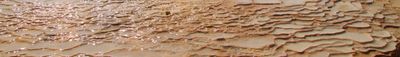
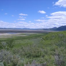
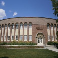
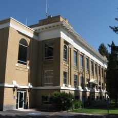
Soda Springs is a city in Idaho known for natural mineral springs that emerge from the ground across the landscape, creating a distinctive water-rich environment. Located at roughly 1,760 meters elevation, the area is surrounded by hundreds of these carbonated water sources, formed through natural geological processes.

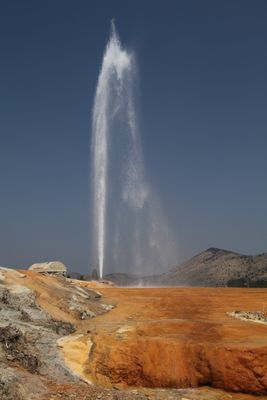
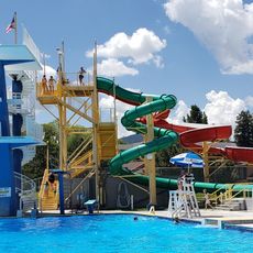
The area served as a navigation point for travelers and settlers long before the town was established and became a stable community in the region. A turning point came in 1937 when city officials accidentally discovered a pressurized carbon dioxide chamber while drilling for a swimming pool, leading to the creation of the world's first controlled geyser.

The name derives from the natural carbonated water sources that define the place, and these springs served as important way markers for travelers moving through the region. Today, visitors can see how these mineral-rich waters shaped the settlement's identity and connection to the land.

The controlled geyser releases water on a regular schedule through a managed system, and visitors can observe this from dedicated viewing platforms with information displays nearby. The area has walkable paths that guide you through the natural springs, making it easy to explore on foot during most of the year.

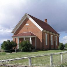
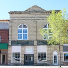
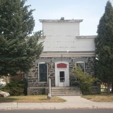
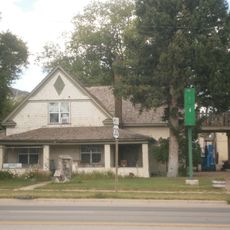
The Henry Store Museum, a preserved commercial building from 1908, offers a window into the region's early trade history and everyday commerce of that era. This store became closely tied to local events, including the Henry Stampede Rodeo, which began in 1918 and brought the community together.

Location: Caribou County

Elevation above the sea: 1,760 m

Website: http://sodaspringsid.com

GPS coordinates: 42.65810,-111.59600

Latest update: December 20, 2025 12:21

Photos
Around this place
Chesterfield
United States of America

Chesterfield

34.1 km
Lava Hot Springs
United States of America

Lava Hot Springs

34.5 km
Grays Lake National Wildlife Refuge
United States of America

Grays Lake National Wildlife Refuge

47.1 km
Lava Hot Springs Olympic Swimming Complex
United States of America

Lava Hot Springs Olympic Swimming Complex

34.5 km
United States of America

Niter Ice Cave

17.9 km
Montepelier Odd Fellows Hall
United States of America

Montepelier Odd Fellows Hall

44.7 km
Georgetown Relief Society Hall
United States of America

Georgetown Relief Society Hall

27.6 km
Montpelier Historic District
United States of America

Montpelier Historic District

44.9 km
Soda Springs City Hall
United States of America

Soda Springs City Hall

534 m
United States of America

L.D.S. Ward Building

34.5 km
Grace Pegram Truss Railroad Bridge
United States of America

Grace Pegram Truss Railroad Bridge

14 km
Caribou County Courthouse
United States of America

Caribou County Courthouse

568 m
Enders Hotel
United States of America

Enders Hotel

604 m
United States of America

Arthur Taylor House

50 km
John A. Bagley House
United States of America

John A. Bagley House

44.3 km
United States of America

Lander Road

41.8 km
United States of America

Emigration Canyon, Idaho

32.5 km
William Hopkins House
United States of America

William Hopkins House

310 m
Edgar Walter Largilliere Sr. House
United States of America

Edgar Walter Largilliere Sr. House

712 m
The National Oregon / California Trail Center
United States of America

The National Oregon / California Trail Center

44.7 km
United States of America

Alexander Reservoir

3.4 km
United States of America

Oneida Narrows Reservoir

42 km
United States of America

Chesterfield Reservoir

40.4 km
United States of America

Soda Point

8.9 km
United States of America

Snowside Point

46.5 km
United States of America

Little Valley Reservoir

45.5 km
United States of America

Little Valley Reservoir

48.1 km
United States of America

Dempsey Ridge Golf Course

35.6 km
Show the full map
Reviews

Visited this place? Tap the stars to rate it and share your experience / photos with the community! Try now! You can cancel it anytime.

« Soda Springs - Natural geyser site in Caribou County, Idaho, United States » is provided by Around Us (aroundus.com). Images and texts are derived from Wikimedia project under a Creative Commons license. You are allowed to copy, distribute, and modify copies of this page, under the conditions set by the license, as long as this note is clearly visible.

Discover hidden gems everywhere you go!

From secret cafés to breathtaking viewpoints, skip the crowded tourist spots and find places that match your style. Our app makes it easy with voice search, smart filtering, route optimization, and insider tips from travelers worldwide. Download now for the complete mobile experience.

Around Us App Screenshot

A unique approach to discovering new places

Le Figaro

All the places worth exploring

France Info

A tailor-made excursion in just a few clicks

20 Minutes