
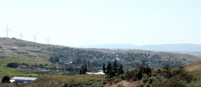
Arlington, city in Oregon, USA
Location: Gilliam County
Inception: 1885
Elevation above the sea: 86.87 m
Website: http://cityofarlingtonoregon.com
GPS coordinates: 45.71500,-120.19972
Latest update: November 6, 2025 11:46
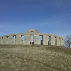
Maryhill Stonehenge
47.2 km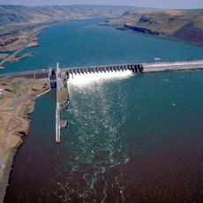
John Day Dam
38.4 km
Cottonwood Canyon State Park
33.8 km
Brooks Memorial State Park
43.9 km
Columbia Hills
45.6 km
Lake Umatilla
38.4 km
Lake Celilo
38.5 km
Wells Springs Segment
40.7 km
SAGE Center
42.4 km
Carty Reservoir
30.3 km
Grass Valley Canyon
21.5 km
Weatherford Historical Monument
10.7 km
Old Oregon Trail Monument
21.8 km
Big Eddy
36.2 km
Cleveland Shrub Steppe Natural Area Preserve
30.5 km
Badger Gulch Natural Area Preserve
29.7 km
Simcoe Mountain Wildlife Area Unit
37.7 km
Canoe Encampment Rapids
36 km
Lone Pine Butte
41.4 km
Rock Creek Longhouse
18.2 km
China Creek Golf Course
1.1 km
Viewpoint of John day dam
41.1 km
Scenic viewpoint
33.3 km
Mountain Identifier
40.5 km
Rock Creek Viewpoint
28.2 km
Tumwater Falls
24.3 km
Tumwater Falls
24.4 km
Waterfall
32.2 kmReviews
Visited this place? Tap the stars to rate it and share your experience / photos with the community! Try now! You can cancel it anytime.
Discover hidden gems everywhere you go!
From secret cafés to breathtaking viewpoints, skip the crowded tourist spots and find places that match your style. Our app makes it easy with voice search, smart filtering, route optimization, and insider tips from travelers worldwide. Download now for the complete mobile experience.

A unique approach to discovering new places❞
— Le Figaro
All the places worth exploring❞
— France Info
A tailor-made excursion in just a few clicks❞
— 20 Minutes