Log in to your account

AroundUs is a community-driven map of interesting places, built by curious explorers like you. It grows with every review, story, and photo you share.
Connect to save your favorite spots, contribute locations, and create personalized routes.
Continue with Google
Continue with Apple
Continue with X
Continue with Facebook
Continue with email
By continuing, you accept our Terms and Conditions and our Privacy Policy
Create an account
Add to collection
Map
Suggest a change
Share

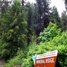
Coeur d’Alene Indian Reservation, Native American reservation in Kootenai County, United States

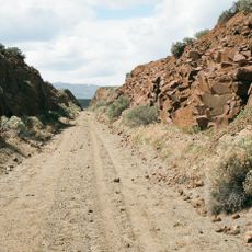
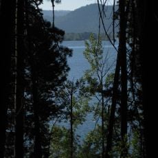
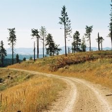
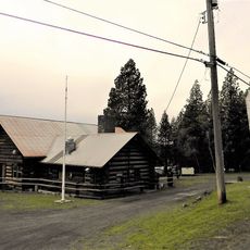
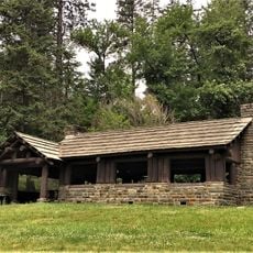
Coeur d'Alene Indian Reservation is tribal land of the Schitsu'umsh in northwestern Idaho that covers forests, waterways, and several small communities. The territory includes portions of Lake Coeur d'Alene and is governed and managed by the tribe itself.

The Schitsu'umsh lived in this region before the reservation was formally established through official action in 1873. This legal establishment changed the boundaries and status of tribal lands significantly.

The Schitsu'umsh people built their settlements along waterways and developed fishing practices that remain important to the community today. The connection to water and forests shapes how people here live and understand themselves.

Visitors can access several communities like Plummer and Harrison as starting points for exploration. The area offers access to natural spaces but requires respect for private land and tribal resources.

The tribe has secured legal authority over portions of the lake through court decisions and now manages water quality standards in the area. This control represents decades of efforts to establish tribal sovereignty over natural resources.

Location: Kootenai County

Website: https://cdatribe-nsn.gov

GPS coordinates: 47.28312,-116.82274

Latest update: December 10, 2025 15:55

Photos
Around this place
Coeur d'Alene Resort
United States of America

Coeur d'Alene Resort

43.4 km
Old Mission State Park
United States of America

Old Mission State Park

45.7 km
Palouse to Cascades State Park Trail
United States of America

Palouse to Cascades State Park Trail

32.8 km
Heyburn State Park
United States of America

Heyburn State Park

9.1 km
Coeur d’Alene Casino
United States of America

Coeur d’Alene Casino

19.7 km
McCroskey State Park
United States of America

McCroskey State Park

26.1 km
Veterans Memorial Centennial Bridge
United States of America

Veterans Memorial Centennial Bridge

41.4 km
Coeur d'Alene Mission of the Sacred Heart
United States of America

Coeur d'Alene Mission of the Sacred Heart

16.7 km
Mineral Ridge National Recreation Trail, Idaho
United States of America

Mineral Ridge National Recreation Trail, Idaho

38.7 km
Commercial Historic District
United States of America

Commercial Historic District

40.7 km
Coeur d'Alene Masonic Temple
United States of America

Coeur d'Alene Masonic Temple

43.7 km
St. Maries Masonic Temple No. 63
United States of America

St. Maries Masonic Temple No. 63

19.6 km
Benewah County Courthouse
United States of America

Benewah County Courthouse

19.7 km
American Legion Cabin
United States of America

American Legion Cabin

40.6 km
St. Maries 1910 Fire Memorial
United States of America

St. Maries 1910 Fire Memorial

18.2 km
John P. and Stella Gray House
United States of America

John P. and Stella Gray House

43.2 km
Silas W. and Elizabeth Crane House
United States of America

Silas W. and Elizabeth Crane House

19 km
Coeur d'Alene City Hall
United States of America

Coeur d'Alene City Hall

43.6 km
Edward and Ida Soncarty Barn
United States of America

Edward and Ida Soncarty Barn

28.7 km
Rocky Point CCC Properties
United States of America

Rocky Point CCC Properties

9.7 km
Chatcolet CCC Picnic and Camping Area
United States of America

Chatcolet CCC Picnic and Camping Area

11.2 km
Coeur d'Alene Public Library
United States of America

Coeur d'Alene Public Library

43.5 km
Chatcolet Lower Picnic Shelter
United States of America

Chatcolet Lower Picnic Shelter

11.2 km
Plummer Point Picnic Shelter
United States of America

Plummer Point Picnic Shelter

9.4 km
Chatcolet Bridge
United States of America

Chatcolet Bridge

11.8 km
Tekoa Train Trestle
United States of America

Tekoa Train Trestle

20.3 km
Plummer Point CCC Picnic and Hiking Area
United States of America

Plummer Point CCC Picnic and Hiking Area

9.4 km
Rocky Point Assistant Park Manager's Residence
United States of America

Rocky Point Assistant Park Manager's Residence

9.7 km
Show the full map
Reviews

Visited this place? Tap the stars to rate it and share your experience / photos with the community! Try now! You can cancel it anytime.

« Coeur d’Alene Indian Reservation - Native American reservation in Kootenai County, United States » is provided by Around Us (aroundus.com). Images and texts are derived from Wikimedia project under a Creative Commons license. You are allowed to copy, distribute, and modify copies of this page, under the conditions set by the license, as long as this note is clearly visible.

Discover hidden gems everywhere you go!

From secret cafés to breathtaking viewpoints, skip the crowded tourist spots and find places that match your style. Our app makes it easy with voice search, smart filtering, route optimization, and insider tips from travelers worldwide. Download now for the complete mobile experience.

Around Us App Screenshot

A unique approach to discovering new places

Le Figaro

All the places worth exploring

France Info

A tailor-made excursion in just a few clicks

20 Minutes