Enable Location

We need your location to show you interesting places around you

Discover nearby places

Find interesting locations and hidden gems around you

Precise directions

Get accurate directions and distances to places

Your location is never shared with other users. It's only used when you tap the location button.

Heyburn State Park

Log in to your account

Start exploring — it's free

Trusted by 61,585 travelers worldwide

Continue with Google
Continue with Apple
or

We will send you a code to connect

By continuing, you accept our Terms and Conditions and our Privacy Policy

Check your inbox

We've sent a pincode in your inbox. Please enter the code below.

Heyburn State Park

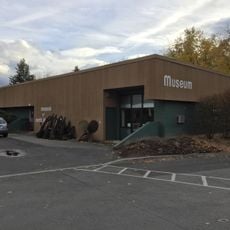
Heyburn State Park, State park in Benewah County, Idaho, US

Description

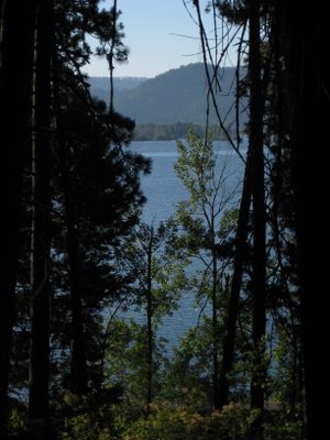
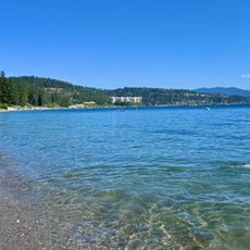
Heyburn State Park sits at the southern end of Lake Coeur d'Alene with three lakes, dense ponderosa pine forests, and open meadows. The landscape combines water and woodland in a range of settings across its grounds.

History

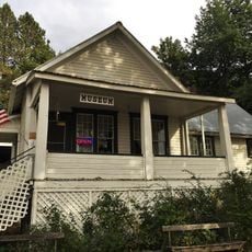
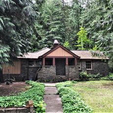
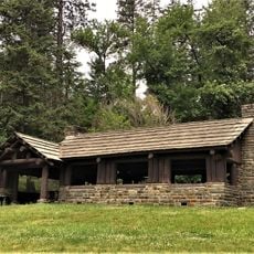
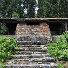
The park was established in 1908 as the first state park in the Pacific Northwest. Teams from the Civilian Conservation Corps built several structures there during the 1930s that still stand today.

Culture

The Coeur d'Alene people lived here for centuries, depending on the lakes and rivers for food and travel. Local names and stories still reflect this deep connection to the land.

Practical

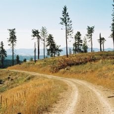
The park has boat ramps, camping areas, hiking trails, and a marina available for visitors. You should wear sturdy shoes and be ready for changing weather, especially on the wooded paths.

Did you know?

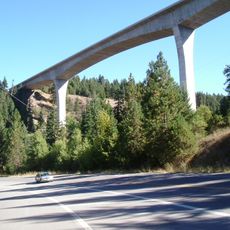
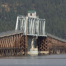
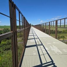
A notable feature is a 3,100-foot railroad trestle bridge over the St. Joe River that is part of a popular cycling path. This bridge connects riders to a long-distance route spanning 72 miles through the region.

Location
Location
Inception
1908
GPS coordinates
47.35324,-116.76128
Latest update
December 9, 2025 18:47

AroundUs brings together thousands of curated places, local tips, and hidden gems, enriched daily by 60,000 contributors worldwide. Discover all places nearby (Idaho).

Around this place
The Roosevelt Inn
United States of America

The Roosevelt Inn

36.1 km
McCroskey State Park
United States of America

McCroskey State Park

35.1 km
Fort Sherman
United States of America

Fort Sherman

36.3 km
Veterans Memorial Centennial Bridge
United States of America

Veterans Memorial Centennial Bridge

33 km
St. Thomas Catholic Church
United States of America

St. Thomas Catholic Church

36 km
Coeur d'Alene Mission of the Sacred Heart
United States of America

Coeur d'Alene Mission of the Sacred Heart

25.8 km
Kootenai County Courthouse
United States of America

Kootenai County Courthouse

36.1 km
Mineral Ridge National Recreation Trail, Idaho
United States of America

Mineral Ridge National Recreation Trail, Idaho

29.8 km
First United Methodist Church
United States of America

First United Methodist Church

36 km
Coeur d'Alene Masonic Temple
United States of America

Coeur d'Alene Masonic Temple

35.8 km
Coeur d'Alene Federal Building
United States of America

Coeur d'Alene Federal Building

35.8 km
St. Maries Masonic Temple No. 63
United States of America

St. Maries Masonic Temple No. 63

15.2 km
Benewah County Courthouse
United States of America

Benewah County Courthouse

15.3 km
St. Maries 1910 Fire Memorial
United States of America

St. Maries 1910 Fire Memorial

13.8 km
John P. and Stella Gray House
United States of America

John P. and Stella Gray House

35.2 km
Silas W. and Elizabeth Crane House
United States of America

Silas W. and Elizabeth Crane House

11.2 km
Coeur d'Alene City Hall
United States of America

Coeur d'Alene City Hall

35.7 km
Harvey M. Davey House
United States of America

Harvey M. Davey House

36.1 km
Rocky Point CCC Properties
United States of America

Rocky Point CCC Properties

1 km
Museum of North Idaho
United States of America

Museum of North Idaho

35.8 km
Chatcolet CCC Picnic and Camping Area
United States of America

Chatcolet CCC Picnic and Camping Area

2.4 km
Sanders Beach
United States of America

Sanders Beach

34.8 km
Coeur d'Alene Public Library
United States of America

Coeur d'Alene Public Library

35.6 km
Plummer Point Picnic Shelter
United States of America

Plummer Point Picnic Shelter

1.4 km
Chatcolet Lower Picnic Shelter
United States of America

Chatcolet Lower Picnic Shelter

2.4 km
Chatcolet Bridge
United States of America

Chatcolet Bridge

2.8 km
Tekoa Train Trestle
United States of America

Tekoa Train Trestle

27.8 km
Plummer Point CCC Picnic and Hiking Area
United States of America

Plummer Point CCC Picnic and Hiking Area

1.4 km
Show the full map
« Heyburn State Park - State park in Benewah County, Idaho, US » is provided by Around Us (aroundus.com). Images and texts are derived from Wikimedia project under a Creative Commons license. You are allowed to copy, distribute, and modify copies of this page, under the conditions set by the license, as long as this note is clearly visible.

Discover hidden gems everywhere you go!

From secret cafés to breathtaking viewpoints, skip the crowded tourist spots and find places that match your style. Our app makes it easy with voice search, smart filtering, route optimization, and insider tips from travelers worldwide. Download now for the complete mobile experience.

Around Us App Screenshot

A unique approach to discovering new places

Le Figaro

All the places worth exploring

France Info

A tailor-made excursion in just a few clicks

20 Minutes

Around Us
Travel Guide & Maps
Download

Send to your phone

QR Code
1

Open the camera app on your mobile.

2

Point at the QR code with your camera. A notification will appear.

3

Tap the notification to open the link.