Enable Location

We need your location to show you interesting places around you

Discover nearby places

Find interesting locations and hidden gems around you

Precise directions

Get accurate directions and distances to places

Your location is never shared with other users. It's only used when you tap the location button.

Blacktail Butte

Log in to your account

Join the adventure

Create your free account and start exploring (like 60k+ others)

We will send you a code to connect

or
Continue with Google
Continue with Apple
By continuing, you accept our Terms and Conditions and our Privacy Policy

Check your inbox

We've sent a pincode in your inbox. Please enter the code below.

Blacktail Butte

Blacktail Butte, Mountain summit in Grand Teton National Park, Wyoming, United States.

Description

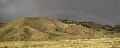
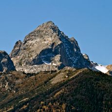
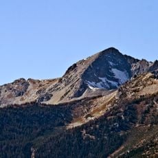
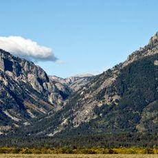
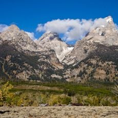
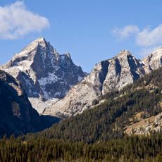
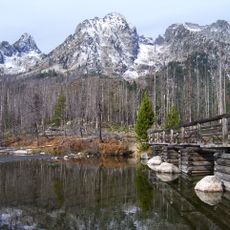
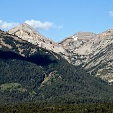
Blacktail Butte is a mountain in Grand Teton National Park with limestone cliffs rising 7,688 feet (2,345 meters) above the Jackson Hole valley and covered with mixed conifer forest and scattered aspen stands. The slopes display different forest types and vegetation zones depending on their exposure and elevation.

History

The formation was originally called Upper Gros Ventre Butte during early mapping work by surveyors in the region. Later naming changes reflect how geographical labels evolved as local knowledge about wildlife and the landscape grew.

Culture

The name comes from the mule deer that live and travel in this area, showing how local wildlife shapes the way places are named.

Practical

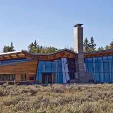
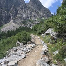
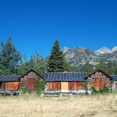
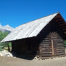
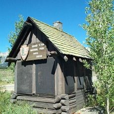
Several hiking trails can be accessed from Antelope Flats Road with parking available at the base for various activities. Trail conditions vary by season and elevation, so arriving prepared for changing weather is wise.

Did you know?

The northern face keeps a darker look from dense forest while the southern slopes are dominated by sagebrush and grassland creating a striking visual contrast. This natural difference is visible from multiple viewpoints throughout the park.

Location
GPS coordinates
43.63550,-110.69270
Latest update
December 13, 2025 12:25

AroundUs brings together thousands of curated places, local tips, and hidden gems, enriched daily by 60,000 contributors worldwide. Discover all places nearby (Wyoming).

Around this place
Mormon Row Historic District
United States of America

Mormon Row Historic District

3.6 km
T. A. Moulton Barn
United States of America

T. A. Moulton Barn

3.6 km
Death Canyon
United States of America

Death Canyon

9.4 km
Buck Mountain
United States of America

Buck Mountain

11.8 km
Andy Chambers Ranch Historic District
United States of America

Andy Chambers Ranch Historic District

3.5 km
Murie Ranch Historic District
United States of America

Murie Ranch Historic District

3.4 km
Static Peak
United States of America

Static Peak

11.3 km
Craig Thomas Discovery and Visitor Center
United States of America

Craig Thomas Discovery and Visitor Center

2.9 km
Menor's Ferry
United States of America

Menor's Ferry

3 km
Granite Canyon
United States of America

Granite Canyon

10.2 km
Death Canyon Trail
United States of America

Death Canyon Trail

9.4 km
White Grass Dude Ranch
United States of America

White Grass Dude Ranch

7 km
Garnet Canyon
United States of America

Garnet Canyon

10.7 km
Death Canyon Barn
United States of America

Death Canyon Barn

11.5 km
Amphitheater Lake Trail
United States of America

Amphitheater Lake Trail

11.8 km
Manges Cabin
United States of America

Manges Cabin

7.7 km
Hunter Hereford Ranch Historic District
United States of America

Hunter Hereford Ranch Historic District

8.1 km
Avalanche Canyon
United States of America

Avalanche Canyon

9.9 km
Murie Residence
United States of America

Murie Residence

3.2 km
Valley Trail
United States of America

Valley Trail

11.1 km
Highlands Historic District
United States of America

Highlands Historic District

8.7 km
Geraldine Lucas Homestead-Fabian Place Historic District
United States of America

Geraldine Lucas Homestead-Fabian Place Historic District

9.7 km
White Grass Ranger Station Historic District
United States of America

White Grass Ranger Station Historic District

7.5 km
Moose Entrance Kiosk
United States of America

Moose Entrance Kiosk

3.6 km
Old Administrative Area Historic District
United States of America

Old Administrative Area Historic District

6.7 km
Open Canyon
United States of America

Open Canyon

9.1 km
Shoshoko Falls
United States of America

Shoshoko Falls

12 km
Laurance S. Rockefeller Preserve Center
United States of America

Laurance S. Rockefeller Preserve Center

6.7 km
Show the full map
« Blacktail Butte - Mountain summit in Grand Teton National Park, Wyoming, United States » is provided by Around Us (aroundus.com). Images and texts are derived from Wikimedia project under a Creative Commons license. You are allowed to copy, distribute, and modify copies of this page, under the conditions set by the license, as long as this note is clearly visible.

Discover hidden gems everywhere you go!

From secret cafés to breathtaking viewpoints, skip the crowded tourist spots and find places that match your style. Our app makes it easy with voice search, smart filtering, route optimization, and insider tips from travelers worldwide. Download now for the complete mobile experience.

Around Us App Screenshot

A unique approach to discovering new places

Le Figaro

All the places worth exploring

France Info

A tailor-made excursion in just a few clicks

20 Minutes

Around Us
Travel Guide & Maps
Download

Send to your phone

QR Code
1

Open the camera app on your mobile.

2

Point at the QR code with your camera. A notification will appear.

3

Tap the notification to open the link.