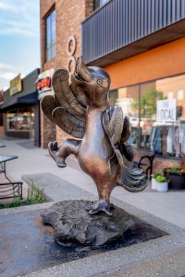
Gillette, Energy production city in Wyoming, United States.
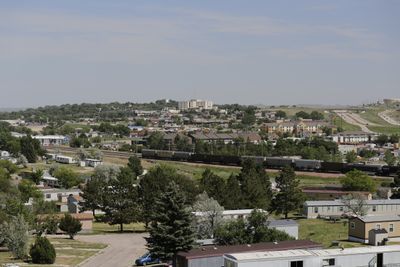
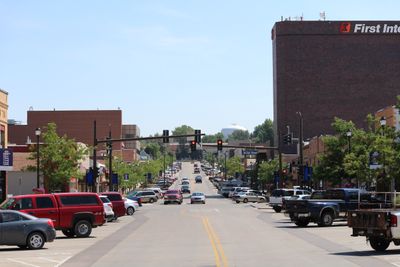
Gillette is a city in Campbell County, northeastern Wyoming, spread across the Powder River Basin between the Bighorn Mountains and the Black Hills. Buildings sit along wide streets, and the surrounding terrain shifts between flat plains and rolling hills.
The Chicago, Burlington and Quincy Railroad built a station here in 1892 and named it after surveyor Edward Gillette. Over the following decades, the settlement grew from a railroad stop into a center for coal mining.
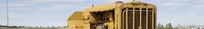
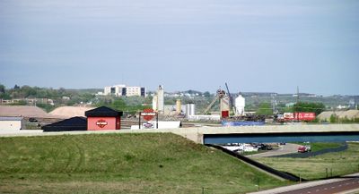
The city name honors Edward Gillette, a railroad surveyor who mapped the first routes through this region. Today, massive mining equipment forms part of the everyday landscape, and residents frequently see haul trucks moving through town, a reminder of the industry that shapes daily life.
The regional airport northeast of town connects with larger travel hubs, and an intercity bus service provides regular routes through the region. Due to the elevation and dry air, carry plenty of water and allow time to adjust to the conditions.
The surrounding coal mines supply more than one third of all coal produced in the United States. This output shapes the townscape so strongly that visitors often spot massive conveyor belts and spoil heaps on the horizon.
Location: Campbell County
Inception: 1892
Elevation above the sea: 1,388 m
Address: Gillette, WY, USA
Website: https://gillettewy.gov
GPS coordinates: 44.28278,-105.50528
Latest update: December 4, 2025 23:05
Fort Phil Kearny
108.6 km
Vore Buffalo Jump
110.9 km
Tower Ladder
71.6 km
Keyhole State Park
58.6 km
Inyan Kara Mountain
92.5 km
Jim Gatchell Memorial Museum
95.4 km
TA Ranch Historic District
94 km
Wyoming Highway 110
71.4 km
Old Headquarters Area Historic District
71.2 km
Cantonment Reno
81.5 km
Holland House
95.4 km
EDZ Irigary Bridge
64.4 km
Sundance State Bank Building
90.7 km
Union Congregational Church and Parsonage
95.1 km
Main Street Historic District
95.3 km
CKW Bridge over Powder River
66.8 km
Entrance Station
72.5 km
DXN Bridge
111.8 km
Clearmont Jail
79.9 km
EDL Peloux Bridge
91.9 km
Sundance School
90.8 km
Gillette City Hall
19.5 km
EAU Arvada Bridge
65 km
Johnson County Courthouse
95.3 km
EBF Bridge over Powder River
79.8 km
Devils Tower Information Marker
72.1 km
Dry Creek Petrified Tree Environmental Education Area
82 km
Gillette Fishing Lake
2.3 kmReviews
Visited this place? Tap the stars to rate it and share your experience / photos with the community! Try now! You can cancel it anytime.
Discover hidden gems everywhere you go!
From secret cafés to breathtaking viewpoints, skip the crowded tourist spots and find places that match your style. Our app makes it easy with voice search, smart filtering, route optimization, and insider tips from travelers worldwide. Download now for the complete mobile experience.
A unique approach to discovering new places❞
— Le Figaro
All the places worth exploring❞
— France Info
A tailor-made excursion in just a few clicks❞
— 20 Minutes