Belloy Formation, Permian geological formation in Alberta, Canada
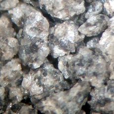
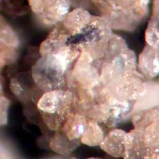
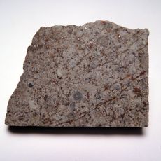
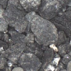
The Belloy Formation is a Permian geological unit found across the Peace River Country that contains layers of chert, sandstone, siltstone, conglomerate, and dolomite. The stacked rock layers represent millions of years of sediment deposition in an ancient marine environment.
The unit was first documented by geologist H.L. Halbertsma in 1959 and named after the hamlet of Belloy in Alberta's Peace River region. This naming helped scientists classify the layered sequences within the broader Western Canadian Sedimentary Basin.
The formation serves as a research site for geologists studying the Western Canadian Sedimentary Basin's complex stratigraphic patterns and mineral compositions.
Access to the formation is possible via established geological roads and field sites in the area where rock layers are visible. Visitors should plan trips during warmer months when snow does not cover the exposed rock surfaces.
The formation displays a tidally-influenced depositional pattern that reveals how ancient ocean currents and tidal forces shaped the arrangement of rocks. These clues to past tidal dynamics make it valuable for understanding early marine conditions.
The community of curious travelers
AroundUs brings together thousands of curated places, local tips, and hidden gems, enriched daily by 60,000 contributors worldwide.