Prince Albert, Administrative center in Saskatchewan, Canada
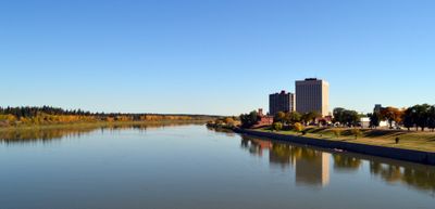
Prince Albert is a city in Saskatchewan that sits along the North Saskatchewan River and serves as a gateway to the northern parts of the province. Industrial sites and retail areas define much of the cityscape, while the riverside location provides connections to more remote communities further north.
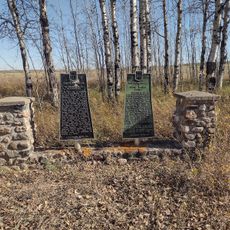
A Presbyterian missionary established a mission station here in 1866 and named it after Queen Victoria's husband. The settlement grew over the decades into an important hub for trade and supply lines reaching into northern Saskatchewan.
The city maintains a strong Indigenous presence, with nearly forty-five percent of residents identifying as First Nations or Métis people.
A trail network covering more than twenty kilometers runs through the city and offers routes for cycling, jogging, and wheelchair users year-round. The paths connect different neighborhoods and provide a way to see the area along the river and through green spaces.
A city park covers an area larger than many urban green spaces in comparable towns. Visitors can use cross-country ski trails in winter and mountain bike paths through the woods in summer without leaving the city limits.
Location: Saskatchewan
Inception: 1866
Elevation above the sea: 440 m
Part of: community in Saskatchewan
Shares border with: Redwing
Website: http://citypa.ca
GPS coordinates: 53.20000,-105.75000
Latest update: December 14, 2025 17:06
Art Hauser Centre
2.1 km
Rotary Museum of Police and Corrections
2.4 km
St. Louis Bridge
30.9 km
Nisbet Provincial Forest
3.7 km
South Branch House
39.4 km
Diefenbaker House
418 m
Keyhole Castle
551 m
Land Titles Building
407 m
Prince Albert Arts Centre
636 m
The Evolution of Education Museum
2.4 km
Prince Albert Historical Museum
719 m
Diefenbaker Bridge
1.1 km
Canadian Northern Railway Bridge
975 m
Muskoday Bridge
21.1 km
Emma Lake (Murray Point) Recreation Site
46.5 km
Sturgeon River Recreation Site
9.1 km
Sturgeon Lake Regional Park
36.5 km
Buckland Wildlife Management Unit
3.9 km
Cole Rapids
37.3 km
Saskatchewan River Forks Recreation Site
44.5 km
Nisbet Trails Recreation Site
14.3 km
Kachur's Golf Club
9.9 km
Emma Lake Golf Course
41.4 km
Birch Hills Golf Course
31 km
Kinette Amphitheatre
1 km
Mann Art Gallery
626 m
Neis Beach
42 km
Scenic viewpoint, tower, Observation tower
4.4 kmVisited this place? Tap the stars to rate it and share your experience / photos with the community! Try now! You can cancel it anytime.
Discover hidden gems everywhere you go!
From secret cafés to breathtaking viewpoints, skip the crowded tourist spots and find places that match your style. Our app makes it easy with voice search, smart filtering, route optimization, and insider tips from travelers worldwide. Download now for the complete mobile experience.
A unique approach to discovering new places❞
— Le Figaro
All the places worth exploring❞
— France Info
A tailor-made excursion in just a few clicks❞
— 20 Minutes