Enable Location

We need your location to show you interesting places around you

Discover nearby places

Find interesting locations and hidden gems around you

Precise directions

Get accurate directions and distances to places

Your location is never shared with other users. It's only used when you tap the location button.

Jackson County

Log in to your account

Start exploring — it's free

Trusted by 64,797 travelers worldwide

Continue with Google
Continue with Apple
or

We will send you a code to connect

By continuing, you accept our Terms and Conditions and our Privacy Policy

Check your inbox

We've sent a pincode in your inbox. Please enter the code below.

Discussion Reviews 1 Photos
10.1k Popularity

Jackson County, County in southwestern Oklahoma, United States

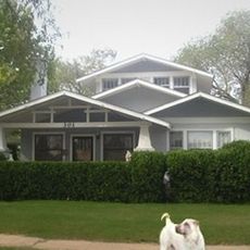
Jackson County is an administrative county in southwestern Oklahoma, with Altus serving as its county seat. The terrain is mostly flat and given over to farmland, dotted with small towns and rural communities spread across the plains.

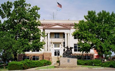
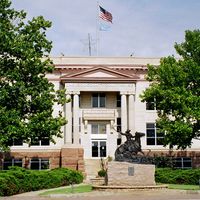
Jackson County was created in 1907 when Oklahoma became a state, and Altus was named the county seat from the start. In the following decades, the arrival of farming families and the growth of cotton production shaped the towns and infrastructure of the region.

The county seat of Altus draws people from across the surrounding plains for errands, local markets, and community gatherings. Cotton and wheat farming shape the rhythm of daily life here, and that agricultural identity is visible in the towns, the roadside businesses, and the seasonal pace of the region.

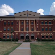
Most services and county offices are located in Altus, which is the natural base for anyone visiting or dealing with administrative matters in the area. A car is essential here since the distances between communities are long and public transport is limited.

Altus Air Force Base sits within the county and is one of the main training centers for air mobility crews in the entire US military. Its presence has shaped Altus as a town far more than farming alone, bringing a steady flow of military families and support businesses over the decades.

The community of curious travelers

AroundUs brings together thousands of curated places, local tips, and hidden gems, enriched daily by 60,000 contributors worldwide.

Start exploring
Location
Inception
July 16, 1907
Capital city
Altus
Shares border with
Greer County, Kiowa County, Tillman County, Wilbarger County, Hardeman County, Harmon County
GPS coordinates
34.59000,-99.41000
Latest update
March 4, 2026 01:07
Around this place
Quartz Mountain Nature Park
United States of America

Quartz Mountain Nature Park

41.1 km
United States of America

Devil's Canyon

30.8 km
Doan's Adobe House
United States of America

Doan's Adobe House

30.9 km
Perryman Ranch Headquarters
United States of America

Perryman Ranch Headquarters

17.2 km
United States of America

Fullerton Dam

8.3 km
W.C. Baker House
United States of America

W.C. Baker House

9.1 km
Jackson County Courthouse
United States of America

Jackson County Courthouse

8.8 km
United States of America

Cross S Ranch Headquarters

12 km
Greer County Courthouse
United States of America

Greer County Courthouse

32.7 km
United States of America

Morgan Doll Museum

9.6 km
United States of America

Tri-County Turkey Creek Site 21 Reservoir

25.2 km
United States of America

Tri-County Turkey Creek Site 2a Reservoir

36.1 km
United States of America

Tri County Turkey Creek Site 4 Reservoir

34.3 km
United States of America

Baldy Point

35.4 km
United States of America

Lake Altus

38.5 km
United States of America

State of Oklahoma Reformatory Lake

41.5 km
Chillicothe First Methodist Church
United States of America

Chillicothe First Methodist Church

38.5 km
United States of America

Tri-County Turkey Creek Site 14a Reservoir

34.9 km
United States of America

Kickapoo Sandy Creek Site K3 Reservoir

29.3 km
United States of America

Medicine Mound Depot, 1910

44.2 km
United States of America

Quanah Commercial Historic District

44.3 km
United States of America

Quanah Country Club

40.1 km
United States of America

Mangum Municipal Golf Course

36.1 km
United States of America

Christmas Tree Pole

10.1 km
United States of America

Lockheed C-141B Starlifter

13.6 km
United States of America

Boeing GKC-135A Stratotanker

13.5 km
United States of America

Douglas C-47B Skytrain

13.8 km
United States of America

B-47E Stratojet

10.1 km
Show the full map
Reviews
Share your experience

No review yet

Discussions
Start a discussion...

No discussion yet

Administrative divisions
« Jackson County - County in southwestern Oklahoma, United States » is provided by Around Us (aroundus.com). Images and texts are derived from Wikimedia project under a Creative Commons license. You are allowed to copy, distribute, and modify copies of this page, under the conditions set by the license, as long as this note is clearly visible.

Discover hidden gems everywhere you go!

From secret cafés to breathtaking viewpoints, skip the crowded tourist spots and find places that match your style. Our app makes it easy with voice search, smart filtering, route optimization, and insider tips from travelers worldwide. Download now for the complete mobile experience.

Around Us App Screenshot

A unique approach to discovering new places

Le Figaro

All the places worth exploring

France Info

A tailor-made excursion in just a few clicks

20 Minutes

Around Us
Travel Guide & Maps
Download

Send to your phone

QR Code
1

Open the camera app on your mobile.

2

Point at the QR code with your camera. A notification will appear.

3

Tap the notification to open the link.