Enable Location

We need your location to show you interesting places around you

Discover nearby places

Find interesting locations and hidden gems around you

Precise directions

Get accurate directions and distances to places

Your location is never shared with other users. It's only used when you tap the location button.

Lake of the Arbuckles

Log in to your account

Start exploring — it's free

Trusted by 62,508 travelers worldwide

Continue with Google
Continue with Apple
or

We will send you a code to connect

By continuing, you accept our Terms and Conditions and our Privacy Policy

Check your inbox

We've sent a pincode in your inbox. Please enter the code below.

Lake of the Arbuckles

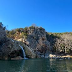
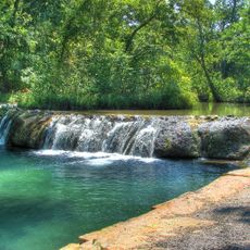
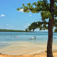
Lake of the Arbuckles, body of water

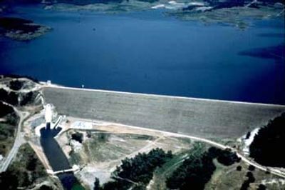
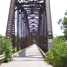
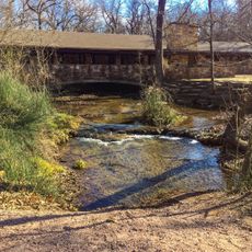
The Lake of the Arbuckles is a reservoir in south-central Oklahoma near the town of Sulphur covering around 2,350 acres. It is formed by a dam that holds back three creeks and features campgrounds, boat ramps, and covered fishing piers throughout its shoreline.

The lake was completed in 1967 after a drought in the 1950s had strained the region's water supply. The Bureau of Reclamation led the project to ensure reliable water for nearby towns and to manage flooding during heavy rains.

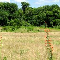
The lake takes its name from the nearby Arbuckle Mountains that define the region. It serves as a gathering place for local families and anglers who come to spend leisure time together and connect with the water.

The lake is surrounded by three campgrounds offering tent and RV sites with picnic areas and restrooms. Visitors should follow fishing regulations and can find bait shops and local stores nearby for supplies and gear.

The lake is managed by the National Park Service and sits within the larger Chickasaw National Recreation Area where visitors can explore other parks and trails. Researchers from Oklahoma State University use the lake to study rare wildlife like the Plains spotted skunk.

The community of curious travelers

AroundUs brings together thousands of curated places, local tips, and hidden gems, enriched daily by 60,000 contributors worldwide.

Start exploring
Location
GPS coordinates
34.43361,-97.02778
Latest update
February 7, 2026 11:01
Around this place
Greater Wynnewood Exotic Animal Park
United States of America

Greater Wynnewood Exotic Animal Park

27.2 km
Turner Falls
United States of America

Turner Falls

11.1 km
Turner Falls Park
United States of America

Turner Falls Park

11.2 km
Fort Washita
United States of America

Fort Washita

57.4 km
Chickasaw Cultural Center
United States of America

Chickasaw Cultural Center

7.2 km
Wintersmith Park Historic District
United States of America

Wintersmith Park Historic District

49.7 km
Tishomingo National Wildlife Refuge
United States of America

Tishomingo National Wildlife Refuge

45.1 km
Wanette–Byars Bridge
United States of America

Wanette–Byars Bridge

54.2 km
Chickasaw Nation Capitols
United States of America

Chickasaw Nation Capitols

38.7 km
James C. Nance Memorial Bridge
United States of America

James C. Nance Memorial Bridge

70.9 km
Bethel Missionary Baptist Church
United States of America

Bethel Missionary Baptist Church

40.2 km
Sugg Clinic
United States of America

Sugg Clinic

49.5 km
Pontotoc County Courthouse
United States of America

Pontotoc County Courthouse

49.4 km
Black Theater of Ardmore
United States of America

Black Theater of Ardmore

30.6 km
Ada Arts and Heritage Center
United States of America

Ada Arts and Heritage Center

49.5 km
Ardmore Carnegie Library
United States of America

Ardmore Carnegie Library

30.9 km
Murray County Courthouse
United States of America

Murray County Courthouse

9.3 km
Garvin County Courthouse
United States of America

Garvin County Courthouse

38.5 km
Travertine Creek
United States of America

Travertine Creek

9.4 km
Love County Courthouse
United States of America

Love County Courthouse

55.8 km
Marshall County Courthouse
United States of America

Marshall County Courthouse

44.9 km
Love County Jail and Sheriff's Residence
United States of America

Love County Jail and Sheriff's Residence

56 km
First National Bank Building
United States of America

First National Bank Building

40.7 km
Marina Beach
United States of America

Marina Beach

42.4 km
Travertine Nature Center
United States of America

Travertine Nature Center

10.6 km
Cold Springs Campground Comfort Station #30
United States of America

Cold Springs Campground Comfort Station #30

10 km
Bromide Pavilion
United States of America

Bromide Pavilion

8.1 km
Lake Murray State Park
United States of America

Lake Murray State Park

38.6 km
Show the full map
« Lake of the Arbuckles - body of water » is provided by Around Us (aroundus.com). Images and texts are derived from Wikimedia project under a Creative Commons license. You are allowed to copy, distribute, and modify copies of this page, under the conditions set by the license, as long as this note is clearly visible.

Discover hidden gems everywhere you go!

From secret cafés to breathtaking viewpoints, skip the crowded tourist spots and find places that match your style. Our app makes it easy with voice search, smart filtering, route optimization, and insider tips from travelers worldwide. Download now for the complete mobile experience.

Around Us App Screenshot

A unique approach to discovering new places

Le Figaro

All the places worth exploring

France Info

A tailor-made excursion in just a few clicks

20 Minutes

Around Us
Travel Guide & Maps
Download

Send to your phone

QR Code
1

Open the camera app on your mobile.

2

Point at the QR code with your camera. A notification will appear.

3

Tap the notification to open the link.