Chest opened
+${chestReward.xp} XP
Explorer
NOUVEAU ×${chestReward.collectible.quantity}
tapez pour fermer

See the monuments around you in AR Open chests in the app

Around Us is built for your phone — point your camera at the streets and discover the monuments and places around you in augmented reality. Around Us is built for your phone — chests unlock when you walk, explore and capture nearby places.

Enable Location

We need your location to show you interesting places around you

Discover nearby places

Find interesting locations and hidden gems around you

Precise directions

Get accurate directions and distances to places

Your location is never shared with other users. It's only used when you tap the location button.

Log in to your account

Start exploring — it's free

Trusted by 86,222 travelers worldwide

Continue with Google
Continue with Apple
or

We will send you a code to connect

By continuing, you accept our Terms and Conditions and our Privacy Policy

Check your inbox

We've sent a pincode in your inbox. Please enter the code below.

Stroud Lake
Discussion Reviews Photo
1.1k Popularity

Stroud Lake, body of water

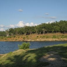
Stroud Lake is a reservoir in Creek County, Oklahoma, located about 7 miles northeast of the town of Stroud. It spans about 600 acres with a shoreline of over 14 miles and reaches depths of nearly 50 feet, making it suitable for fishing, boating, and swimming. The surrounding landscape features open land and scattered trees that frame the water.

The lake was constructed in 1968 and was originally named Salt Camp Creek Watershed Dam No. 12 before becoming known as Stroud Lake. It was built primarily as a water storage facility for the region but has since become a popular recreation area for the local community.

Visitors should bring their own supplies, as facilities are limited and there are no major amenities nearby. The lake is easily accessible with simple parking areas close to the water for a quick day visit.

The lake is home to bass, catfish, and crappie, making it a draw for anglers seeking to catch multiple fish species. The productive fishing has earned it recognition as a reliable spot for successful catches.

The community of curious travelers

AroundUs brings together thousands of curated places, local tips, and hidden gems, enriched daily by 60,000 contributors worldwide.
Start exploring
Location
GPS coordinates
35.80583,-96.60889
Latest update
September 13, 2026 12:47
Around this place
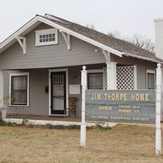
Jim Thorpe House
United States of America

Jim Thorpe House

24.1 mi
Keystone State Park
United States of America

Keystone State Park

30 mi
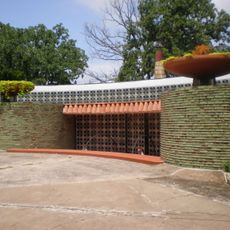
John Frank House
United States of America

John Frank House

31.5 mi
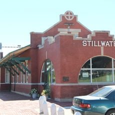
Stillwater Santa Fe Depot
United States of America

Stillwater Santa Fe Depot

32.7 mi
Boley Historic District
United States of America

Boley Historic District

22.6 mi
Chandler Armory
United States of America

Chandler Armory

16.5 mi
Joseph Carpenter House
United States of America

Joseph Carpenter House

4.6 mi
Bristow Presbyterian Church
United States of America

Bristow Presbyterian Church

12.2 mi
William Frick House
United States of America

William Frick House

33 mi
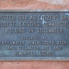
Citizens Bank Building
United States of America

Citizens Bank Building

32.9 mi
First Presbyterian Church of Chandler
United States of America

First Presbyterian Church of Chandler

16.9 mi
St. Stephen's Episcopal Church
United States of America

St. Stephen's Episcopal Church

16.9 mi
St. Paul Baptist Church and Cemetery
United States of America

St. Paul Baptist Church and Cemetery

24.3 mi
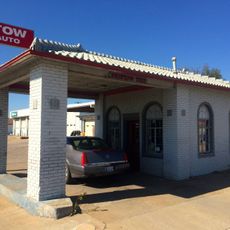
Bristow Tire Shop
United States of America

Bristow Tire Shop

12.3 mi
Conklin House
United States of America

Conklin House

16.9 mi
Mascho Building and Public Privy
United States of America

Mascho Building and Public Privy

16.6 mi
Chandler Bookstore
United States of America

Chandler Bookstore

16.5 mi
Clapp-Cunningham Building
United States of America

Clapp-Cunningham Building

16.7 mi
Boston Store
United States of America

Boston Store

16.6 mi
Flynt Building
United States of America

Flynt Building

16.8 mi
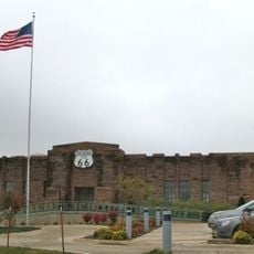
Route 66 Interpretive Center
United States of America

Route 66 Interpretive Center

16.4 mi
United States of America

Black Pig

26.7 mi
United States of America

Route 66 Interpretative Center (Chandler)

16.5 mi
United States of America

Burnett Mansion

30.6 mi
United States of America

Woody Guthrie home

31.3 mi
United States of America

Maggie M

31.3 mi
United States of America

Old Gas Station

17.1 mi
United States of America

St. Cloud Classics (Chandler)

17 mi
Show the full map
Reviews
Share your experience

No review yet

Discussions
Start a discussion...

No discussion yet

« Stroud Lake - body of water » is provided by Around Us (aroundus.com). Images and texts are derived from Wikimedia project under a Creative Commons license. You are allowed to copy, distribute, and modify copies of this page, under the conditions set by the license, as long as this note is clearly visible.

Discover hidden gems everywhere you go!

From secret cafés to breathtaking viewpoints, skip the crowded tourist spots and find places that match your style. Our app makes it easy with voice search, smart filtering, route optimization, and insider tips from travelers worldwide. Download now for the complete mobile experience.

Around Us App Screenshot

A unique approach to discovering new places

Le Figaro

All the places worth exploring

France Info

A tailor-made excursion in just a few clicks

20 Minutes

Around Us
Travel Guide & Maps
Download

Send to your phone

QR Code
1

Open the camera app on your mobile.

2

Point at the QR code with your camera. A notification will appear.

3

Tap the notification to open the link.