El Tuparro National Natural Park, National park in Vichada Department, Colombia
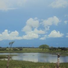
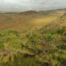
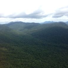
El Tuparro is a protected natural area in Vichada and encompasses savannas, gallery forests, and several rivers including the Orinoco and Tuparro. The landscape shifts between open grasslands and denser forested strips along waterways.
The area was designated as a protected zone in 1970 and received national park status in 1980 to conserve the region's natural resources. This recognition enabled systematic conservation efforts and scientific work in the region.
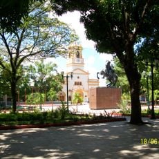
Indigenous groups like the Piaroa and Curripaco inhabit areas around the park and maintain their traditional ways of life within this landscape. Visitors may encounter traditional settlements along trails and see how communities exist within this remote environment.
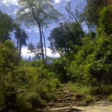
The Attalea trail passes through palm forests and rocky outcrops to a viewpoint overlooking Maipures Rapids. Visitors should bring sturdy shoes and water bottles, as paths are uneven and sun exposure is intense.
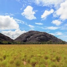
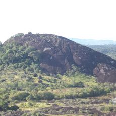
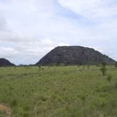
The area contains remnants of the ancient Guiana Shield with rocky formations under 900 meters, among the continent's oldest geological structures. These ancient formations offer glimpses into early Earth history and function like an open-air natural museum.
Location: Vichada Department
Inception: 1970
Elevation above the sea: 88 m
Website: http://parquesnacionales.gov.co/PNN/portel/libreria/php/decide.php?patron=01.020211
GPS coordinates: 4.97000,-68.30000
Latest update: December 7, 2025 20:42
Santos Luzardo National Park
210 km
Cerro Autana
95.2 km
Piedra La Tortuga Natural Monument
102.6 km
Casa sobre La Piedra
107.2 km
Estadio Antonio José de Sucre
108.4 km
Galeras del Cinaruco
217 km
Cathedral of Mary Help of Christians, Puerto Ayacucho
107.6 km
Gran Hotel Amazonas
107.8 km
Cuao-Sipapo y Moriche Massif Natural Monument
98.2 km
Monumento Natural Cerro Autana
95.2 km
Sipapo Forest Reserve
128.9 km
Parguaza Forest Reserve
186 km
Piedra La Tortuga
102.5 km
Piedra Pintada Natural Monument
104.7 kmComunidad Indígena de Sabanitas
130 kmPlaya Bonita
172.2 kmEl Balancín
58.8 kmEstadero La Soga
175.3 kmCentro Recreacional El Cacique
166.9 kmManga de Coleo
173.5 kmCasa de la Piedra
107.2 kmMonumento Bicentenario
108.6 kmSoy amazonas
108.7 kmWork of art, sculpture
110.4 kmInstallation artwork, Work of art
106.5 kmPuerto wipane
174.6 kmDesembarcadero Puerto Mosco
173.7 kmScenic viewpoint
152.8 kmVisited this place? Tap the stars to rate it and share your experience / photos with the community! Try now! You can cancel it anytime.
Discover hidden gems everywhere you go!
From secret cafés to breathtaking viewpoints, skip the crowded tourist spots and find places that match your style. Our app makes it easy with voice search, smart filtering, route optimization, and insider tips from travelers worldwide. Download now for the complete mobile experience.
A unique approach to discovering new places❞
— Le Figaro
All the places worth exploring❞
— France Info
A tailor-made excursion in just a few clicks❞
— 20 Minutes