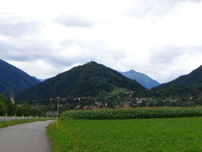
Danielsberg, Mountain summit in Möll Valley, Austria
Danielsberg is a mountain summit near Reißeck in Carinthia that rises to about 966 meters. Several hiking trails cross its slopes and connect to the broader network of paths through the surrounding region.
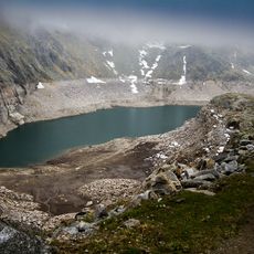
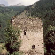
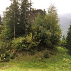
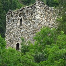
The region has a long history of mining, particularly for pyrite extraction at higher elevations in past centuries. These activities shaped the mountain and left marks on the landscape that remain visible today.
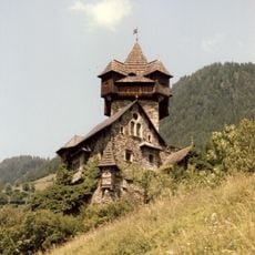
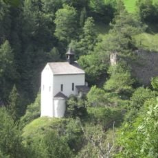
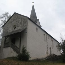
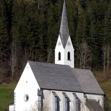
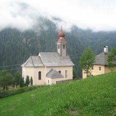
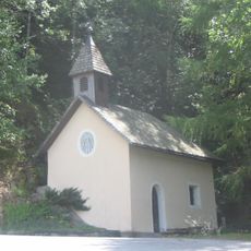
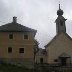
The church on the summit draws pilgrims who make the journey as part of local spiritual traditions. The place remains connected to how residents think about their landscape and mark important occasions.
The trail starts from lower elevations near Preisdorf and leads to Gasthof Herkuleshof with a steady climb of around 200 meters elevation gain. Good footwear and a few hours of walking time help ensure a comfortable experience on the mountain.
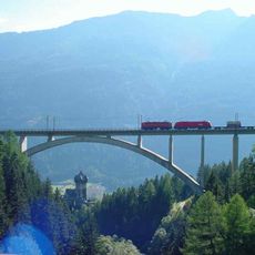
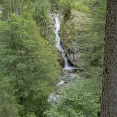
The summit connects to the Alpe-Adria Trail, a long-distance route that links different mountain regions and passes through varied rock formations. Hikers on this connection can spot distinct layers and types of stone that tell the story of how the mountains formed over time.
Location: Reißeck
Elevation above the sea: 966 m
GPS coordinates: 46.88779,13.28271
Latest update: December 12, 2025 17:48
Falkenstein Castle
5 km
Kreuzeckbahn
3.1 km
Falkensteinbrücke
5.2 km
Burgruine Falkenstein
5 km
Großer Mühldorfer See
7.8 km
Pfaffenbergbrücke
3.9 km
Filialkirche Heiliger Georg, Danielsberg
8 m
Marienkirche Maria Tax, Stallhofen
5.8 km
Kirche Kolbnitz
2.4 km
Maria am Sandbichl, Preisdorf
1.2 km
Filialkirche hl. Andreas, Rappersdorf
7.3 km
Johannes der Taeufer, Pfaffenberg
5.3 km
Pfarrkirche Teuchl
4.4 km
Pfarrkirche Mühldorf, Kärnten
6.2 km
Rupbauerkapelle, Napplach
1.5 km
Pfarrkirche Penk
2.1 km
Ebnerkapelle
2.8 km
Oberverweßhaus, Obervellach
7.8 km
Hotel Zur Post, Obervellach
7.8 km
Burg Falkenstein
5.3 km
Reißeck-Standseilbahn
3 km
Barbarossaschlucht
5.6 km
Burgruine Mölltheuer, Reißeck
2.3 km
Ehem. Bezirksgericht, ehem. Oberstbergmeisteramt
7.9 km
Wohnhaus, Langhaus (Ertl`sche Behausung)
7.9 km
Pfarrhof Teuchl
4.4 km
Gemeindeamt (ehem. Bergrichterhaus)
7.9 km
Faulturm
7.7 kmVisited this place? Tap the stars to rate it and share your experience / photos with the community! Try now! You can cancel it anytime.
Discover hidden gems everywhere you go!
From secret cafés to breathtaking viewpoints, skip the crowded tourist spots and find places that match your style. Our app makes it easy with voice search, smart filtering, route optimization, and insider tips from travelers worldwide. Download now for the complete mobile experience.
A unique approach to discovering new places❞
— Le Figaro
All the places worth exploring❞
— France Info
A tailor-made excursion in just a few clicks❞
— 20 Minutes