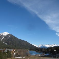
Reither Spitze, Mountain summit in Tyrol, Austria
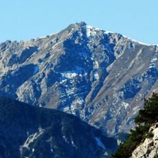
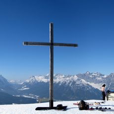
Reither Spitze is a mountain summit in the Karwendel Alps standing at 2,374 meters with distinctive dolomite rock formations. The peak marks the southwestern boundary of a mountain group and attracts hikers seeking accessible high-altitude terrain.
The mountain takes its name from the nearby village of Reith bei Seefeld. Earlier centuries saw extraction of oil-bearing slate in the surrounding area, reflecting the geological resources that shaped human activity here.
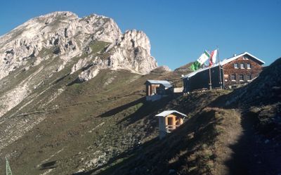
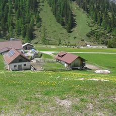
The mountain hut serves as a gathering place where climbers meet and rest during their journeys through this Alpine region. It functions as a social hub for those pursuing mountain activities in the Karwendel.
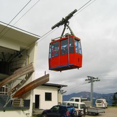
The summit can be reached in about twenty minutes from the mountain hut above. Getting to the hut itself takes roughly one hour from the cable car station, so plan your day accordingly for this straightforward climb.
The rock layers here contain fossils of ancient fish from prehistoric times. This geological feature draws researchers interested in understanding the region's deep past and the life forms that once existed in these mountains.
Location: Tyrol
Elevation above the sea: 2,374 m
GPS coordinates: 47.32326,11.23601
Latest update: December 13, 2025 11:46
Standseilbahn Rosshütte
2.9 km
Wildsee
3.4 km
Bahnhof Seefeld in Tirol
3.6 km
Seefelder Jochbahn
2.1 km
Seefelder Spitze
1.1 km
Eppzirler Alm
2.5 km
Freiungspitzen
2.1 km
Kuhljochspitze
2.8 km
Rauenkopf
1.7 km
Neuer Friedhof mit Friedhofskapelle
3 km
Marienkapelle am Schlossberg
3.4 km
Hotel Berghof, Seefeld in Tirol
3.3 km
Mariahilfkapelle, Auland
3.2 km
Frau Häusl-Kapelle, Kapelle Mariä Heimsuchung
3.2 km
Mittenwaldbahn - Schlossbachgrabenbrücke
3.1 km
Mittenwaldbahn - Schlossbachgrabenbrücke
3.1 km
2 Brücken-Galerien nach Schlossbachgraben-Brücke
3.1 km
2 Brücken zwischen Personentunnel Birkl und HS Seefeld-Playcastle
3.3 km
Meilenstein
3.3 km
Schlossbachgraben-Brücke
3.1 km
2 Brücken zw. Aufnahmsgebäude Reith u. Brücke Kaltwasserbad
3.5 km
Hermelesbachviadukt
2.8 km
Haltestelle Seefeld-Playcastle
3.3 km
Grenzstein, Römerstein
3.6 km
Bildstock hl. Martin
2.5 km
Seefelder Joch
1.9 km
Brücke zw. Pflegerbach und Lehenviadukt
3.6 km
Brücke nach Hermelesbachviadukt
2.8 kmVisited this place? Tap the stars to rate it and share your experience / photos with the community! Try now! You can cancel it anytime.
Discover hidden gems everywhere you go!
From secret cafés to breathtaking viewpoints, skip the crowded tourist spots and find places that match your style. Our app makes it easy with voice search, smart filtering, route optimization, and insider tips from travelers worldwide. Download now for the complete mobile experience.
A unique approach to discovering new places❞
— Le Figaro
All the places worth exploring❞
— France Info
A tailor-made excursion in just a few clicks❞
— 20 Minutes