Almkanal, Medieval canal system in Salzburg, Austria
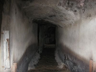
The Almkanal is a water system that has run through Salzburg since medieval times, partly underground beneath the Old Town. Water from the Königsseeache river has historically powered mills, craft workshops, and later electricity generation.
Construction of the waterway began in the 1130s using materials from Roman ruins of the ancient settlement. The system has remained in continuous use and undergone various modifications to serve changing needs over centuries.
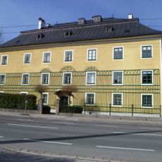
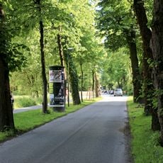
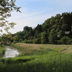
The waterway has shaped how people in Salzburg use and move through their city, serving as a gathering place and recreation route for residents today. Walking along its banks, you notice small bridges connecting neighborhoods and locals stopping to watch the water flow.
The waterway is accessible from several points in the Old Town, especially along the riverside paths open to pedestrians. Visitors should know that some underground sections are not publicly accessible, so viewing focuses on above-ground sections and paved walkways.
At St. Peter's Abbey, water still powers a mill that has continuously supplied a bakery for centuries through its medieval mechanism. This ancient system demonstrates how a simple water-driven device can function across generations.
Location: Salzburg
Elevation above the sea: 462 m
Address: Innere Stadt
GPS coordinates: 47.78230,13.04210
Latest update: December 8, 2025 19:42
Schloss Leopoldskron
717 m
Salzburger Kommunalfriedhof
646 m
Schloss Neudegg
934 m
Scharfrichterhaus
248 m
Pfarrkirche Salzburg-Gneis
1.2 km
Daunschlössl
1.1 km
Weiherhof
710 m
Dutch memorial cemetery Salzburg
645 m
Krautwächterhaus
1.1 km
ORF regional studios
1 km
Salzburger Kommunalfriedhof - crematorium
673 m
Bauernhaus, Lainerhof – Wohnhaustrakt
765 m
Bauernhof (Anlage), Buberlgut
703 m
Figurenbildstock hl. Johannes Nepomuk, Leopoldskron
136 m
Villa Schider
1.2 km
Former Nonntal retirement home, Salzburg
938 m
Buchholzerhof
1 km
Ehem. Fürsterzbischöfliches Jägerhaus
1 km
Magazin des landesfürstlichen Gestüthofs, Salzburg
833 m
Stolperstein dedicated to Max Reinhardt
841 m
Nonnberghof mit Nebengebäuden und Ummauerung
1.1 km
Ehem. Seegasthof
808 m
Salzburger Kommunalfriedhof - memorial to Infanterieregiment Erzherzog Rainer
529 m
Gestüthof, Verwalterhaus
931 m
Leopoldskroner Allee mit Leopoldskronstraße
820 m
Kopfweiden am Almkanal
947 m
The Falling Man
888 m
Moorwiesen bei den St.Peter-Weihern
942 mVisited this place? Tap the stars to rate it and share your experience / photos with the community! Try now! You can cancel it anytime.
Discover hidden gems everywhere you go!
From secret cafés to breathtaking viewpoints, skip the crowded tourist spots and find places that match your style. Our app makes it easy with voice search, smart filtering, route optimization, and insider tips from travelers worldwide. Download now for the complete mobile experience.
A unique approach to discovering new places❞
— Le Figaro
All the places worth exploring❞
— France Info
A tailor-made excursion in just a few clicks❞
— 20 Minutes