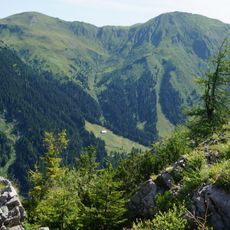
Gailtaler Polinik, Mountain summit in Kötschach-Mauthen, Austria
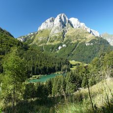
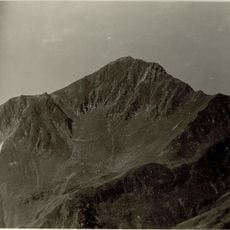
The Gailtaler Polinik is a mountain in the Carnic Alps that rises to 2,332 meters with steep descending slopes on multiple sides. The summit stands prominently visible from the Gail Valley below.
The Gailtaler Polinik lies on the main ridge of the Carnic Alps, which here forms the border between Carinthia and Italy; the Plöcken Pass northeast of the summit has been a crossing between the Gail valley and Friuli since Roman times. The German name is traced by Pohl to the Slovene pol (half), giving the sense of a midday mountain.
The name Polinik is traced by Pohl to the Slovene word pol (half), giving the sense of a midday mountain, comparable to the name Zwölfer. The peak is also called Angerkofel. The usual route from the Plöckenhaus leads over the Spielbodenalm and the Spielbodentörl to the summit.
The ascent from Plöckenhaus takes roughly 6 hours round trip and requires hiking gear and adequate water supplies. The route demands physical endurance and proper mountain preparation.
The name Polinik is derived by Pohl from the Slovene word pol (half), giving the meaning "midday mountain", comparable to the mountain name Zwölfer. The peak is also known as the Angerkofel. Its free-standing position gives a wide panorama over the upper Gail valley and the Gailtal Alps.
The community of curious travelers
AroundUs brings together thousands of curated places, local tips, and hidden gems, enriched daily by 94,202 contributors worldwide.