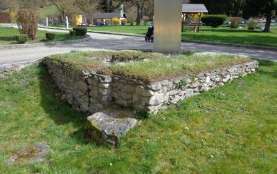
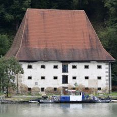
Castra of Schlögen, Roman military fort in Haibach ob der Donau, Austria.
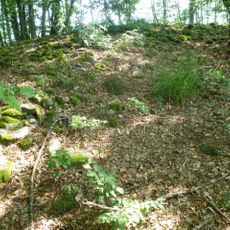
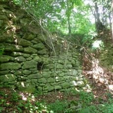
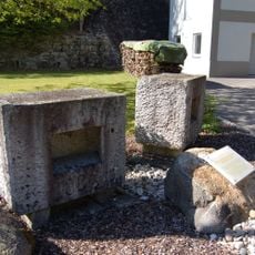
The Castra of Schlögen is a Roman military installation built on a strategic elevated location above a bend in the Danube River, with foundation remains and stone walls from that period still visible today. The site displays the typical rectangular shape of a legion fort with recognizable areas for residential buildings, storage, and fortifications.
The installation was built in the 1st century to protect the Danube frontier of the Roman Empire and remained in operation for about 400 years. After the decline of the empire, the site was abandoned and the structures gradually reclaimed by nature.
The site is known locally as evidence of Roman presence along the Danube, valued today for its visible wall remains that still show the original extent of the fort. The stones themselves speak of a time when thousands of soldiers lived out their garrison life here.
The remains are openly accessible on grounds next to the Danube riverbank and can be explored on foot; informative panels explain the original layout of the area. Those wanting to explore the exact layout should ask in advance if guided tours are available, as the terrain is sometimes difficult to navigate.
At this location, the Danube forms a tight bend that forced ships to navigate slowly and carefully, making the spot ideal for monitoring trade traffic. The Romans exploited this strategic advantage to secure their control over one of the empire's most important trade routes.
The community of curious travelers
AroundUs brings together thousands of curated places, local tips, and hidden gems, enriched daily by 60,000 contributors worldwide.