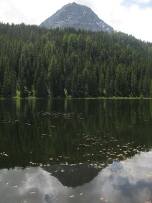
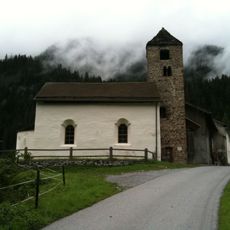
Schwarzsee, Natural monument lake in Nauders, Austria
Schwarzsee is a protected moorland lake in the Stubai Alps, situated at 1720 meters elevation between two mountain peaks and covering about 2.3 hectares of wetland habitats. The water appears dark due to peat layers, and the shoreline displays typical wetland vegetation with specialized plant communities.
In the 19th century, local residents extracted peat from the lake area for fuel and created irrigation channels for nearby farmland. This historical use left marks on the landscape that remain visible today.
The lake gets its name from the dark water, colored by peat deposits that define the moorland character. Visitors today can still observe the effects of these natural processes in the special plants growing around the shore.
The lake is roughly one hour on foot from Nauders and accessible via marked trails that also connect to nearby lakes and mountain paths. Visitors should bring weatherproof clothing, as conditions at this elevation can change quickly.
The lake remains fishless due to low oxygen levels, yet this allows a rich water lily flora to thrive. At the same time, scoter ducks use the shoreline as a breeding habitat, making the lake an important home for specialized water birds.
Location: Nauders
Elevation above the sea: 1,720 m
GPS coordinates: 46.86988,10.47810
Latest update: December 14, 2025 16:45
Schloss Naudersberg
2.7 km
Piz Lad
2.6 km
Pfarrkirche Nauders
3.2 km
Church San Niclà (Strada)
4.2 km
Serviezel Castle
2.4 km
Church San Plasch
3.9 km
Museum Stamparia da Strada
3.5 km
Reformierte Kirche Martina GR
1.9 km
Reformierte Kirche Strada im Engadin
3.4 km
Naudersberg
2.7 km
Ehemalige Spitalkirche Hl. Geist, Nauders
3.1 km
Mariahilferkirche, Nauders
3 km
Hofkapelle Kompatsch, Nauders
3.4 km
Immaculata-Brunnen bei der Pfarrkirche, Nauders
3.2 km
Friedhof Nauders
3.2 km
Immaculata-Brunnen bei der Mariahilferkirche, Nauders
3 km
Kapelle hl. Leonhard
2.7 km
Wegkapelle bei Burg Naudersberg, Schlosskapelle
2.7 km
Friedhofskapelle
3.2 km
Wegkapelle hl. Notburga
3.5 km
Mühlenkapelle/Kapelle zur schmerzhaften Maria
2.6 km
Katholische Kirche Martina GR
1.9 km
Bauernhaus 133, Nauders
3.3 km
Ehemaliges Spital, Nauders
3.1 km
Kriegerdenkmal
3.2 km
Frühmeß-Widum
3.2 km
Widum Nauders
3.2 km
Punt da Sclamischot
2.4 kmVisited this place? Tap the stars to rate it and share your experience / photos with the community! Try now! You can cancel it anytime.
Discover hidden gems everywhere you go!
From secret cafés to breathtaking viewpoints, skip the crowded tourist spots and find places that match your style. Our app makes it easy with voice search, smart filtering, route optimization, and insider tips from travelers worldwide. Download now for the complete mobile experience.
A unique approach to discovering new places❞
— Le Figaro
All the places worth exploring❞
— France Info
A tailor-made excursion in just a few clicks❞
— 20 Minutes