Chest opened
+${chestReward.xp} XP
Explorer
NOUVEAU ×${chestReward.collectible.quantity}
tapez pour fermer

See the monuments around you in AR Open chests in the app

Around Us is built for your phone — point your camera at the streets and discover the monuments and places around you in augmented reality. Around Us is built for your phone — chests unlock when you walk, explore and capture nearby places.

•

Enable Location

We need your location to show you interesting places around you

Discover nearby places

Find interesting locations and hidden gems around you

Precise directions

Get accurate directions and distances to places

Your location is never shared with other users. It's only used when you tap the location button.

Plankogel

Log in to your account

Start exploring — it's free

Trusted by 94,456 travelers worldwide

Continue with Google
Continue with Apple
or

We will send you a code to connect

By continuing, you accept our Terms and Conditions and our Privacy Policy

Check your inbox

We've sent a pincode in your inbox. Please enter the code below.

Plankogel

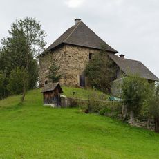
Plankogel, Mountain summit in Styria, Austria

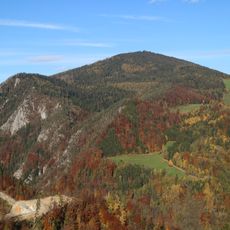
Plankogel is a 1531 m summit in the Grazer Bergland, in the east of the Teichalm-Sommeralm pasture area north of Sankt Kathrein am Offenegg. Its broad, largely treeless top lies close to the Sommeralmstraße (L355) and is built mainly of schists such as Passailer Phyllit. The ridge runs west to Heulantsch and Hochlantsch, east to Streberkogel and Offner Berg; the Steinkogel is an immediate eastern sub-peak.

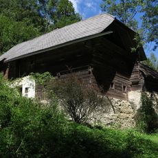
Iron ore was mined at Plankogel from 1790, when Weichard Konrad Graf von Trautmannsdorf received permission to run a smelting furnace in Birkfeld. The Barbarastollen tunnel, a powder tower and a bell tower were built; the ore was described in 1810 as poorly suited to smelting, and the furnace closed in 1822. Mining resumed in 1842 with ore sent to Breitenau, and in 1940 small amounts were extracted by open pit and sent to Essen for test smelting. All plans were abandoned in 1956 when no lease was agreed.

The peak area is largely treeless because the upper tree line was lowered to create pasture; below it stands a mixed conifer forest with scattered green alder. On the hummocky meadows under the summit, dwarf shrubs such as heather, blueberry and lingonberry grow on the wind- and drought-exposed hummock fronts, while the hollows between them hold moisture-loving plants like globeflower and broad-leaved helleborine. The neighbouring Steinkogel gave its name to the folk music group Die Stoakogler.

The broad, largely treeless summit area lies close to the Sommeralmstraße (L355), so it is often visited on foot or by car. From the summit the ridge runs west toward Heulantsch (1471 m) and Hochlantsch and east toward Streberkogel (1447 m) and Offner Berg (1293 m). The nearest village is Gasen, about three kilometres north in a ravine.

The first wind turbine in Styria stood on Plankogel, which is why the summit is known beyond the region. Iron ore was mined here from 1790 until the Second World War; the Barbarastollen adit is now derelict. The neighbouring Steinkogel gave its name to the folk music group Die Stoakogler.

The community of curious travelers

AroundUs brings together thousands of curated places, local tips, and hidden gems, enriched daily by 94,456 contributors worldwide.

Start exploring
GPS coordinates
47.35494,15.55811
Latest update
November 4, 2026 04:19
Reviews
Share your experience

No review yet

Discussions
Start a discussion...

No discussion yet

« Plankogel - Mountain summit in Styria, Austria » is provided by Around Us (aroundus.com). Images and texts are derived from Wikimedia project under a Creative Commons license. You are allowed to copy, distribute, and modify copies of this page, under the conditions set by the license, as long as this note is clearly visible.

Discover hidden gems everywhere you go!

From secret cafés to breathtaking viewpoints, skip the crowded tourist spots and find places that match your style. Our app makes it easy with voice search, smart filtering, route optimization, and insider tips from travelers worldwide. Download now for the complete mobile experience.

Around Us App Screenshot
❝

A unique approach to discovering new places❞

— Le Figaro

❝

All the places worth exploring❞

— France Info

❝

A tailor-made excursion in just a few clicks❞

— 20 Minutes

Around Us
Travel Guide & Maps
Download

Send to your phone

QR Code
1

Open the camera app on your mobile.

2

Point at the QR code with your camera. A notification will appear.

3

Tap the notification to open the link.