Enable Location

We need your location to show you interesting places around you

Discover nearby places

Find interesting locations and hidden gems around you

Precise directions

Get accurate directions and distances to places

Your location is never shared with other users. It's only used when you tap the location button.

Feni District

Log in to your account

Start exploring — it's free

Trusted by 62,993 travelers worldwide

Continue with Google
Continue with Apple
or

We will send you a code to connect

By continuing, you accept our Terms and Conditions and our Privacy Policy

Check your inbox

We've sent a pincode in your inbox. Please enter the code below.

Discussion Reviews 1 Photos
31.1k Popularity

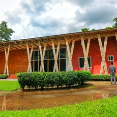
Feni District, Administrative district in Chattogram Division, Bangladesh

Feni District is an administrative region in southeastern Bangladesh, positioned between India's Tripura state and the neighboring districts of Noakhali and Chattogram. The area is divided into six administrative subdivisions, with Sonagazi being the largest and Parshuram the smallest of these units.

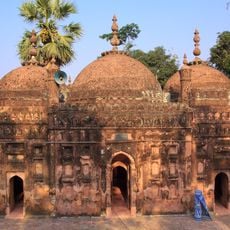
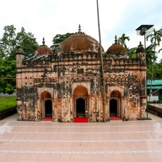
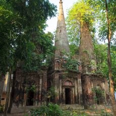
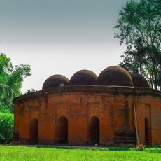
The area became a subdivision in 1976 and was elevated to full district status in 1984. The region played a notable role during the 1971 Liberation War, shaping its modern identity.

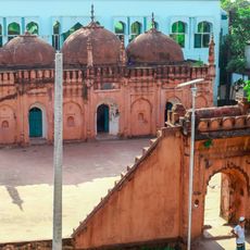
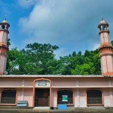
The district is predominantly Muslim, with Hindu, Buddhist, and Christian communities contributing to local life and traditions. Visitors experience a diverse society where different faiths coexist and influence everyday customs.

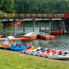
The district is shaped by three major waterways – the Feni River, Little Feni River, and Muhuri River – which define its landscape and support agriculture. Visitors should expect wet conditions and water-based transportation being an important part of local movement.

The district borders India and is shaped by river systems known for traditional fishing and boat-building practices. These waterways have long defined the local economy and way of life for generations.

The community of curious travelers

AroundUs brings together thousands of curated places, local tips, and hidden gems, enriched daily by 60,000 contributors worldwide.

Start exploring
Capital city
Feni
Shares border with
Chattogram District, Noakhali District, Cumilla District
GPS coordinates
23.01670,91.39170
Latest update
December 20, 2025 01:42
Reviews
Share your experience

No review yet

Discussions
Start a discussion...

No discussion yet

« Feni District - Administrative district in Chattogram Division, Bangladesh » is provided by Around Us (aroundus.com). Images and texts are derived from Wikimedia project under a Creative Commons license. You are allowed to copy, distribute, and modify copies of this page, under the conditions set by the license, as long as this note is clearly visible.

Discover hidden gems everywhere you go!

From secret cafés to breathtaking viewpoints, skip the crowded tourist spots and find places that match your style. Our app makes it easy with voice search, smart filtering, route optimization, and insider tips from travelers worldwide. Download now for the complete mobile experience.

Around Us App Screenshot

A unique approach to discovering new places

Le Figaro

All the places worth exploring

France Info

A tailor-made excursion in just a few clicks

20 Minutes

Around Us
Travel Guide & Maps
Download

Send to your phone

QR Code
1

Open the camera app on your mobile.

2

Point at the QR code with your camera. A notification will appear.

3

Tap the notification to open the link.