Enable Location

We need your location to show you interesting places around you

Discover nearby places

Find interesting locations and hidden gems around you

Precise directions

Get accurate directions and distances to places

Your location is never shared with other users. It's only used when you tap the location button.

Uxbridge

Log in to your account

Start exploring — it's free

Trusted by 61,787 travelers worldwide

Continue with Google
Continue with Apple
or

We will send you a code to connect

By continuing, you accept our Terms and Conditions and our Privacy Policy

Check your inbox

We've sent a pincode in your inbox. Please enter the code below.

Uxbridge, Township municipality in Durham Regional Municipality, Canada

Description

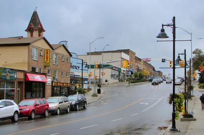
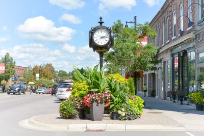
Uxbridge is a township municipality in the Durham Regional Municipality, spanning 420 square kilometers across south-central Ontario with residential areas and commercial zones. The municipality combines rural and urban spaces with various facilities serving residents and visitors.

History

The township was established in 1850 as part of York County and transferred to Ontario County in 1852. These early administrative shifts shaped how the area was governed and developed over the following decades.

Culture

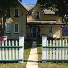
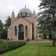
The Friends Meeting House, built in 1820, remains a focal point of local identity and reflects the Quaker roots that shaped early community life here.

Practical

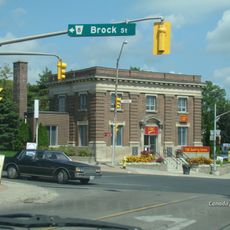
The municipal office operates from 51 Toronto Street South and provides administrative services and community information. Visitors can find helpful resources and local guidance at this main civic location.

Did you know?

The area earned recognition as Trail Capital of Canada, with over 200 kilometers of walking and cycling paths throughout the region. This extensive network supports outdoor activities for nature enthusiasts year-round.

Inception
1850
Elevation above the sea
273 m
Part of
Regional Municipality of Durham
Shares border with
Scugog, East Gwillimbury, Whitchurch–Stouffville, Georgina, Brock, Pickering
GPS coordinates
44.11670,-79.13330
Latest update
December 14, 2025 19:42

AroundUs brings together thousands of curated places, local tips, and hidden gems, enriched daily by 60,000 contributors worldwide. Discover all places nearby (Regional Municipality of Durham).

« Uxbridge - Township municipality in Durham Regional Municipality, Canada » is provided by Around Us (aroundus.com). Images and texts are derived from Wikimedia project under a Creative Commons license. You are allowed to copy, distribute, and modify copies of this page, under the conditions set by the license, as long as this note is clearly visible.

Discover hidden gems everywhere you go!

From secret cafés to breathtaking viewpoints, skip the crowded tourist spots and find places that match your style. Our app makes it easy with voice search, smart filtering, route optimization, and insider tips from travelers worldwide. Download now for the complete mobile experience.

Around Us App Screenshot

A unique approach to discovering new places

Le Figaro

All the places worth exploring

France Info

A tailor-made excursion in just a few clicks

20 Minutes

Around Us
Travel Guide & Maps
Download

Send to your phone

QR Code
1

Open the camera app on your mobile.

2

Point at the QR code with your camera. A notification will appear.

3

Tap the notification to open the link.