Chest opened
+${chestReward.xp} XP
Explorer
NOUVEAU ×${chestReward.collectible.quantity}
tapez pour fermer
Chest locked

Open chests in the app

Around Us is built for your phone — chests unlock when you walk, explore and capture nearby places.

Enable Location

We need your location to show you interesting places around you

Discover nearby places

Find interesting locations and hidden gems around you

Precise directions

Get accurate directions and distances to places

Your location is never shared with other users. It's only used when you tap the location button.

Lake Nipigon

Log in to your account

Start exploring — it's free

Trusted by 72,887 travelers worldwide

Continue with Google
Continue with Apple
or

We will send you a code to connect

By continuing, you accept our Terms and Conditions and our Privacy Policy

Check your inbox

We've sent a pincode in your inbox. Please enter the code below.

Lake Nipigon
Discussion Reviews 1 Photos
31.4k Popularity

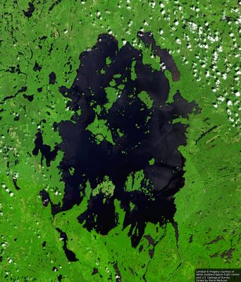
Lake Nipigon, Rift lake in Thunder Bay District, Ontario

Lake Nipigon is a large rift lake system in the Thunder Bay region spanning roughly 4,800 square kilometers with waters reaching depths around 165 meters (540 feet). The lake contains several islands including Kelvin, Murcheson, and Shakespeare, each contributing to the overall aquatic geography.

The lake became an early point of contact between European explorers and Anishinaabe peoples when French Jesuits arrived in the late 1600s. This encounter led to the establishment of trading posts near the Nipigon River mouth, which shaped the region's commercial development.

The name comes from the Ojibwe language and means "at continuous water". This body of water has long been essential to Anishinaabe communities, who have relied on its resources for survival and trade.

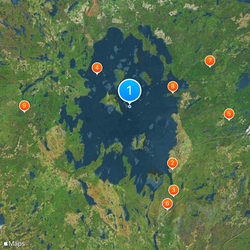
The lake is accessible by car via roads connecting coastal communities, with several entry points around the shoreline for visitors. The best time to visit is during warmer months when road conditions are reliable and water conditions are more stable.

The lake's beaches display green-black colored sands created from weathered diabase rock that surfaced roughly one billion years ago through geological fracturing of the Earth's crust. This distinctive coloring makes the shoreline visually distinctive and tells a story of deep geological time.

The community of curious travelers

AroundUs brings together thousands of curated places, local tips, and hidden gems, enriched daily by 60,000 contributors worldwide.

Start exploring
Elevation above the sea
260 m
GPS coordinates
49.83333,-88.50000
Latest update
December 20, 2025 01:20
Reviews
Share your experience

No review yet

Discussions
Start a discussion...

No discussion yet

« Lake Nipigon - Rift lake in Thunder Bay District, Ontario » is provided by Around Us (aroundus.com). Images and texts are derived from Wikimedia project under a Creative Commons license. You are allowed to copy, distribute, and modify copies of this page, under the conditions set by the license, as long as this note is clearly visible.

Discover hidden gems everywhere you go!

From secret cafés to breathtaking viewpoints, skip the crowded tourist spots and find places that match your style. Our app makes it easy with voice search, smart filtering, route optimization, and insider tips from travelers worldwide. Download now for the complete mobile experience.

Around Us App Screenshot

A unique approach to discovering new places

Le Figaro

All the places worth exploring

France Info

A tailor-made excursion in just a few clicks

20 Minutes

Around Us
Travel Guide & Maps
Download

Send to your phone

QR Code
1

Open the camera app on your mobile.

2

Point at the QR code with your camera. A notification will appear.

3

Tap the notification to open the link.