Kirkland Lake, Mining town in Timiskaming District, Canada
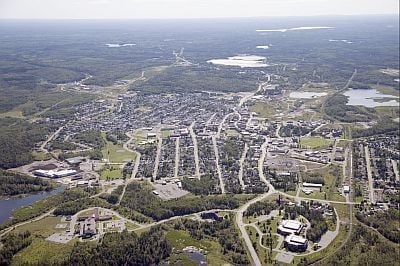
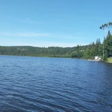
Kirkland Lake is a town in northeastern Ontario surrounded by forested landscapes and lakes, situated at an elevation of about 243 meters. The settlement developed around gold mining operations that dominated the local economy for much of its history.
Gold was discovered in the area in 1911, triggering rapid settlement and leading to the town's official establishment in 1919. This discovery transformed the region from sparsely populated forestland into a thriving mining hub.
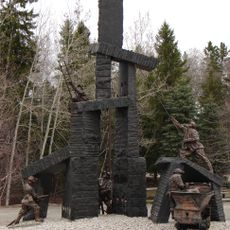
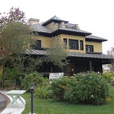
The mining museum here displays equipment and photographs from the gold extraction era, showing how important this industry was to the town's development. Visitors can see how people lived and worked through the objects on display, connecting with the past through tangible artifacts.
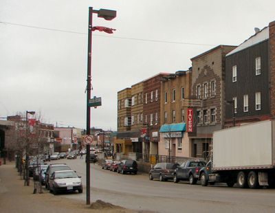
The town is connected to larger cities through regular transportation services, making it accessible for visitors. Local shops and services meet most everyday needs for those exploring the area.
Every February, an 18-day Winter Carnival brings residents and visitors together for outdoor activities and sports competitions across the snow-covered landscape. This event transforms the cold season into a time for community gathering and shared recreation.
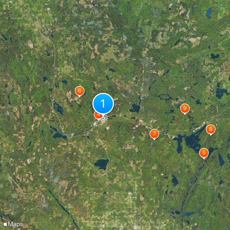
Location: Timiskaming District
Inception: 1919
Elevation above the sea: 243 m
Shares border with: Unorganized South East Cochrane District
Website: https://kirklandlake.ca
GPS coordinates: 48.15000,-80.03333
Latest update: December 14, 2025 21:14
Kirkland Lake Miners' Memorial
1.2 km
Museum of Northern History
1.1 kmHockey Heritage North
1.6 kmRaven Falls
36.3 kmMasonville Bernhardt Muskeg Maple Moraine Conservation Reserve
10.8 kmSouth Grassy Lake Outwash Conservation Reserve
18.5 kmMcGarry Township Forest Conservation Reserve
36.4 km
Gem Lake Maple Bedrock Provincial Park
27.3 kmPearl Beach
29 kmEsker Lakes Provincial Park
22.2 kmLarder River Waterway Provincial Park
36.1 kmEnglehart River Fine Sand Plain and Waterway Provincial Park
32.9 kmBlue Mountain
12.8 kmStuart's Rapids
32.7 kmPushkin Hills Provincial Nature Reserve
31.2 kmEighty Foot Falls
30.1 kmHigh Falls
19.2 kmMount Kempis
30.8 kmThackeray Provincial Nature Reserve
34.2 kmLavaflow Mountain
34.5 kmDunmore Township Balsam Fir Outwash Deposit Conservation Reserve
28.1 kmArctic Watershed
18.2 kmScenic viewpoint
19.6 kmWaterfall
20.4 kmWaterfall
24 kmWaterfall
24 kmRaven Falls
36.3 km80 foot waterfall
30.1 kmVisited this place? Tap the stars to rate it and share your experience / photos with the community! Try now! You can cancel it anytime.
Discover hidden gems everywhere you go!
From secret cafés to breathtaking viewpoints, skip the crowded tourist spots and find places that match your style. Our app makes it easy with voice search, smart filtering, route optimization, and insider tips from travelers worldwide. Download now for the complete mobile experience.
A unique approach to discovering new places❞
— Le Figaro
All the places worth exploring❞
— France Info
A tailor-made excursion in just a few clicks❞
— 20 Minutes