Enable Location

We need your location to show you interesting places around you

Discover nearby places

Find interesting locations and hidden gems around you

Precise directions

Get accurate directions and distances to places

Your location is never shared with other users. It's only used when you tap the location button.

Charles de Gaulle Bridge

Log in to your account

Start exploring — it's free

Trusted by 61,423 travelers worldwide

Continue with Google
Continue with Apple
or

We will send you a code to connect

By continuing, you accept our Terms and Conditions and our Privacy Policy

Check your inbox

We've sent a pincode in your inbox. Please enter the code below.

Charles de Gaulle Bridge

Charles de Gaulle Bridge, Steel bridge between Repentigny and Rivière-des-Prairies-Pointe-aux-Trembles, Canada.

Description

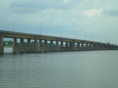
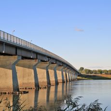
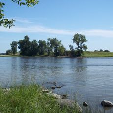
The Charles de Gaulle Bridge is a 1045-meter steel structure spanning the Rivière des Prairies, connecting Montreal's eastern neighborhoods to the Lanaudière region. It carries six lanes of Autoroute 40 and serves as a major route toward Trois-Rivières and Quebec City.

History

The bridge opened in 1965, establishing a vital link between Montreal and northern regions along the Saint Lawrence River. It was built during a period when Quebec was rapidly modernizing its infrastructure.

Culture

The bridge takes its name from French President Charles de Gaulle and reflects the strong French influence on Quebec's infrastructure during that era. This naming choice shows how deeply French history shaped the region's public spaces and identity.

Practical

The bridge is open daily for traffic in both directions, with peak times varying depending on the time of day. Pedestrians and cyclists should note that this is primarily an expressway and alternative crossings may be safer.

Did you know?

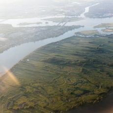
Morning traffic often creates extensive backups extending into Repentigny, while afternoon congestion primarily affects eastbound lanes toward Charlemagne. This pattern reveals how predictable the daily traffic flow is and how heavily the region depends on this crossing.

Location
Inception
1965
Official opening
1965
Length
1,045.4 m
Made from material
steel
GPS coordinates
45.70194,-73.50889
Latest update
December 12, 2025 17:46

AroundUs brings together thousands of curated places, local tips, and hidden gems, enriched daily by 60,000 contributors worldwide. Discover all places nearby (Repentigny).

« Charles de Gaulle Bridge - Steel bridge between Repentigny and Rivière-des-Prairies-Pointe-aux-Trembles, Canada » is provided by Around Us (aroundus.com). Images and texts are derived from Wikimedia project under a Creative Commons license. You are allowed to copy, distribute, and modify copies of this page, under the conditions set by the license, as long as this note is clearly visible.

Discover hidden gems everywhere you go!

From secret cafés to breathtaking viewpoints, skip the crowded tourist spots and find places that match your style. Our app makes it easy with voice search, smart filtering, route optimization, and insider tips from travelers worldwide. Download now for the complete mobile experience.

Around Us App Screenshot

A unique approach to discovering new places

Le Figaro

All the places worth exploring

France Info

A tailor-made excursion in just a few clicks

20 Minutes

Around Us
Travel Guide & Maps
Download

Send to your phone

QR Code
1

Open the camera app on your mobile.

2

Point at the QR code with your camera. A notification will appear.

3

Tap the notification to open the link.