Enable Location

We need your location to show you interesting places around you

Discover nearby places

Find interesting locations and hidden gems around you

Precise directions

Get accurate directions and distances to places

Your location is never shared with other users. It's only used when you tap the location button.

Forêt-Ouareau Regional Park

Log in to your account

Start exploring — it's free

Trusted by 62,800 travelers worldwide

Continue with Google
Continue with Apple
or

We will send you a code to connect

By continuing, you accept our Terms and Conditions and our Privacy Policy

Check your inbox

We've sent a pincode in your inbox. Please enter the code below.

Forêt-Ouareau Regional Park

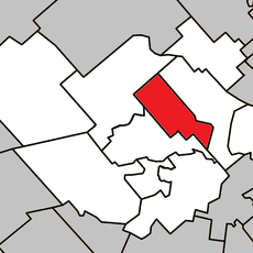
Forêt-Ouareau Regional Park, Regional park in Matawinie, Canada.

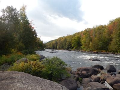
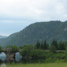
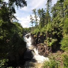
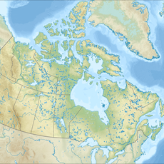
Forêt-Ouareau Regional Park is an extensive natural area in the Matawinie region of Quebec spanning multiple municipalities. The landscape features mountain ranges, river valleys, and several lakes connected by a network of interconnected trails throughout five distinct zones.

The park's name received official recognition from Quebec's toponymy commission on September 24, 2003. The designation was based on the Ouareau River, which appeared on survey maps dating to 1789.

The name Ouareau comes from the Algonquin language and means 'far away'. This reflects the deep connection between the land and the Indigenous peoples who lived here for generations.

The park divides into five separate sectors, each offering trails suited to different interests and fitness levels. Infrastructure includes hiking routes, winter activity areas, and designated climbing zones, all clearly marked for visitor navigation.

Climbing walls at Lac Blanc and along Murmures Trail operate through Quebec's mountain climbing federation system. These specialized areas allow climbers to practice their skills in a natural setting while staying within managed safety protocols.

The community of curious travelers

AroundUs brings together thousands of curated places, local tips, and hidden gems, enriched daily by 60,000 contributors worldwide.

Start exploring
Location
GPS coordinates
46.23889,-73.98333
Latest update
December 14, 2025 18:00
« Forêt-Ouareau Regional Park - Regional park in Matawinie, Canada » is provided by Around Us (aroundus.com). Images and texts are derived from Wikimedia project under a Creative Commons license. You are allowed to copy, distribute, and modify copies of this page, under the conditions set by the license, as long as this note is clearly visible.

Discover hidden gems everywhere you go!

From secret cafés to breathtaking viewpoints, skip the crowded tourist spots and find places that match your style. Our app makes it easy with voice search, smart filtering, route optimization, and insider tips from travelers worldwide. Download now for the complete mobile experience.

Around Us App Screenshot

A unique approach to discovering new places

Le Figaro

All the places worth exploring

France Info

A tailor-made excursion in just a few clicks

20 Minutes

Around Us
Travel Guide & Maps
Download

Send to your phone

QR Code
1

Open the camera app on your mobile.

2

Point at the QR code with your camera. A notification will appear.

3

Tap the notification to open the link.