Enable Location

We need your location to show you interesting places around you

Discover nearby places

Find interesting locations and hidden gems around you

Precise directions

Get accurate directions and distances to places

Your location is never shared with other users. It's only used when you tap the location button.

Großenhain

Log in to your account

Start exploring — it's free

Trusted by 62,171 travelers worldwide

Continue with Google
Continue with Apple
or

We will send you a code to connect

By continuing, you accept our Terms and Conditions and our Privacy Policy

Check your inbox

We've sent a pincode in your inbox. Please enter the code below.

Großenhain, Urban municipality in Meissen District, Germany

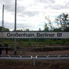
Großenhain is an urban municipality in Meissen District that spreads along the Röder river and covers about 130 square kilometers. The terrain sits roughly 122 meters above sea level and benefits from connections to major federal roads and two railway stations.

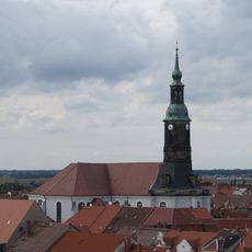
The settlement is first recorded in 1205 as Hayne and grew into a significant town under the rule of the margraves of Meissen and Brandenburg. A major fire in 1744 destroyed much of the town, leading to reconstruction that reflected the building standards of that era.

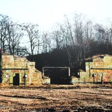
The Marienkirche shapes the town center and displays architectural elements from the early 18th century that recall Dresden's religious buildings. Religious structures like this define the town's character today and show how people chose to rebuild after destruction.

The town sits on major federal roads and has two railway stations, making it easy to arrive and depart. The flat terrain and direct traffic connections mean exploring from here is straightforward, whether you visit the town itself or surrounding communities.

In 2010, the town was struck by an F3 tornado that caused significant damage and prompted new early-warning systems to be put in place. This event left lasting impacts on infrastructure and emergency planning in the community.

The community of curious travelers

AroundUs brings together thousands of curated places, local tips, and hidden gems, enriched daily by 60,000 contributors worldwide.

Start exploring
Location
Elevation above the sea
122 m
GPS coordinates
51.29194,13.53417
Latest update
December 19, 2025 22:06
« Großenhain - Urban municipality in Meissen District, Germany » is provided by Around Us (aroundus.com). Images and texts are derived from Wikimedia project under a Creative Commons license. You are allowed to copy, distribute, and modify copies of this page, under the conditions set by the license, as long as this note is clearly visible.

Discover hidden gems everywhere you go!

From secret cafés to breathtaking viewpoints, skip the crowded tourist spots and find places that match your style. Our app makes it easy with voice search, smart filtering, route optimization, and insider tips from travelers worldwide. Download now for the complete mobile experience.

Around Us App Screenshot

A unique approach to discovering new places

Le Figaro

All the places worth exploring

France Info

A tailor-made excursion in just a few clicks

20 Minutes

Around Us
Travel Guide & Maps
Download

Send to your phone

QR Code
1

Open the camera app on your mobile.

2

Point at the QR code with your camera. A notification will appear.

3

Tap the notification to open the link.