Neukirchen-Vluyn, Medium-sized district town in Wesel, Germany
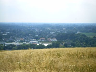
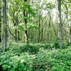
Neukirchen-Vluyn is a medium-sized district town in Wesel, North Rhine-Westphalia, that combines residential areas with green spaces. The municipality spans several districts and features a mix of built-up areas and open landscapes.
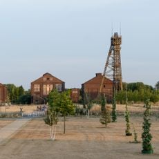
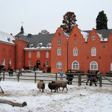
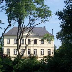
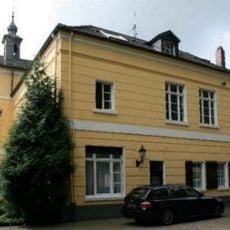
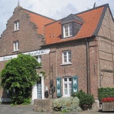
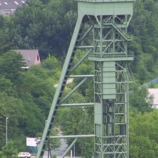
The town developed through coal mining and agriculture, industries that shaped its economy for many decades. The 18th-century castle Bloemersheim and preserved miners' colonies remain as reminders of this industrial past.
The Kulturhalle hosts exhibitions that document the area's agricultural and mining past through local artifacts and photographs. These collections show how these industries shaped the community and the way people lived and worked here.
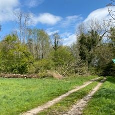
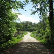
The town is accessible by public transportation, and the wir4mobil service offers on-demand rides for residents and visitors. The area is well-suited for exploring by bicycle or on foot, with numerous paths throughout and around town.
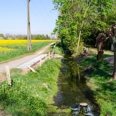
Bloemersheim castle hosts classical music concerts in its courtyard, transforming the historic space into a cultural venue throughout the year. The surrounding area features an extensive network of riding and hiking trails that wind through woods and fields.
Location: Wesel
Elevation above the sea: 30 m
Shares border with: Kamp-Lintfort, Moers
Website: https://neukirchen-vluyn.de
GPS coordinates: 51.44167,6.55833
Latest update: December 19, 2025 23:35
Halde Norddeutschland
3.2 km
Bergwerk Niederberg
345 m
Schloß Bloemersheim
3.1 km
Schloss Leyenburg
2.8 kmEyllsche Berg
4.9 kmVinnbrück
6 km
Averdunkshof
2.2 km
St. Antonius
5.1 km
Haus Erprath (Tönisberg)
5.1 km
Haus Baaken
5.1 km
Nieder Heide am Egelsberg
5.7 km
Orbroich
6.3 km
Ortsgeschichtliches Museum Neukirchen-Vluyn
1.9 kmNieper Altrheinrinne
4.1 kmNiep
3.6 kmUhrenmuseum Hubben
1.8 kmRayener Berg
3.7 kmLSG-Klingerhuf
1.9 km
Village church Neukirchen-Vluyn
1.8 km
LSG-Inneboltsgraben, Plankendickskendel, Schwanenbrueckskendel, Kleine Goorley
3.1 kmLSG-Halde Norddeutschland
3.3 kmLSG-Donke Hasselt
1.8 km
Evangelische Pfarrkirche Kapellen
3.7 kmLSG-Binnenlandwehr
4.1 kmLSG-Waldgebiet noerdlich und suedlich der Rayer Strasse
3.7 kmLSG-Am Oferweg und An den Neubenden
4.8 km
Nieper Altrheinrinne bei Bloemersheim
2.6 kmLSG-Am Oferweg und An den Neubenden <temporaer>
5 kmVisited this place? Tap the stars to rate it and share your experience / photos with the community! Try now! You can cancel it anytime.
Discover hidden gems everywhere you go!
From secret cafés to breathtaking viewpoints, skip the crowded tourist spots and find places that match your style. Our app makes it easy with voice search, smart filtering, route optimization, and insider tips from travelers worldwide. Download now for the complete mobile experience.
A unique approach to discovering new places❞
— Le Figaro
All the places worth exploring❞
— France Info
A tailor-made excursion in just a few clicks❞
— 20 Minutes