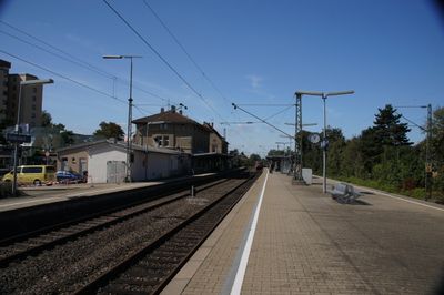
Endersbach station, Railway station in Weinstadt, Germany.
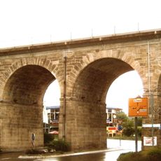
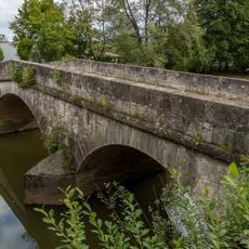
Endersbach station is a railway station in Weinstadt with three platform faces and multiple tracks. The facility sits at 239 meters elevation within the Stuttgart S-Bahn network and features a viaduct with four arches spanning the Haldenbach river.
The Royal Württemberg State Railways built the station in 1861 as part of the Stuttgart to Nördlingen connection. The construction of the viaduct over the Haldenbach valley represented a key engineering achievement for the railway line in this region.
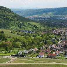
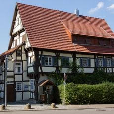
The two-story sandstone building displays typical 19th-century design with tall windows and a shallow hipped roof. This architectural character continues to shape the village's appearance.
The station is well integrated into the Stuttgart S-Bahn system and provides connections to many regional destinations. Keep in mind that it serves a smaller community and train frequency may vary depending on time of day.
The station building's ground floor housed a postal distribution center serving Endersbach and Beutelsbach until 1896. This dual function was typical for railway stations of that era and shows how central the building was to the community.
Location: Weinstadt
Official opening: July 25, 1861
Elevation above the sea: 239 m
Website: https://bahnhof.de/bahnhof-de/Endersbach-1024170
GPS coordinates: 48.81310,9.37028
Latest update: December 9, 2025 20:23
Burg Beutelsbach
2 km
Steinzeitmuseum Korb-Kleinheppach
1.8 km
Stiftskirche Beutelsbach
1.5 km
Schloss Großheppach
1.6 km
Württemberg-Haus
1.6 km
Protestant Church
2.3 km
Haldenbach-Viadukt
250 m
Evangelische Kirche Kleinheppach
1.8 km
Evangelische Kirche
411 m
Aegidiuskirche
1.4 km
Rialtobrücke
1.7 km
Aegidiuskirche
1.4 km
Evangelische Kirche Korb-Kleinheppach
1.8 km
Brücke über die Rems in Waiblingen-Beinstein
1.7 km
Talabschnitt der Rems zwischen Weinstadt und Remshalden samt Fuß des Kappelberges
2.3 km
Beutelstein und angrenzende Gebiete
1 km
Fünf Pyramidenpappeln
2 km
St. Andreas
243 m
Heimatmuseum Pflaster 14
440 m
Prallhang der Rems mit Klebwald
1.2 km
Alter Birnbaum
2.2 km
Eibe
1.4 km
Linde mit Alter Steinbank
2.1 km
Schwarzkiefer
592 m
Erlenwäldchen
2.3 km
Kuppe des Sonnenbergs
2.2 km
Ehemaliger Muschelkalksteinbruch
619 m
2 Roßkastanien
64 mVisited this place? Tap the stars to rate it and share your experience / photos with the community! Try now! You can cancel it anytime.
Discover hidden gems everywhere you go!
From secret cafés to breathtaking viewpoints, skip the crowded tourist spots and find places that match your style. Our app makes it easy with voice search, smart filtering, route optimization, and insider tips from travelers worldwide. Download now for the complete mobile experience.
A unique approach to discovering new places❞
— Le Figaro
All the places worth exploring❞
— France Info
A tailor-made excursion in just a few clicks❞
— 20 Minutes