Enable Location

We need your location to show you interesting places around you

Discover nearby places

Find interesting locations and hidden gems around you

Precise directions

Get accurate directions and distances to places

Your location is never shared with other users. It's only used when you tap the location button.

Log in to your account

Start exploring — it's free

Trusted by 62,860 travelers worldwide

Continue with Google
Continue with Apple
or

We will send you a code to connect

By continuing, you accept our Terms and Conditions and our Privacy Policy

Check your inbox

We've sent a pincode in your inbox. Please enter the code below.

Ahauser Stausee

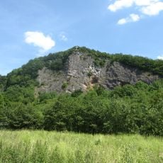
Ahauser Stausee, reservoir

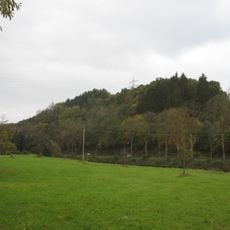
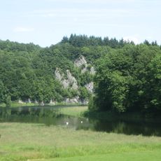
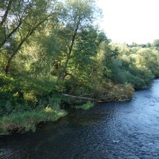
The Ahauser Stausee is an artificial lake in Kreis Olpe formed by an earth dam approximately 165 meters wide, with a water surface covering more than 33 hectares and a maximum depth of roughly 13 meters. Located on the border between the towns of Attendorn and Finnentrop, it receives water from the Bigge River and releases it downstream after use.

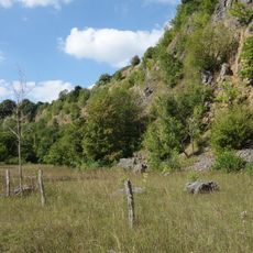
Built between 1937 and 1938, the Ahauser Stausee was created as part of a water management system designed to improve electricity supply and flood control in the Kreis Olpe region. In 2003, a portion of the lake and its rocky shoreline was designated as the nature reserve 'Ahauser Klippen und Stausee'.

The Ahauser Stausee serves as a gathering place for the local community, with an annual boat race featuring a popular sailing class that brings families and enthusiasts together. The lake's role in the region reflects a balance between practical water management and recreational use that shapes how people interact with the landscape.

The lake is accessible via Landesstraße 539 and offers fishing opportunities and walking paths along the shoreline. Visitors should note that boating is restricted in certain areas and that water levels can fluctuate noticeably throughout the day.

A small hydropower plant with a capacity of 2.2 megawatts harnesses the water flow to generate approximately 3 million kilowatt-hours annually for the local area. Adjacent to the lake lies the Attendorn-Finnentrop airfield, which offers visitors the chance to view the landscape and water from above.

The community of curious travelers

AroundUs brings together thousands of curated places, local tips, and hidden gems, enriched daily by 60,000 contributors worldwide.

Start exploring
Location
GPS coordinates
51.13530,7.95028
Latest update
February 9, 2026 08:22
« Ahauser Stausee - reservoir » is provided by Around Us (aroundus.com). Images and texts are derived from Wikimedia project under a Creative Commons license. You are allowed to copy, distribute, and modify copies of this page, under the conditions set by the license, as long as this note is clearly visible.

Discover hidden gems everywhere you go!

From secret cafés to breathtaking viewpoints, skip the crowded tourist spots and find places that match your style. Our app makes it easy with voice search, smart filtering, route optimization, and insider tips from travelers worldwide. Download now for the complete mobile experience.

Around Us App Screenshot

A unique approach to discovering new places

Le Figaro

All the places worth exploring

France Info

A tailor-made excursion in just a few clicks

20 Minutes

Around Us
Travel Guide & Maps
Download

Send to your phone

QR Code
1

Open the camera app on your mobile.

2

Point at the QR code with your camera. A notification will appear.

3

Tap the notification to open the link.